
CMC Bi-Weekly Hike News
10/12/2005
| All Day Saturday and Sunday Hikes |
| Half Day Sunday Hikes |
| Wednesday Hikes |
Looking Back ... with hike reports
| All Day Saturday and Sunday Hikes |
| Half Day Sunday Hikes |
| Wednesday Hikes |
Joe Cirvello, 828-627-1797, cirvello25@bellsouth.net
I spent all day with two other CMC hikers exploring alternative trails for the annual Panthertown Prowl, and concluded that we could not improve on the route that was used in the past. So this year we will again begin and end at the West entrance for the fantastic views of Panthertown valley, then hike to Upper Warden's Falls, Schoolhouse Falls , and then lunch on top of Little Green with great views. After lunch, we'll hike down and through the valley, up to the summit of Big Green, down along Panthertown Creek, past Granny Burrell Falls and back up to Salt Rock Gap for our farewell views of the valley.
Hike 10.2, Drive 140, 1500 ft. ascent, Rated A-B
Elisabeth Feil, 828-684-8719, hofeil@brinet.com
900M An outstanding rock outcrop along the AT and stunning views are the highlights of the trip. From Newfound Gap, we’ll hike 4 miles to our lunch spot at the Bunion, then along Dry Sluice Gasp, Grassy Branch and Kephart Prong Trails down to US 441. Note that this hike has 2800 ft. of descent . Car shuttle. Second meeting place: Quality Inn in Maggie
HALF DAY No. H0504-008 Oct. 16
Hike 5.7, Drive 35, Rated B-B
Note early start time. This moderate hike will feature good views and a variety of trees and late wild flowers in bloom. Car shuttle. Second meeting place:
Old
Hike 5-6, Drive 60, 1,000-ft ascent, Rated C-B
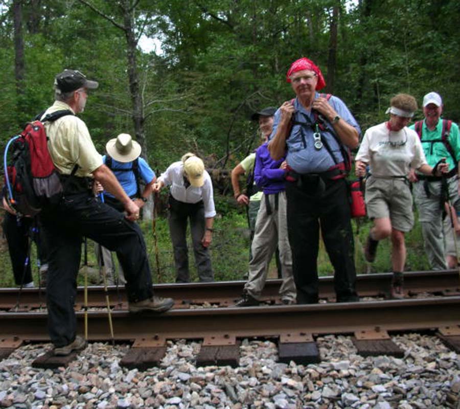
Note early start time. We will walk up on old U.S. 70, now blocked off from traffic, to Swannanoa Gap, where we will enjoy a view of the valley, the railroad and tunnel. This hike is the CMC contribution to the WNC “Together We Read” program; this year’s book is The Road by John Ehle, about building the railroad up to Swannanoa Gap. (See www.togetherweread.org.) Second meeting place: Parking lot adjacent to McDonald’s at exit 64 of I-40 at
WEDNESDAY No. W0504-068 Oct. 12
Big Butt from BRP 8:30 AM Hike 8, Drive 55, 1700 ft. ascent, Rated B-A Ruth Hartzler, 828-251-0886, ruthmtn@aol.com
We will take the Big Butt trail from Balsam Gap on the BRP, following the ridge crest to Big Butt (Yeates Knob), a short bushwhack at just under 6000 ft., and return via the same route. We will stop at Point Misery for lunch and colorful fall views of the Black Mtns. Second meeting place: Craven Gap at 8:50 AM. Topos: Montreat, Mt. Mitchell; also South Toe River PNF map
WEDNESDAY No. W0504-489 Oct. 19 Bad Fork - Trace Ridge Loop 8:00 AM* Hike 8, Drive 45, 1200 ft. ascent, Rated B-B Pat Elias and Kathy Giddings: Pat, 828-687-1651, patelias@bellsouth.net ; Kathie Giddings: 828-696-9808, kmgiddings@highstream.net P400 Starting at the Trace Ridge parking area, we will hike along an unmarked trail that follows a stream to the Bad Fork Trail. This trail takes us to the BRP on a steep 800 ft. ascent, then over Ferrin Knob on the MST to the Beaver Dam Overlook. We will lunch, enjoying the beautiful views, then proceed down the Trace Ridge Trail to the parking area. *Meet at Westgate to form carpools and meet leaders at N. Mills River Recreation parking lot at 8:30 AM. Topo: Dunsmore Mtn.; also Nat’l. Geo. PRD map
ALL DAY NO. No. A0504-398 Oct. 9
Sunburst – Green Knob – Haywood Gap TrailHike 7, Drive 95, 2000 ft. ascent, Rated B-AA
Carroll Koepplinger, 828-667-0723, carrollkoepp@bellsouth.net
P400 This very strenuous and difficult hike will start with an initial very steep mile (up to 39 degree incline) to Green Knob and its spectacular views, then we’ll do a short bushwhack down to the Grassy Ridge Branch trail. We’ll return on the seldom-hiked lower Haywood Gap Trail returning to the Sunburst Campground. There are two wet crossings, one river and one carway. Wilderness area limited to ten people. Please contact leader to reserve your space. Topo: Sam Knob; also Nat’l. Geo. PRD map
Post Hike Report for Oct. 9th. Sunburst, Green Knob, Haywood Gap Trail
Six hikers including a new member on her first CMC hike (Leanna) had a great workout going up the Green Knob Trail. With the recent rains parts of the trail was muddier than hoped for which resulted in a few slips and slides but nothing serious. This portion of the hike is one of the more strenuous climbs in the Pisgah. Unfortunately the weather did not cooperate from atop Green Knob with its great long range views. Temp was moderate with more clouds than sun.
The bushwhack did not turn out quite like I wanted but being only 100 yds. or so off the mark it created no serious problems. I geed when I should of hawed. One unfortunate situation was the loss of a digital camera, which after going back to look, could not find.
We left the trail head at 9:05 AM and returned at 4:40 PM with all being quite glad to return and also pleased with the hike. A number of flowers were seen: blue stemmed goldenrod, sharp leaved goldenrod, closed gentian, short aster, white wood aster, flat topped aster, heart leaved aster, joe pye- weed, wild basil and white snakeroot. Carroll.
ALL DAY No. A0503-074 Sept. 25 Tanawha Trail 8:00 AM Hike 13.3, Drive 150, 1300 ft. ascent, Rated AA-B Don Gardner, 828-754-4067, gardog3@charter.net A fragile and ancient ecosystem, rhododendron and laurel tunnels, hardwood coves, boulder fields and great views make this a special trip. Optional supper stop at Little Siena. Second meeting place: parking lot adjacent to McDonald’s at exit 64 of I-40 at 8:20 AM. Topo: Grandfather Mtn.
9-25-05 Tanawha Trail
Seven hikers drove to the trailend location at Beacon Heights to meet the leader and one other hiker; we did a car shuttle to the trailhead at Price Park in clouds and dense fog. This weather persisted all day, with occasional rain. We had a great hike even without the scenery, over a varied trail that starts with hiking through open meadows, and later climbs over rocky terrain with amazing trail rockwork that reminds the hiker of the CMC rock work around Potato Knob. It was frustrating to be on overlooks with nothing to see but fog. Three hikers stayed at the Linn Cove Overlook at the 12 mile point, while the other 6 finished the hike at 13.5 miles. The Asheville group finished off the day by enjoying a good meal at Spear's Restaurant in Linville Falls .
SATURDAY No. A0503-314 Sept. 24 MST: Double Top to Balsam Gap 8:00 AM* Hike 10, Drive 90, 500 ft. ascent, Rated A-C Marianne Newman, 828-454-1036, marianneln@msn.com Have you ever wanted to hike that long MST ridge down to Balsam Gap? Here is your chance in the downhill direction, enjoying the views along the way. Car shuttle. *Meet at Westgate at 8:00 AM to form carpools, and meet leader at rest stop beyond Waynesville on US 23/74 at 8:30 AM. Topo: Hazelwood
Seven hikers enjoyed a lovely early fall day hiking the Mountains to Sea Trail from the Licklog Gap overlook on the BRP to Balsam Gap. One might say "down" to Balsam Gap, except that there's a surprising amount of uphill along the way. The last of the wildflowers, including some gentians, a flock of wild turkeys, and a cooling lunchtime breeze added to our enjoyment. This would also be a fine hike as soon as it's accessible in the spring - lots of flowers and a great view before the trees leaf out. Marianne Newman
All-day hikes submitted by Bruce Bente 692-0116, bbente@cytechusa.com . Driving distance is round-trip from Asheville. All Saturday and Sunday hikes assemble at Westgate Shopping Center near I-240 UNLESS OTHERWISE NOTED.
HALF DAY No. A0503-467 Oct. 2
Dupont Forest: Cascade Lake P.L. #1 12:30 PM* Hike 5+ miles, Drive 75, Rated C-C Rusty Breeding, 828-692-0359, bree@planetusa.net
Note early start time. Hike begins at 1:30 PM at the Cascade Lake Road parking lot. One boots-off creek crossing; bring water shoes. Highlights: Bridal Veil Falls from the top and Big Rock overlook.
*Meet at Westgate at 12:30 PM to form carpools, and meet leader at side parking lot of Pisgah Forest Bi-Lo at 1:00 PM.
No post hike report
HALF-DAY No. H0504-286 Oct. 9
Sycamore Cove Trails 1:00 PM*
Hike 6, Drive 70, Rated B-B Pat Elias, 828-687-1651, patelias@bellsouth.net
A moderate hike (some uphill) in the Pisgah National Forest along several trails: Thrift Cove, Grassy Road. *Meet at Westgate at 1:00 PM to form carpools; meet leader at entrance to Davidson River Campground parking lot on US 276 at 1:45 PM.
Seventeen enthusiastic hikers joined the hike leader at the Davidson River Campground parking lot on a somewhat dreary afternoon. After the preliminaries, we had a ten minute walk along the Davidson River, crossing Route 276 before reaching the trailhead. A short distance into the hike, one of our hikers determined she was not prepared to do the hike. Greg Goodman graciously offered to walk her back to the starting point and, as it turned out, he, again graciously, drove her back to Westgate, leaving a note on my car of what he had done. For the next hour and a half the hikers enjoyed a nicely-paced walk, stimulating conversation, and a few scares by mountain bikers. We stopped for a brief snack at the half-way point and then, resuming the hike, experienced a nice little aerobic workout before descending along a rocky, somewhat eroded trail. I particularly enjoyed the hike, catching up on news with CMC hikers I have not seen in a while.
And,
if I read the group right, they seemed also to enjoy themselves. The
only downside was that at the end of the hike one of the hikers
discovered he lost his keys. He thought he might have dropped them
from his backpack when we stopped for a snack. He decided to return to
the snack spot to look for them. Now, even though we had traveled an
hour and a half from that snack spot, I knew of way to get there in 15
minutes. But, so also did Stuart English who, graciously, directed the
owner of the lost keys to the snack spot. Alas, no keys were found.
The hiker of the lost keys did have a ride back to town and his driver
offered (another gracious person - hikers are such nice people) to take
him to his home to pick up his spare set of keys and then drive him to
Westgate. Pat Elias
Half Day hikes submitted by Paula Robbins 828-687-1651 paularww@bellsouth.net. Leaders: Mail please mail your sign-up sheets. Meet at Westgate unless otherwise noted.
WEDNESDAY. No. W0503-040 Sept. 28 MST in Marion 8:30 AM Hike 4.8, Drive 60, 1500 ft. Ascent, Rated C-B Don Walton, 828-654-9904, donwalton@bellsouth.net We will spot cars, then hike along the MST from Woodlawn Picnic area down to the North Fork of the Catawba River, where we will see the now completed footbridge, the longest on the MST. We will go out on the Forest Service Rd. to Creek Road. Second meeting place: parking lot adjacent to McDonald's at exit 64 of I-40 at 8:50 AM. 9/28 Marion Hike:
 14 hikers started off from the access road to the Forest Service area leading to the new bridge across the North Fork of the Catabawa River . We started hiking about 10AM and arrived at the bridge site at 10:30 . The MST has now been relocated on both sides leading to the bridge. It is very nice 200 ft long steel structure with a 2x8 wooden floor. It reportedly cost $250K to build. Our federal dollars at work! We toured both new ends of the approach to the bridge took many pictures then continued up trail to our lunch spot. We climbed most of the 1200 ft before lunch and stopped at the top with good views of the distance Mackey Mountain . We arrived back in Asheville about 3pm. Don Walton
WEDNESDAY No. W0504-488 Oct. 5
Gabes Mt. Trail 8:00 AM Hike 8, Drive 150, 1400 ft. ascent, Rated B-B Jack Fitzgerald, 685-2897, suejackfitz@bellsouth.net
900M Hike from Cosby Campground in GSMNP to Hen Wallow Falls, then through Old Growth forest to primitive camp site for lunch along pretty stream flowing over moss covered rock. Second meeting place: Pilot Truck Stop at exit 24 of I-40 at 8:30 AM. Topos: Hartford, Luftee Knob; also Nat’l. Geo. GSMNP map
No posthike report
Wednesday Hikes are submitted by Paula McNabb, 828- 274-0057 gcmcnabb@charter.net and Ann Gleason, 828-859-9387, cowbonetail@yahoo.com . The meeting place for each hike will be designated by the hike leader and will appear in the hike description. Driving mileage will be listed, round trip, from the first designated meeting place.