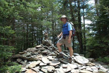
ALL DAY NO. A0603-526 July 9 Down the Incline 8:30 AM* Hike 7-8, Drive 80, 1350 ft. ascent, Rated B-B Tom Bindrim & Joan Lemire, 828-273-3880 P400 Some off-trail; historic; wilderness area, limit 10, so call leader for reservation. Are you inclined? *Note later start time. Meet at Westgate at 8:30 AM to form carpools, and meet leader at second meeting place (phone leader for location.). Topo: Sam Knob; also Nat’l. Geo. PRD map
ALL DAY NO. A0603-237 July 16 Plott Balsams 7:30 AM* Hike 9, Drive 90, 3400 ft. ascent, Rated B-AA+ Dave Wetmore, 828-884-7297, dwetmore@citcom.net SB6K Note earlier starting time. Here is your chance to climb all four of the 6000-footers in the Plott Balsams, and see spectacular views of the Smokies and nearby mountains. From Waterrock Knob (6292 ft.), we will follow a very rough, steep trail over Browning Knob to Lyn Lowry (6240 ft.) and Plott Balsam (6088 ft.). Then we will hike back to our starting point and then to the top of Yellow Face (6032 ft.). The hike is strenuous due to the rough trail and climbing over fallen spruce trees on steep slopes. Wear long sleeve shirts and pants. Topos: Hazelwood, Sylva North
HALF-DAY No.H0603-043 July 9Frying Pan Tower 1:30 PMHike 4, Drive 45, Rated C-CPaula Robbins, 828-281-3253, paularww@bellsouth.net
This easy in-and-out hike features a spectacular display of summer wildflowers and a 360° view from the tower. Call the leader if you wish to join her for dinner reservations at the Pisgah Inn after the hike. Second meeting place Pisgah Inn parking lot near the convenience store at 2:00 PM.
HALF-DAY No. H0603-525 July 16DuPont Forest: Cascade Lake P. L. #2 1:00 PM*Hike 4, Drive 94, Rated C-B Becky Elston, 828-749-1886, belston@cytechusa.com
A pleasant loop with a break at the bottom of Bridal Veil Falls. Weather and conditions permitting we can walk behind the falls. Note early start time. Meet at 1:00 PM at Westgate to form carpools, and meet leader at Hooker Falls Parking Area at 1:45 PM. WEDNESDAYNO. W0603-465 July 5 Sam Knob Sketching hike 9:00 AM Hike 5, drive 70, rated C-B Gerry McNabb, 274-0057, gerrymcnabb@charter.net P400 Take the Sam Knob trail, with side trip up Sam Knob for a new twist. We’ll take 45 minutes for a sketch, then lunch. Non-sketchers also welcome. Meet leader at Westgate; call leader if you desire a second meeting place. Bring sketchpad and drawing pencil or pigma micron pen, .05 size, if you plan to sketch. A small watercolor pen could add to the fun as well. Site also good for photos.
WEDNESDAY NO. W0603-529 July 12 Fletcher Fields & Spencer Branch Trail 8:00 AM* Hike 8, drive 60, rated B-C Greg Goodman, 828-684-9703 P400 This will be a woods hike, crossing small creeks, using log bridges. It will involve Fletcher Creek Trail via Spencer Branch and the Middle Fork; Trace Ridge trailhead to Fletcher Creek Trail, to Mid Fork Trail, and back to Fletcher Creek. *Meet at Westgate at 8:00 AM to form carpools, and meet leader at pull-out just before Mills River Recreation Area at 8:30 AM.
WEDNESDAY NO. W0603-530 July 19 Bent Creek Loop #10 -Stradley Mountain via Rice Pinnacle. 9:00 AM Hike 8, Drive 25, 900 ft. ascent, Rated B-B Sherman Stambaugh, 828 254 1736 P400 This moderate hike is in the eastern part of Stradley Mountain. It is probably a new hike for most. Great views of Hominy Valley. We will return by Boyd Branch and Deer Lake Lodge Trail. Second meeting place: Ingles across from Biltmore Square Mall on NC 191 at 9:15 AM.
ALL DAY No. A0602-137 June 25 Roans above 6000’ 8:00 AM Hike 9, Drive 150, 2000 ft. ascent, Rated A-A Tom Sanders, 828-252-6327, tomary2@charter.net SB6K A beautiful AT hike with some of WNC’s finest views. Expect rhododendrons and flame azaleas to be in bloom, with perhaps an early Gray’s lily. From Carver’s Gap we’ll go north to Grassy Ridge (6160 ft.), then double back south to Roan High Knob (6285 ft.) and the vista from Roan High Bluff (6287 ft.). Topo: Carvers Gap; also Nat’l. Geo. South Holston & Watauga Lakes map.

Despite forecast of rain, 13 people began this hike, which was designed to view rhododendron and to climb 3 peaks over 6000 ft. The trip to the trailhead took over 90 minutes, going through Burnsville and Bakersville and then on to Carver Gap, on the NC-TN line. Clouds were very heavy, obscuring the views. We hiked first to Grassy Cove Top 2 miles north on the AT, with the weather alternating between gloomy and promising. There 4 of the group took a different route, continuing a half mile further to where under normal circumstances there would be good views. The rest of us descended back to Carver Gap, picking up rain on the way (Tom's reputation for good weather is now shattered). After lunch we went through intermittent rain South on the AT to Roan High Knob and then on to Roan High Bluff. We decided to end the hike there, since we had gone 9.7 miles. Despite the rain and lack of views everyone enjoyed the trip, with the highlight being spectacular rhododendron and at times flame azalea. Tom Sanders.
ALL DAY. No. A0602-475 July 2 Hump Mountain from Yellow Mtn. Gap 8:30 AM* Hike 9, Drive 130, 2400 ft. ascent, Rated B-AA Amy Treverton, 828-298-1882, athikerbabe@yahoo.com *Note later start time. We will hike from Roaring Creek Road to Yellow Mountain Gap at which point we join the AT, along an open ridge to Little Hump Mt and on to Hump Mt where will have lunch on a grassy bald at 5587 ft. We return to Yellow Mt Gap and take the Overmountain Victory Loop back to the cars. The fabulous vistas and meadows full of flowers make the drive and moderately strenuous hike very much worth while. Topos: Carver's Gap, White Rocks Mtn.
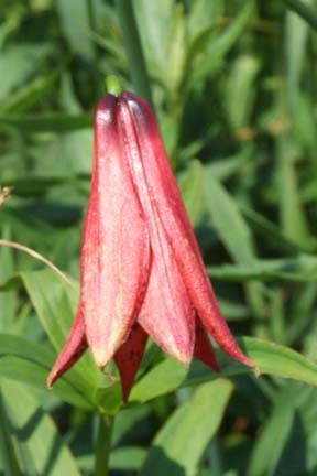
Although the temperature was high, a total of 23 sturdy folks turned up for the impressive hike. The views and flowers, among which were a few Gray's lillies, were spectacular. We lunched on the ridge below Hump Mountain, where we FINALLY convinced Don Walton that he was looking at Grandfather Mountain, not Mt. Rogers!!! We returned to the cars via the Overmountain Victory Trail. No one got lost and we managed to gain 2 hikers on the way up!! Amy.
HALF-DAY No. H0602-347 June 25 Twin Falls 12:40 PM*Hike 6, Drive 80, 1000 ft ascent
Rated B-BStuart English, 828-883-2447, stuengo@citcom.net
P400 *Note early start time. This is a moderate hike in the Pisgah National Forest, starting on the Buckhorn Gap Trail, taking the Twin Falls Bypass to view two nice waterfalls and completing a loop on a Forest Service Road and the Clawhammer Cove Trail. *Meet at Westgate at 12:40 PM to form carpools, and meet leader at Pisgah Ranger Station at 1:15 PM.
Sunday morning was dark, ominous, and stormy and by noon I knew I
had to make a decision. One of our members from Asheville called me and
agreed to go to Westgate and gave me her cell phone number. When I called
her five minutes past their meeting time, I felt very negative about the
hike. It was raining and thundering in Brevard and I told her my doubts and
they decided not to come. Then I drove to the Pisgah Ranger Station to make
the final decision. Eventually two people showed up and said that they were
willing to go and we started out. We had a little rain, but no lightning,
and it turned into a great day. We went up to Twin Falls and then on up the
Buckhorn Gap Trail to a Forest Service Road, where Greg Goodman took us on a
little side trip to an old cemetery on a ridge of Clawhammer mountain. Then
we proceeded on to Clawhammer Cove Trail, where I must commend Bill Newton's
Friday crew for weed whacking what was once a formidable amount of poison
ivy. It just goes to show that you can't ever tell about the weather. Go
ahead, take a chance and hike. And don't pay attention to that worrisome
hike leader. Stuart English.
HALF-DAY No. H0602-064 July 2 Fletcher Creek via Spencer Branch Trail 1:00 PM*Hike 6, Drive 6, Rated B-CGreg Goodman, 828-684-9703
P400 *Note early start time. From the Trace Ridge Trailhead, we will hike in a moderate loop along the Big Creek Trail, past the Hendersonville Reservoir, and along the Spencer Branch, Middle Fork and Fletcher Creek Trails. There will be a few stream crossings. *Meet at Westgate at 1:00 PM to form carpools, and meet leader at pull-out just before Mills River Recreation Area at 1:30 PM.
All Day WednesdayWEDNESDAY No. W0602-165 June 21 Mt. Le Conte via Boulevard, Alum Cave Trails
8:00 AM Hike 13, Drive 150, 2400 ft. ascent, Rated AA-AA Ted Connors, 828-697-7166, tcconnors@mchsi.com SB6K, 900M This great hike features 6593 ft. Mt. Le Conte and good views from the AT, Boulevard Trail, our lunch spot at Cliff Top overlook, and the Alum Cave Trail. Topos: Clingman’s Dome, Mt. Le Conte; also Nat’l. Geo. GSMNP map
8 CMC members enjoyed one of the more spectacular hikes in the CMC repertoire on a “blue sky and sunshine” day. Starting out from Newfound Gap on the AT, we then made a gradual ascent on the Boulevard Trail. Part of this trail is along a knife-edge ridge, with great views on either side.
The trail on the final ascent up to Mount LeConte crosses an old landslide and then works its way up toward the top, with more great views into Tennessee – as long as you don’t mind the very steep, very long drop on the downhill side of the trail. (Was I the only one who hugged the uphill side of the trail?)
After Steve Pierce bagged his 21st SB6K at the summit, we had lunch at Cliff Top, with yet more exceptional views toward North Carolina. The rare sand myrtles (aka mountain myrtle) were in bloom, and the juncos were boldly looking for a handout. We then hiked down to the LeConte Lodge, where we stopped to stock up on T shirts and cool water. And speaking of cool, on a day when Asheville got up to 90 degrees, the temperature on the mountain reached 70.
The final leg of the hike was down the Alum Cave Trail – very rocky, very long and steep drop-offs, and, oh yes, more great views. It was a very long day, with a long drive and a long hike, but with a great return on the effort invested. Ted Connors
WEDNESDAY NO. W0602-035 Looking Glass Rock June 28
8:00 AM Hike 6, Drive 70, 1800 ft. ascent, Rated C-A Ruth Hartzler, 828-251-0886, ruthmtn@charter.net
A moderately difficult well-graded trail leads to the top of this interesting pluton. There are excellent viewpoints from the overlook at the end of the trail just beyond the summit. From the top of Looking Glass, we will identify the location of a proposed USFS timber sale in the vicinity of Case Camp Ridge. The proposed sale involves timber on 165 acres viewable from Looking Glass. Second meeting place: Pisgah Ranger Station on US 276 at 8:35 AM. This is a change from the listing in Let's Go. a
**No report**
All-day hikes submitted by Bruce Bente 692-0116, bbente@cytechusa.com . Driving distance is round-trip from Asheville. All Saturday and Sunday hikes assemble at Westgate Shopping Center near I-240 UNLESS OTHERWISE NOTED.
Half Day hikes submitted by Paula Robbins 828-687-1651 paularww@bellsouth.net. Leaders: Mail please mail your sign-up sheets. Meet at Westgate unless otherwise noted.
Wednesday Hikes are submitted by Paula McNabb, 828- 274-0057paulamcnabb@charter.net and Ann Gleason, 828-859-9387, cowbonetail@yahoo.com . The meeting place for each hike will be designated by the hike leader and will appear in the hike description. Driving mileage will be listed, round trip, from the first designated meeting place.