
CMC Bi-Weekly Hike Reports
Looking Back - November 7, 2008
[See Upcoming Hikes.]
| All Day Saturday and Sunday Hikes |
| Half Day Sunday Hikes |
| Wednesday Hikes |
|
SATURDAY No. A0804-447 Oct. 25 Six hikers showed up Saturday morning, four at Westgate and two at the French Broad Overlook. The climb to Mt. Pisgah was done surrounded by fog. A few other hikers were on the trail and a group up at the tower. Occasionally the sun broke through but not enough to offer any views. There was some water on the trail from the previous day's rain but the trail was manageable. Lunch was a little early, around noon, and was taken at a rock outcrop that gave as much of a view as possible with the fog still prominent. We passed the Turk's Cap Lilies which were done for the season from the frost. The seed pods identified the plants. The fog lifted and by 1 P.M., views of the mountains and the Fall foliage were enjoyed. Bruce Bente shared how he used to find caves in Alabama by watching for patches of fog rising from the valley. Victoria ALL DAY No. A0804-622 Oct. 26 Our trip to Cold Mountain had everything. The hike was actually longer and had more elevation gain than the usual route from Camp Daniel Boone, but the soft, almost rock-free and gentle grade made it seem much shorter and far less tiring, at least below Deep Gap. The weather was great, the leaves were colorful, and the views were clear and beautiful. The mountain itself was crowded. Between Deep Gap and the summit we encountered probably 15-20 people. The only excitement was provided by the leader, who took a wrong turn on the Canton short-cut. ALL DAY No. A0804-063 Nov. 2 On a fabulous fall day, nine hikers enjoyed the Big East Fork, Art Loeb, Shining Creek Loop. We were underway by 9:00, following the Big East Fork with its numerous waterfalls and cascades. Around 10:30, we took a snack break on the rock in the middle of the stream, and then went on to the crossings of the Big East Fork and Greasy Prong. We haven't had a lot of rain; rock hopping was easy and no one fell in. This is where the steep stuff starts, which makes this one of the more strenuous hikes we sponsor, but we enjoyed our lunch on a grassy slope about halfway up. When we finally came out on the Shining Rock ledge after climbing about 3000 ft. we were greeted by wonderful views. We took another break at Flower Gap on the Art Loeb Trail with both north and south views. At this point we were getting a bit tired as we headed onto the Shining Creek Trail, but when we reached Shining Creek we took in the waterfalls and cascades there. Much of this hike is rather rocky, and maneuvering it takes a lot of focus and energy. One of the highlights was Tom's acrobatic slide of about 20 feet down a steep slope when his hiking poll went down instead of into the ground. No problem! The surface was all leaves and loose dirt. And then onward. A wonderful fall hike and certainly a good workout. When I got home I weighed 164. The previous time I had weighed it was 173. For those who want to knock off a few pounds and really enjoy yourself, try this hike. Tom ALL DAY No. A0804-444 Nov. 2
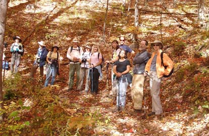
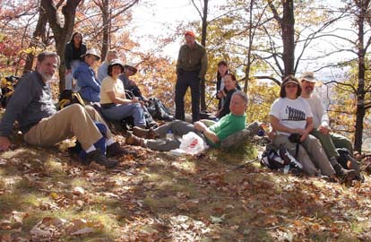
The thirteen hikers who assembled for this one brought good luck the Sunday after Halloween. We had the most beautiful fall day in the woods that I have enjoyed in a long time. We were between 2000 and 4000 feet and the colors were still perfect. The only thing we could have asked for was to have a few more leaves off the trees on top of Rich Mountain, where we ate lunch,for our view there; but the rest of them we would have had stay up in the trees. But actually, I think most of us agreed that this was close to a perfect hike. Stuart. Photos by Stuart English. HALF-DAY No. H0804-009 Oct. 26
HALF-DAY No. H0804-295 Nov. 2
No report. Photo by Gerry McNabb.
WEDNESDAY No. W0804-600 Oct. 29
WEDNESDAY No. W0804-271 Nov. 5 T The hike began with a relatively easy walk along Hickory Branch . There were several beautiful cascades and creek crossings before we began climbing. After reaching the ridge we did a short out and back on Lead Mine Gap trail towards Buckeye Knob. We stopped before the summit, but had great views of the Blacks, 7 Sisters, Graybeard, Green Knob, Clingman, etc. Next was a fun and sometimes challenging climb to Chestnutwood Mountain, primarily following ridge lines. From this point on the trails are not maintained or blazed and numerous blow downs meant several bushwhacks. After hitting the summit, the remainder of the hike involved bushwhacking down to logging roads, more bushwhacking and more beautiful views and leaves. While on the ridge line we could also see Mackey Mountain and the Linville Gorge area. The final stretch of the hike brought us down by Paddy's creek and returned down hill to Curtis Creek Road. The group as a whole seemed to enjoy the beautiful area and were excited about seeing a new area. I really had fun leading my first hike. The group was great and perfectly suited for this hike. Charlie was amazing helping me scout it out and getting me off to a good start. I'm excited about the area. It really would be perfect for some of our winter club hikes. It's closer to Westgate than the Brevard area hikes and would give us some more options. I'm attaching a group picture. It was taken at the summit of Chestnutwood Mountain. Charlie may be sending more pix. Lee. Photo by Lee Silver. All-day hikes submitted by Bruce Bente 692-0116, bbente@bellsouth.net . Driving distance is round-trip from Asheville. All Saturday and Sunday hikes assemble at Westgate Shopping Center near I-240 UNLESS OTHERWISE NOTED. Half Day hikes submitted by Lucy Prim 828-693-6580 lucette32@mchsi.com. Wednesday Hikes are submitted by Charlie Ferguson, 828-398-0213 ccf108@gmail.com and Ann Gleason, 828-859-9387, gleason.ann@gmail.com . The meeting place for each hike will be designated by the hike leader and will appear in the hike description.
Driving mileage will be listed, round trip, from the first designated meeting place. |
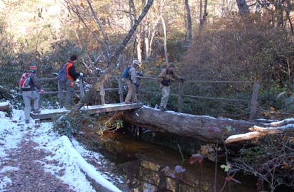
 Seventeen hikers lined up to go to Rattlesnake Lodge. Our group included Jim Ariail, the Section Maintainer for this section who also served as the sweep. We started at the real Bull Gap instead of Ox Creek. The switchbacks look much better after the recent overhaul by our crews. We stopped at the CMC sign near the old lodge site and talked about the sites of the old buildings. We took the traditional break at the spring house site and observed the old electric generator stand in the tool shed near by. After the break we went up the access to the water reservoir. It is dry as is most of the springs and streams in the area. Continuing on the loop back to the MST and the lodge, we noted the Shack location, Potato Root House and site of the pig pen. We arrived back at Westgate about 5:30 safe and sound. Don Walton. Picture by Bobbi Powers.
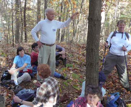
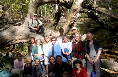
 Six CMC members joined hike leader Jack Fitzgerald on a hike through the Pink Beds, up to Buckhorn Gap, then down to the South Mills river before returning to cars back through the Pink Beds. The weather was quite cold to start, below 32 degrees, but quickly warmed up. The fall colors were quite beautiful. According to a GPS reading, the hike turned out to be 12 instead of 10 miles. Jack. Photo by Ted Connors.
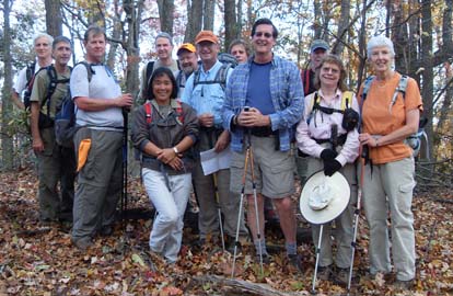 hirteen hikers met at the Black Mountain McDonalds and the trail end ready to explore an area that few were familiar with. We turned up Curtis Creek road just east of Old Fort and drove 1.8 miles to the trail end. We left cars there for the shuttle and drove another 3 miles to the trail head which is just past the camp ground. The hike was in the first area purchased for Pisgah National Forest in 1911. The 8,000 acre area is very pretty and provides some interesting hiking opportunities. The weather was perfect with blue skies, sunshine and warm temperatures. The leaves were amazing. It was definitely the peak of color in the Old Fort area.