CMC Bi-Weekly Hike Reports
June 19th, 2009 -- Looking Back
|
| Wednesday Hikes |
All Day Saturday & Sunday ALL DAY NO. A0902-459 May 31
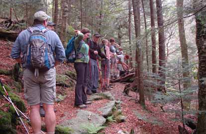
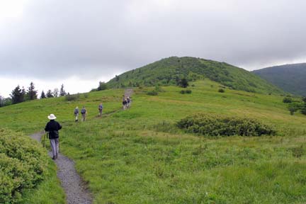
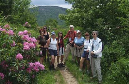
Photos by Ted Connors The weather forecast was good after many days of rain, and 15 people showed up for this hike. The route goes from NC128 (the Mt. Mitchell Road) along the MST to Greybeard Overlook on the Blue Ridge Parkway, around 9 miles. As we drove up the Parkway dark clouds were overhead and then we ran into dense fog. We left 2 cars at the Overlook and went on to the trailhead, where the MST crosses 128. The first two miles, a 1,000 foot climb, feature the remarkable rock work that went into building the trail. I remember how proud the crew was of what they had done. It was still chilly and overcast when we reached the crest and totally new environments. The trail went up and down and then steadily upward to 6,000 plus Blackstock Mtn. After a couple of false guesses, we found the summit. We then descended for lunch at Balsam Gap. The sun now came out. In the afternoon we walked the final 4 miles, enjoying the frequent outstanding views both into the Valley around Dillingham and the North Fork Reservoir. At the end, 3 of the group chose to climb 6000-plus Craggy Dome. Twelve in all stopped by my house on the way back for wine, beer, munchies and fellowship. There were many comments about what a great day and hike it had been.--Tom Sanders NATIONAL TRAILS DAY HIKES - 2 all day hikes on Sunday June 7: National Trails Day Hike: ALL DAY NO. A0902-217 June 7
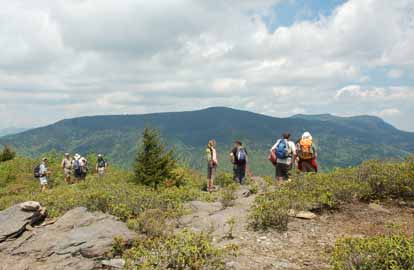
Photos by Ted Connors Approximately 20 hikers congregated at Westgate, and were assigned four vehicles with adequate ground clearance to negotiate the rocky roads leading to the two trail heads. After meeting hike leader Sarah Carothers at the base of Earley's Mtn. & Boyd Cove Rd.(second meeting place), each group ascended the tenuous roadbeds leading to the respective trail heads. Per the hike description, the Surritt Cove ascent is steep and enduring, made no easier by the significant ground erosion resulting from the impact of illegal ATV traffic on the trail, and adjoining areas. Respective land owners have been advised of this situation. Nonetheless, all parties were enthralled with the views towards the Smokies, upon popping out on the ridge. After a short 45 minute spur hike to a bench located atop the next hump to the southwest towards Crabtree Bald, we continued our ridge top sojourn to Big SandyMush Bald, where we awaited the arrival of the group commencing from Boyd Cove. Amazingly, less than 10 minutes transpired before both groups enjoyed a lunch together in the tall grasses of the Bald. After ample time for enjoying food, camaraderie, the views, and a photo opportunity, we exchanged keys and continued on our respective journey amidst the lupine and other wild flowers. Generally, visibility on the ridge top was better than fair, for this time of year, and improved as the tangential position of the sun lowered in the sky. Views to the northwest, into the smokies were quite good, especially towards Mt Sterling, Cammerer, and Guyot in the distance. To the North, Hurricane, Max Patch and Big Bald were easily recognized. Having Alan Householder along provided a fantastic resource to enjoy every little nuance. Views to the far east were diminished by low lying clouds. Beautiful views of downtown Asheville were evident later in the day. In the future, we probably need to key swap at the beginning, as the distances to the lunch spot are different from both directions, and that would avoid the hour wait that half the group incurred at the second meeting place, at the end of the hike.--Rob Resneck National Trails Day Hike: ALL DAY NO. A0902-137 June 7
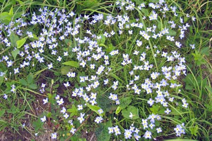
Photos by Danny Bernstein There were 13 people on the hike - new hikers from Indiana, New York City, Charlotte and Shelby. It was a beautiful, partly clody day after several weeks of rain. We hiked to Grassy Ridge and had lunch on Round Bald with its awesome views, then on to Roan High Knob. We split the group then, with half walking on to Roan High Bluff to obtain SB6K status and the other half going back to Carver's Gap and then driving to the Bluff, picking up the remaining hikers. The rhododendron was just popping out and will probably peak around June 20. Wild flowers spotted were Golden Ragwort, Jack-in-the-Pulpit, Clinton Lilly, wild strawberry, and lots of Bluets.--Les Love SATURDAY NO. A0902-604 June 13 Eight of us splashed our way to the Splash Dam site on Big Creek. North Mills River was full and there was a very impressive wall of water coming over the Hendersonville Dam. We had about a mile of off-trail up beautiful Rich Cove to visit the twin buckets. We ate lunch at the dam site and returned to Trace Ridge via the North Mills River trail. We had 12 stream crossings, and some of them were just challenging enough to be a good learning experience. Although rain threatened in the afternoon, nobody got wet above the knees. --Dave Wetmore ALL DAY NO. A0902-644 June 14
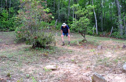
Photos by Bev McDowell and Danny Bernstein This was the third and last hike CMC scheduled as part of the 75th Anniversary celebration for the Great Smoky Mountains National Park. Unfortunately, because of preparations for the ground breaking for the new Oconaluftee Visitors Center, no Park Staff could participate. Nine CMC members participated in the hike. The group separated by hiking speed climbing the Newton Bald Trail, but stayed together on the long downhill on the Mingus Creek Trail. As advertised, the flame azaleas were in full bloom, and after this spring’s rain, bright orange. We also saw mountain laurel, spiderwort, and a host of other wild flowers. The most interesting part of the hike was a side trip to an African-American cemetery. It is a 1.6 mile roundtrip on a side road that leaves the Mingus Creek Trail 1.2 miles from Mingus Mill. The last 100 yards is a steep climb up a hillside. The route is clearly marked with signposts. The cemetery contains markers for about 50 graves, but few are smooth stones that could have had inscriptions. A name and date had been scratched onto one such stone. Three of the graves had recently been mounded up, and the grass was low around all of the gravesites, indicating that someone has been taking care of the cemetery. At the end of the hike, we took a quick look at Mingus Mill, which uses a stainless steel turbine for power rather than the classic water wheel. It was yet another example that the people who lived in the Smokies before the Park was founded were very much a part of the larger world.--Lenny Bernstein
HALF-DAY NO. H0902-641 May 31 On Sunday afternoon 5/31, 22 hikers gathered to do a 5.5 mile hike on the MST. We started at Mt. Pisgah parking lot and after a steep but brief 300-foot climb, arrived on top of Little Pisgah ridge and enjoyed the views on this cool and clear day. After that it was (mostly) downhill to Stony Bald overlook, with more short uphills than I had remembered. A few late trilliums were in bloom, including a couple of Vasey's, but most of the spring flowers were long gone. The heavy rains in May produced thick stands of Cinnamon ferns already 5 feet high, and the giant Turk's Cap Lilies near Mills River Overlook are already 5 to 6 feet high. Come back in July to see the lilies when they are in bloom and at maximum height.--Bruce Bente NATIONAL TRAILS DAY HIKE: HALF-DAY NO. H0902-049 June 7 HALF-DAY No. H0902-465 June 14
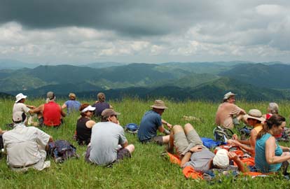
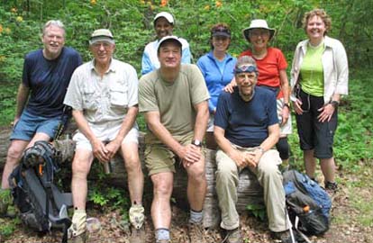
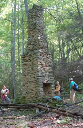
Photo by Ashok Kudva Despite the threat of another afternoon thunderstorm, some 14 of us showed up for the scheduled photo hike to Sam Knob. As it turned out, we had only about a half hour of light showers, putting just a slight dent in the picture taking. It seemed as though the Sam Knob area was expecting us. It had deployed a panoply of floral richness for us to shoot as the date proved ideal on which the hike had been scheduled. I did not take the full 5.6-mile hike as described. And indeed, with the stops for pictures, it turned about just about right. Using the alternate shortcut, we returned to the Sam Knob parking lot at 5:45... at to Westgate at 6:45. The enclosed photo was taken by the leader and shows Half-Day Hike Chairman, Lucy Prim, talking with Jim Airial, while others shoot their own versions of the hike or chat among themselves. One professor from New Jersey had discovered us online and drove to the meeting place after delivering a paper in Charleston. This always amazes me when it happens. It was a good group.-Gerry McNabb WEDNESDAY NO. W0902-636 May 27 Nine hikers attired in full raingear started the hike in heavy rain, a continued pattern for the last week. Sawako Jager, a first year hiker, volunteered to be our sweep. I allowed those wanting to hike faster go ahead up to the next trail junction, to follow trail blazes and avoid other paths off the trail, wait or return to meet me for further direction. It worked well, they beat the rain and we could remove our raincoats when we completed the 1,000 ft climb on the left branch of Coontree Loop at Bennett Gap Trail. The trail was full of mountain laurel petals on the ground. On the ridge we went under a canopy of mountain laurel. Since trees were covered with leaves, a 360 degree mountain vista we enjoyed in the March 29 Sunday hike on the same trail was not available today. We took a snack break at this spot to provide enough fuel for the next 500 ft descent down the Coontree Mountain and a steep 1000-foot climb to Pressley Cove for lunch. A no-name stream, a tributary of Avery Creek, was gushing with white water under several foot bridges. We crossed and around rocks parallelled to Pressley cove Trail. Enchanting sound and sight of many small, no name waterfalls next to the trail made the mile long climb very pleasant. I do not recall seeing much water under foot bridges and any waterfalls in the March 29 hike! After lunch we visited the historic chimney, retraced the stick part of the lollipop loop and returned to the cars via the right branch of Coontree Loop. It was sunny during the last hour of our hike. Our GPS data gave us a 2500 ft total ascent and descent versus 1900ft we reported in the original announcement. But, none of the hikers complained and we had a great hike.--Ashok Kudva NATIONAL TRAILS DAY HIKE: WEDNESDAY NO. W0902-394 June 3
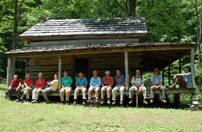
Photos by Ted Connors Fourteen CMC hikers enjoyed a rare chance to explore an area of the Smokies not known to the average hiker, featuring the “dug road,” a track built by hand in the 1850s to enable horse-drawn sledges to pull produce between settlements.. Hike time was approximately 6 hours, hiking distance 7.2 miles, and elevation gain 2,028 feet. Vegetation growth since the May scouting hike made following the Dug Road and bushwack to connect to the Little Cataloochee Trail difficult, but everyone took it in good spirits. We lunched at the Little Cataloochee Chapel and explored the graveyard there. On the way back we checked out the well-restored Cook’s cabin; then we enjoyed a much easier return via Davidson Gap to Palmer Creek and our cars.--Barbara Morgan WEDNESDAY NO. W0902-008 June 10 WEDNESDAY NO. W0902-566 June 17 Reports for Wednesday hikes during the eNews publication week will appear in the following eNews--The Editor. All-day hikes submitted by Bruce Bente 692-0116, bbente@bellsouth.net . Driving distance is round-trip from Asheville. All Saturday and Sunday hikes assemble at Westgate Shopping Center near I-240 UNLESS OTHERWISE NOTED. Half Day hikes submitted by Lucy Prim 828-693-6580 lucette32@mchsi.com. Wednesday Hikes are submitted by Charlie Ferguson, 828-398-0213 ccf108@gmail.com and Ann Gleason, 828-859-9387, gleason.ann@gmail.com . The meeting place for each hike will be designated by the hike leader and will appear in the hike description.
Driving mileage will be listed, round trip, from the first designated meeting place.
|