CMC Bi-Weekly Hike Reports
July 31st, 2009 -- Looking Back
| Half Day Sunday Hikes |
| Wednesday Hikes |
All Day Saturday & Sunday ALL DAY NO. A0903-337 July 5
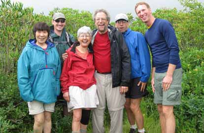
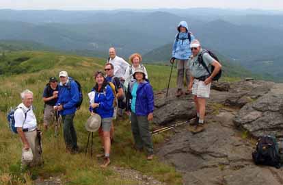
Photo by Lenny Bernstein It was a dark and stormy morning. It rained on the way to the trailhead. We climbed Black Balsam in the clouds, and when we got to the top, the wind was blowing hard enough to be uncomfortable. We stayed only long enough to pay homage to Art Loeb, since this hike was in honor of the 40th Anniversary of the Art Loeb Trail. His daughter, Joan Dixon, had told us that she always yelled “Hi, Dad,” when she got to the plaque or to the top of Shining Rock. So we yelled “Hi, Art.” The rest of the commemoration was at lunch, on top of Grassy Cove Top, when I read from Danny’s book about Art Loeb and the effort to have the trail named after him. The weather started improving as we left the top of Black Balsam and improved for the rest of the day. The view started appearing and by the time we got to the top of Shinning Rock, we had a full 360 degrees and our fourth SB6K peak of the day. The seven of us felt rewarded for persevering and had some unkind words to say about the three who failed to show up for the hike. It turned out to be a great day after all.--Lenny Bernstein ALL DAY NO. A0903-657 July 5
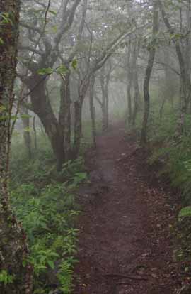
Photo by Bruce Bente This hike was done as a key swap. Reports from both directions follow: Northbound: The weather was a mixture of light rain or cloudy most of the way from Asheville, but as we did the steep climb to Carvers Gap, the skies opened up. The two of us had second (and third) thoughts about doing this hike, but since our car was waiting 7 miles away, there wasn’t a great deal of choice in the matter. Imagine winds of maybe 30mph with horizontal driving rain in thick fog and you’ve got the picture. And a temperature in the mid-50s. Roan Mountain weather. It was an interesting experience…never call us fair-weather hikers! On top of Jane Bald, we heard barking from behind a fence and two Great Pyrenees dogs ran out to inspect us, and quieted down when they determined that we were just two insane hikers. A very short lunch was spent hunkered down on Grassy Ridge Bald in a tiny copse of spruce trees, and then onwards to meet the other hikers for the key swap. And as soon as we got off the open balds and into the woods, the rain stopped, raingear came off and we had a pleasant hike down to Yellow Mountain Gap. The brand-new relo’s were nice downhill and probably even nicer in the uphill direction--Bruce Bente Southbound: Michael, Kathy and I left the trail head at 10am heading south on the A.T. from Yellow Gap and spent several minutes talking with members of the Tennessee Eastman Hiking Club. We started out with rain gear on but had very little rain along the way. Temperature at 60 degrees which probably never got into the 70’s the rest of the day. A dozen or more of the Konnarock Crew were working on two different relo’s on the A.T., one of which they just opened up to hiking as we arrived. We were the first to thread on the new section – nice! The new sections are easier and with a more graduated climb. We also came across the Baa-tany Goat Project with about 30 -40 Angoras with their two guard dogs – Belgium Sheep dogs? The new issue of the A.T. Journeys has an article on the project. After meeting up with Bruce & Ted to exchange car keys, our group continued to Carver Gap in weather that was extremely foggy and windy, but no rain. We opted not to take the side trip to Grassy Ridge Bald due to the fog, visibility was very limited. There was heavy fog throughout the day. --Carroll Koepplinger SATURDAY NO. A0903-658 July 11 Nine hikers had an overcast, somewhat muggy, day to enjoy this verdant trail. After lunch at the falls, the blooming rhododendron provided both tunnels and full hillsides blanketed with white flowers. Mushrooms included red, orange, yellow, white, beige; some were the size of a pinhead and a couple were large enough for seats. No injuries, no snakes, no lost wanderers----just an enjoyable, pleasant walk in the woods.--Janet Martin ALL DAY NO. A0903-473 July 12 With the promise of great views, nine hopeful hikers headed for Mt. Mitchell in a heavy fog. We were rewarded as the fog slowly lifted and the views of the whole range opened up. The hike was billed as moderate but the last two steep and rocky miles were anything but moderate. Luckily everyone was a strong hiker and the leader didn’t receive any complaints.--Bob Hysko ALL DAY NO. A0903-120 July 19
Moderately clear skies, cool temperatures and a large group of individualists were the main ingredients for a pleasant summer hike through the Smokies. Sixteen hikers started the hike to Charlie's Bunion from Newfound Gap including one hiker from Kansas City- Vicki Zasadny, sister of Kathy, co-leader of the hike. Fifteen finished. Bob Hysko who missed the 8 a.m. start at Westgate beat the group to Charlie's Bunion, and passed us as we were entering the lunch spot, which had good views and brownies. Tom Sanders, who started the hike with us, finished it on another route to accumulate miles for the Smokies 900. Bob followed Tom's route, caught up with him, and got a shuttle back to his car at Newfound Gap. Five hikers, who wanted more of a challenge, took a side hike to Mt. Kephart, a peak over 6,000 feet. All but Bob and Tom finished the hike going down Dry Sluice Gap Trail and then a right on Grassy Branch Trail and had a break at the Kephart shelter, and finished the hike on the Kephart Prong trail, crossing Sweat Helfer Creek several times on bridges. Bob and Tom finished their hike at Smokemont.
SATURDAY No. A0903-405 July 25 Three other hikers joined me for a beautiful hike along the MST toward Mt. Pisgah. We left from the Mills River overlook on the BRP at 9:10. At approximately 11:30, we reached the site of the Buck Springs Lodge and decided we really had no need to lunch at Pisgah Inn area. We lunched instead under a nice tree near the old lodge, looking out over the valley. We backtracked to our cars and reached them by 1:30. It was a very pleasant hike with lots of Turks' Cap lilies, black cohosh, some nice fungi, and a gentle cool breeze.--Barbara Morgan ALL DAY NO. A0903-659 July 26
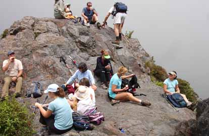
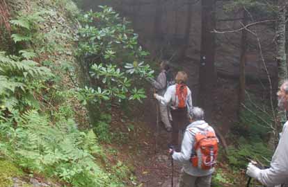
Photo by Steve Bowers Ten hikers were treated to spectacular 360 degree panoramas from atop Little Hump and Hump Mountain on the A.T. after a short climb northbound from Yellow Mountain Gap in Avery County. Cloudy skies kept the sun and heat at bay, and made for a comfortable walk in the high mountain grassy meadows. The long-horned Watusi cattle that often graze here were not to be found today, but strong evidence of their recent visit marked the trail. After a good while in the open, we began our long descent among the trees through Doll Flats into Tennessee, ending just west of Elk Park.--Steve Bowers HALF-DAY NO. H0903-173 July 5 Hike cancelled because of storms. HALF-DAY NO. H0903-349 July12
Photo by Lucy Prim We had a very nice walk down the trail from the Pisgah Inn to where it comes out on US 276. The woods were really beautiful. Lots of flowers were blooming and all the plants looked so lush and green with the lovely rain we've been having. I think most of us enjoyed the hike, though some thought we were going much too slowly and others no doubt thought we weren't going quite slowly enough. Tales of recent bear encounters circled amongst the hikers. In fact, one of our hikers only came on the hike with us because she'd seen three bears the day before while walking near the Pink Beds, and decided it would be safer to walk with a group. But since we walked so incredibly slowly she decided that in the future she'd rather take her chances with the bears. Deep in the woods, Tom Joyce called our attention to the strange sounding call of a yellow-billed cuckoo!--Lucy Prim HALF-DAY NO. H0903-463 July 19 Eighteen CMC members enjoyed a 4.4-mile hike on the Shut-in portion of the Mountains-to-Sea Trail from the Big Ridge Overlook to Elk Pasture Gap on a mostly cloudy and cool (for July) day. They were rewarded with views of a rich profusion of wild flowers, including Turk’s Cap Lilies (Lilium superbum), Fringed Campion (Silene ovata), Leather Flower (Clematis viorna), Black Cohosh (Cimicifuga racemosa), and Ox-eyes (Cheliopsis helianthoides).--Paula Robbins HALF-DAY NO. H0903-655 July 26
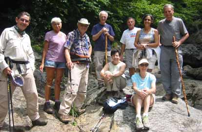
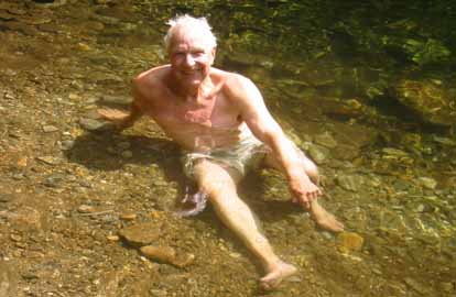
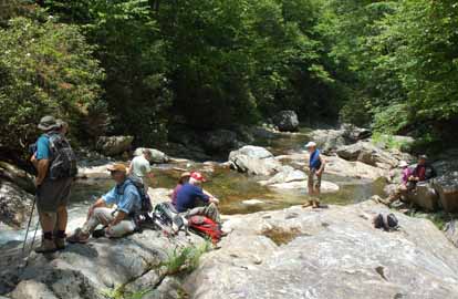
Photos by Bobbi Powers Ten congenial hikers enjoyed an idyllic hike along the picturesque banks of the East Fork of the Pigeon River in Shining Rock Wilderness. The great weather contributed to our mid-river-on-the-rocks lunch and our late afternoon swimming hole stop. Regarding the latter, Greg Goodman, our sole hardy swimmer, rated a photo op!--Bobbi Powers WEDNESDAY NO. W0903-471 July 1
Photos by Ted Connors WEDNESDAY NO. W0903-507 July 8
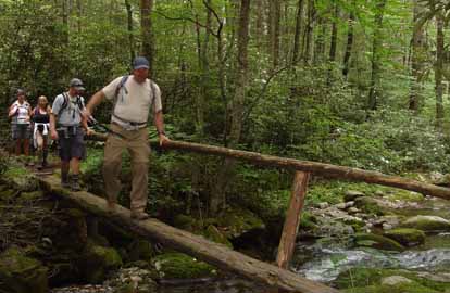
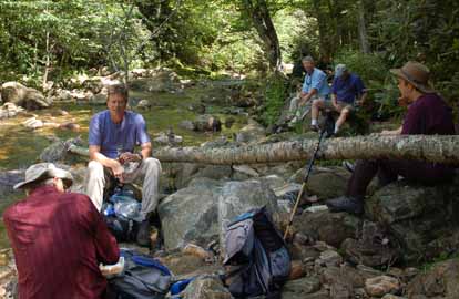
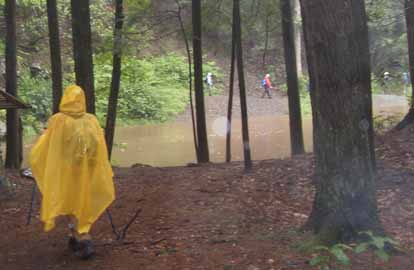
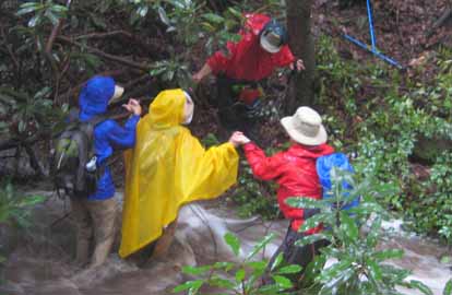
Photos by Lee Silver and Charlie Ferguson Sixteen of us came, expecting to hike along seldom used trails and ford a placid creek in our water shoes. However, when the sky opened up and torrents of rain and lightening came down, we got more than we had hoped for. We got to see how fast placid creek crossings can turn into dangerous creek crossings with strong currents and how fast part of the trail can hide under water. Best of all, I got to see the great spirit of these hikers as they helped each other find the safest places to cross; all the while joking and laughing at our impossible situation, and Charlie and Mary Beth with great patience helping our new hiker, who was having great trouble, with the crossings. She admitted to me later she panicked but you couldn't tell as they eased her across. What a great group of hikers; l would be glad to hike in a blinding rainstorm with these guys anytime.--Brenda Worley WEDNESDAY NO. W0903-654 July 15 A great hike, everyone thought it was a good hike although it turned out to be 12 miles. We had one new hiker--Greg Goodman WEDNESDAY NO. W0903-343 July 22
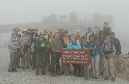
Photos by Ted Connors Twenty-three intrepid hikers took on Mount Mitchell Wed July 22nd. The drive up in the fog and across bumpy roads was a challenge. The clouds stayed on the mountain all day, so the views never opened up. The weather was cool and breezy but it did not rain. It was pleasant to be relatively cool in the middle of the summer. The fog banks sweeping up the mountain gave the woods and trails a mystical feeling. The 6 mile hike involved many rocks, roots, climbs, steep descents and slippery footing. This all combined to make it feel longer than it actually was. The group had a great time together and all seemed to enjoy the experience. We climbed from the ranger station to the summit via the Old Mitchell trail and the MST. We took pictures on the new tower, looked at the maps and clouds and then ate lunch at the summit picnic area. We came down the New Mitchell trail to the Buncombe Horse Trail and Commisary Ridge trail to return to the ranger station. WEDNESDAY NO. W0903-405 July 29 Reports for Wednesday hikes during the eNews publication week will appear in the following eNews--The Editor. All-day hikes submitted by Bruce Bente 692-0116, bbente@bellsouth.net . Driving distance is round-trip from Asheville. All Saturday and Sunday hikes assemble at Westgate Shopping Center near I-240 UNLESS OTHERWISE NOTED. Half Day hikes submitted by Lucy Prim 828-693-6580 lucette32@mchsi.com. Wednesday Hikes are submitted by Charlie Ferguson, 828-398-0213 ccf108@gmail.com and Ann Gleason, 828-859-9387, gleason.ann@gmail.com . The meeting place for each hike will be designated by the hike leader and will appear in the hike description.
Driving mileage will be listed, round trip, from the first designated meeting place.
|