All Day Saturday & Sunday
SUNDAY NO. A1002-370 June 20
South Mills River 8:00 AM
Hike 12.5, Drive 75, 1100 or 750 ft. ascent, Rated AA-B or AA-C
Stu English, 828-883-2447, stuengo@citcom.net and Charlie Ferguson, 828-625-2677, ccf108@gmail.com
P400 *Form carpools at Westgate, and meet leaders at Pisgah Ranger Station at 8:35 AM. This is another of the P400 hikes that is scheduled during a summer month because of its nine stream crossings. Plan to wear water shoes for the section between Cantrell Creek and Wolfe Ford. Two hiking poles are recommended for the stream crossings. The trail follows the old logging railroad grade, so look for old trestles at stream crossings. This hike will be done as a key swap. Topo: Pisgah Forest
The downhill report is followed by the uphill report--Editor
We formed two groups for a key swap hike due to the inordinate amount of driving time between the respective ends of this trail. Eleven were in my group and 15 in Charlie's because they wanted to do more climbing. Ironically, I think we probably climbed a little more than they did at least noticeably. We got off the official South Mills River Trail and followed the trail that followed the river and went by High Falls. This trail save us about two miles and a lot of boredom. From Wolf Ford we made 9 more wet stream crossings. There were 10, 11, or 12 in all depending if you counted every small stream that got your feet wet. The hikers in my group had no problem with the crossings and were faster and more blase about it with every attempt. There were stilll a couple of places where the water was waist deep even though it hasn't rained in a few days. After the Cantrell Creek Lodge site, there were only bridges, although we waded one more time due to warnings from the other group about yellow jackets after the log bridge at Cantrell Creek. At the end, of course, we had to climb back up to the parking lot at Turkey Pen and all that time spent in cool water was a distant memory. Twelve of us enjoyed dinner at Twin Dragons after the hike.--Stuart English
Fifteen hikers began the South Mills River Stream Crossing hike at the Turkey Pen parking lot. Our first 4.5 miles was dry, crossing a few bridges, and arriving at the Cantrell Creek Lodge. Two people got stung by yellow jackets near one bridge. Shortly after the lodge we did the first of 10 wet feet stream crossings. The water was cool and much appreciated by our feet and legs. The water level was about a foot shallower than during the scout. We stopped for lunch about half way (6 miles) and left time for some swimming in the river. Shortly after we started hiking after lunch we met the downstream group and chatted for awhile. We stopped at a rock cliff lining the river for awhile. Six of our group decided to for a really slow subgroup so that they could spend more time in the water at the various swimming holes on the way to the Gauging station. We stopped at Otter Hole and got into the water again before the short walk back to our cars. It was a great hike, not very strenuous. Some folks though that we should make this a yearly hike in the summer.--Charlie Ferguson
SATURDAY NO. A1002-401 June 26
Laurel Mtn.- Slate Rock Creek 8:30 AM
Hike 9, Drive 70, 2500 ft. ascent, Rated A-AA
Brent Martin, 828-369-7084, brentmartin@tws.org
P400 We’ll hike up Laurel Mtn. trail to Sassafras Gap, then drop down to the Slate Rock Creek trail and follow this beautiful trail back to FS 1206. Short car shuttle. Topo: Dunsmore Mtn.; also NatGeo map #780
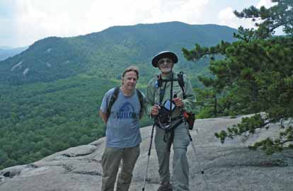 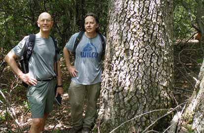 \ \
Photos by Ashok Kudva
SUNDAY NO. A1002-566 June 27
Roans in Bloom 8:30 AM
Hike 8, Drive 150, 1000 ft. ascent, Rated B-B
Tom Sanders, 828-252-6327, tomary.avl@gmail.com
SB6K A beautiful AT hike with some of WNC’s finest views. Expect rhododendrons and flame azaleas to be in bloom, with perhaps an early Gray’s Lily. From Carver’s Gap we’ll go north past Grassy Ridge (6160 ft.) to a scenic overlook for lunch, then double back south to Carvers Gap. From here we’ll drive up to see the Rhododendron Gardens and the vista from Roan High Bluff (6287 ft.). (small fee to enter garden area) Topo: Carvers Gap; also NatGeo. map #783
The forecast was for 90 plus degrees and thunderstorms, but 8 of us took off for the Roans. As we drove, the skies were ominous, and all of us anticipated an eventual rain. From Carver Gap we set off north. Unfortunately, no rhododendrons, too late, but a lot of Gray's lilies and the usual outstanding views from that area. We ran across a lot of people going in both directions. We checked out Grassy Ridge and then moved one peak over to have lunch on a rock face, also with good views. It didn't seem so hot, partly because of the altitude around 6,000 ft., and occasional breezes. After returning to Carver Gap we drove up to Cloudland and walked out to Roan High Bluff and back. About 7 miles in all. A good hike. And it never rained; in fact the visibility was quite good.--Tom Sanders
--Back to Top
Half Day Sunday
HALF-DAY No. H1002-453 June 20
Max Patch Ramble 12:30 PM
Hike 5.5, Drive 104, 800 ft ascent, Rated B-C
Nonmembers, call leader, Gail Lamb, 828-275-4500, galmb46@bellsouth.net
Awesome panoramic views and summer wildflowers make this moderate hike a favorite. We will go to the top of Max Patch, then a combination of Appalachian and Buckeye Ridge trails. This will take us north through meadows, woods and across a small stream. We will break at the AT shelter and return on the AT. Second meeting place only if I-40 is open: Pilot Truck Stop at exit 24 at 1:00 PM.
--Back to Top
WEDNESDAY NO. W1002-566 June 16
The Roans *8:30 AM
Hike 8 Drive 130, 1000 ft. ascent, Rated B-B
Adrian Lotherington, 828-484-9132, jaloth@charter.net
SB6K *ONLY MEETING PLACE: Rose’s car park (opposite McDonalds), exit 19B off I-26 in Weaverville. This in-and-out hike features great views. From Carver’s Gap we go over Jane Bald and Round Bald to Grassy Ridge Bald. With luck we will hit the rhododendron bloom. If time allows we will drive to the gardens and walk ½ mile to see the view from Roan High Bluff (small fee).
The weather forecast was a 60% chance of scattered thunderstorms. Nevertheless, 29 enthusiastic hikers showed up for this hike over three balds. The weather gods blessed us with a breezy and clear day. We enjoyed several sitings of the infamous Gray's Lilly and the flaming azaelas. The Rhododendrum blossoms were not as numerous probably because of the harsher winter weather, but still beautiful in their own right. With a cautious eye on the sky, the group enjoyed long distance panoramic views as we passed safely over the three balds. All in all, the hike was a success with much shared camaraderie. The gardens were bare of blossoms so we skipped that part of the hike.--Jay Bretz
WEDNESDAY NO. W1002-471 June 23
Cold Mtn. Overlook to Bridges Camp Gap to Big East 8:00 AM
Hike 9.7, Drive 55, 1500 ft. ascent, Rated B-A
Tom Sanders, 828-252-6327, tomary.avl@gmail.com.
P400 Hike from Cold Mtn Overlook up to Green Knob (Penny Rock) and to Bridges Camp Gap on the MST, then down to US 276. Short car shuttle. Wilderness area, limit 10, so contact leader for reservation. Second meeting place: Cold Mtn. Overlook at 8:40 AM. Topo: Shining Rock
On a day with forecast of 90 degrees, six of us began our hike at the Wagon Road Gap Overlook on the BRP. We took the access to the MST and then followed the MST up Green Knob, the highest mountain between Pisgah and Black Balsam. This is part of my MST section and Don Walton, Pete Petersen's trailcrew, and I had cleared it of debris. From Penny Rock on Green Knob we enjoyed somewhat hazy views of Looking Glass and other mountains in the Pisgah Ranger District. We then continued on the MST over Chestnut Mtn to the connector near Bridges Camp Gap that leads down to the Big East Fork of the Pigeon River. There we had lunch in a great spot by the water. We then hiked down the Big East Fork, stopping periodically to look at the many waterfalls and cataracts. On the way we encountered several other CMC'ers on a spin led by none other than Marcia Bromberg. After that we walked through a downpour of 20 minutes and then back to US276. This is a superb hike with great variety, good views and one of the most beautiful streams in WNC. It was hot, but probably less than 90 degrees in the woods. Of course, we sweated a lot, which is good.--Tom Sanders
WEDNESDAY NO. W1002-137 June 30
Carvers Gap to Grassy Ridge Bald, Roan Mtn. *8:00 AM
Hike 11.9 Drive 130, 2400 ft. ascent, Rated A-AA
Tish Desjardins , 828-656-2191,desraylet@aol.com
*Form carpools at Westgate, and meet leader at McDonald’s in Burnsville at 8:40 AM. Hike from Carvers Gap north on AT to Grassy Ridge side trail, then return on the AT to Roan High Knob and Roan High Bluff, and return to trail head. 360 degree panoramic views and flowers. Topo: Carvers Gap
Email your hike reports to Dave Wetmore. The deadline for reports is 9:00 p.m. on the Tuesdays before an eNews comes out. Reports for Wednesday hikes during the eNews publication week will appear in the following eNews--The Editor.
--Back to Top
All-day hikes submitted by Bruce Bente 692-0116, bbente@bellsouth.net . Driving distance is round-trip from Asheville. All Saturday and Sunday hikes assemble at Westgate Shopping Center near I-240 UNLESS OTHERWISE NOTED.
Half Day hikes submitted by Lucy Prim 828-693-6580 lucette32@mchsi.com.
Wednesday Hikes are submitted by Charlie Ferguson, 828-398-0213 ccf108@gmail.com and Ann Gleason, 828-859-9387,
gleason.ann@gmail.com .
The meeting place for each hike will be designated by the hike leader and appears in the hike description.
Driving mileage is round trip, based on the first designated meeting place. Meet at Westgate unless otherwise noted. |