|
Looking Ahead
National Trails Day, Saturday, June 7th
This is a special day with special hikes. There will be two moderate half-day hikes and one moderate all-day hike. One of the half-day hikes is the first of what we hope will be a popular series of hikes, all with fire tower destinations. If the weather cooperates, wonderful views are guaranteed!
SATURDAY ALL-DAY NO. A0802-273 June 7
Boogerman Trail *9:00 AM
(moderate hike)
Hike 8, Drive 90, 1000 ft. ascent, Rated B-B
Charlie Ferguson, 828-333-5165, ccf108@gmail.com
900M *Note later start time. A lush forest with many wildflowers, giant old-growth tulip trees and remnants of pioneer life make this a favorite loop hike in the Cataloochee area of the Smokies. If we’re lucky, we may spot some of the elk that have been introduced into this valley. Second meeting place: Pilot truck stop at Exit 24 off I-40 at 9:30 AM. Topos: Cove Creek Gap, Dellwood; also Nat’l. Geo. GSMNP map #229
SATURDAY HALF-DAY NO. H0802-557 June 7
Little Cataloochee Church 9:00 AM
(easy hike)
Hike 5 miles, Drive 100, Rated C-C
New hikers please contact leader: Marcia Bromberg, 828-505-0471, mwbromberg@yahoo.com
900M *Note later start time. Hike to the Little Cataloochee Church and cemetery on a good jeep road, with a short diversion to the Hannah Cemetery. Residents in this vibrant Little Cataloochee community had to leave when the area became the Great Smoky Mountains Nat’l. Park. After the hike, those who wish can drive to the Big Cataloochee valley and see the church, school and other structures. Second meeting place: Pilot truck stop at Exit 24 off I-40 at 9:30 AM. Topo: Cove Creek Gap; also Nat’l. Geo. GSMNP map #229
The Forest Fire Lookout Association and the CMC are co-sponsoring a new challenge (LTC) that involves hiking to 24 publicly accessible fire towers in our area. To kick off the challenge, Peter Barr will be leading a hike to one of the towers.
SATURDAY HALF-DAY NO. H0802-xxx June 7
Wesser Bald lookout tower 9:00 AM - meet in front of the outfitters at the Nantahala Outdoor Center, 13077 Highway 10W, Bryson City, NC
(easy hike)
Hike 3.8 miles, Drive 165, 750 feet ascent, Rated C-C
New hikers please contact leader: Peter Barr, 704-941-9296 , pjbarr@unc.edu
LTC: Shuttle to Tellico Gap. Hike up AT to Wesser Bald tower for lunch and discussion on history of the tower, and then down old fire/jeep access road back to the gap. Roundtrip is 3.8 mi., but hikers have the option to continue and additional solo 6.5 miles and 3000 feet descent on the AT northbound back to the NOC. Topo: Wesser
All Day Saturday & Sunday
ALL DAY NO. A0802-607 June 8
Cat Gap Figure Eight Loop *8:30 AM
Hike 10, Drive 72, 2370 ft. ascent, Rated A-AA
Tom Bindrim & Joan Lemire, 828-273-3880
P400 *Note later start time. Meet at Westgate at 8:30 AM to form carpools, and meet leaders at the Pisgah Fish Hatchery at 9:15 AM. This new CMC hike will be a combo of old favorites. Starting at the Pisgah Fish Hatchery, we’ll do a figure-8 using the Cat Gap Loop, interrupted by a trip over Chestnut Knob and a trip around the John Rock Loop. All on trail, moderately paced, expect later return. Topo: Shining Rock; also Nat’l. Geo. PRD map #780
ALL DAY NO. A0802-599 June 15
Daniel Ridge-Caney Bottom – Cove Creek Falls Loop *8:30 AM
Hike 10, Drive 80, 1800 ft. ascent, Rated A-A
Stuart English, 828-883-2447, stuengo@citcom.net
P400 *Note later start time. Meet at Westgate at 8:30 AM to form car pools, and meet leader at Pisgah Forest Ranger Station at 9:05 AM. We’ll start with the 4-mile Daniel Ridge Loop, ending at Toms Springs Falls, a 100 foot falls. From these falls, we’ll follow an old FS road, go down a perfectly good but unmapped trail to Caney Bottom Trail. Here we’ll loop around it to Cove Creek Trail and 60-foot Cove Creek Falls, then back to Caney Bottom Loop and eventually back to our cars on Davidson River Road (FS 475). Topo: Shining Rock; also Nat’l. Geo. PRD map #780
Half Day Sunday
HALF-DAY No. H0802-465 June 8
Sam Knob Loop 1:30 PM
Hike 5, Drive 70, Rated C-B, 1200 ft. ascent
Nonmembers, call leader, Tom Sanders, 828-252-6327, tomary2@charter.net
P400 From the parking lot at the end of FS816 off the Blue Ridge Parkway, we will take the Sam Knob Trail up Sam Knob to Flat Laurel Creek, then through a spruce forest to return. Second meeting place: BRP Cold Mountain Overlook at M.P. 412 at 2:10 PM.
HALF-DAY NO. H0802-146 June 15
Skinny Dip Falls *12:30 PM
Hike 5, Drive 65, Rated C-B, 1300 ft. ascent
Nonmembers, call leader, Gerry McNabb, 828-274-0057, gerrymcnabb@charter.net
(Cell phone on day of hike only 828-279-3214)
P400 *Note early start time. On this in-and-out hike we will start at Looking Glass Rock Overlook, take the Mountains-to-Sea Trail past Skinny Dip Falls, then turn around, have our break at Skinny Dip Falls and then retrace our steps to the Overlook parking lot. Bring your bathing suit if you have nerves of steel! Second meeting place: BRP Looking Glass Rock Overlook at M.P. 417 at 1:15 PM.
All Day Wednesday
WEDNESDAY NO. W0802-541 June 11
Brushy Ridge Trail to Henson Waterfall 8:00 AM
Hike 4.2, Drive 150, 1425 ft. ascent, Rated C-B
Don Walton, 828-654-9904, donwalton@bellsouth.net
This hike goes down into Linville Gorge, including Huckleberry Rock overlook, Henson Falls and a nice view of the Linville River. Linville Gorge Wilderness area, limit 10, so call leader for reservation. Second Meeting Place: Parking lot adjacent to McDonald's at exit 64 of I-40 at 8:20 AM. Topo: Linville Falls; also PNF Linville Gorge Wilderness map.
WEDNESDAY NO. W0802-566 June 18
The Roans *8:30AM
Hike 8, Drive 130, 1000 ft. ascent, rated B-C
Adrian Lotherington, 828-484-9132, jaloth@charter.net
SB6K *ONLY MEETING PLACE: Rose's car park (opposite McDonald’s) exit 19B off I-26, in Weaverville. This in-and-out hike features superb views. From Carver's Gap we go over Jane Bald and Round Bald, to Grassy Ridge Bald. These balds are rare and beautiful ecosystems. The mountain ranges from 5500 ft at Carver's Gap to 6285 ft at Roan High Knob. Hopefully we will hit the time when we will walk among the magnificent mounds of Rhododendrons. If time allows we will, at the end of the hike, drive to the gardens and walk ½ mile to see the view from Roan High Bluff (a small fee to enter the garden area).
Looking Back......
All Day Saturday & Sunday
--Photos by Cindy McJunkin
ALL DAY NO. A0802-214 May 18
Standing Indian Circuit 8:00 AM
Hike 11, Drive 170, 2800 ft. ascent, Rated A-AA
Cindy McJunkin, 828-213-9701, mcjfive@aol.com
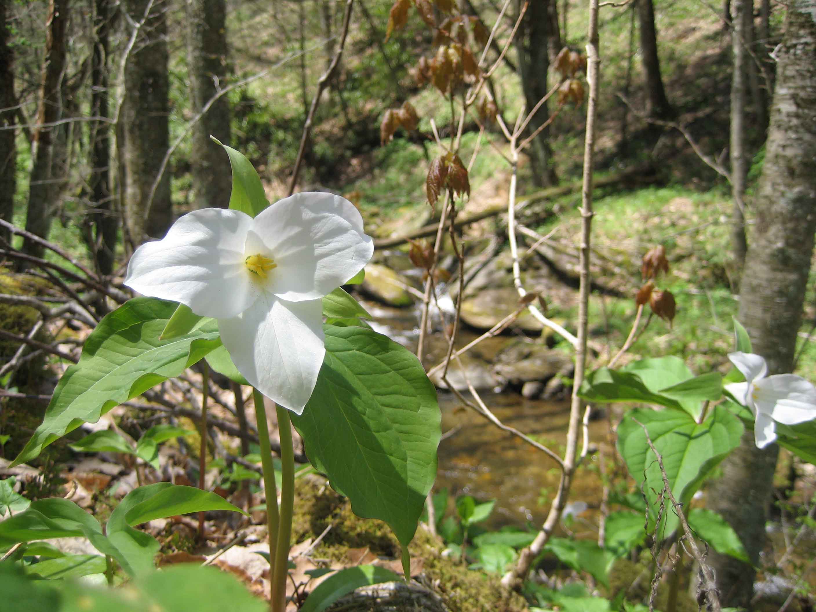
The Standing Indian area in the Nantahala National Forest is known for its beautiful forest, rushing streams and excellent vistas. We’ll hike up the Kimsey Creek Trail to the AT, and the AT to our lunch spot, Standing Indian. At 5498 ft., it is the highest mountain on the AT south of the Great Smoky Mountains, with outstanding views. We’ll return on the Ridge Trail. Optional supper at the Jarrett House on the way home. Second meeting place: Rest Stop beyond Waynesville on US 23/74 at 8:30 AM. Topo: Rainbow Springs
Nine fit hikers traveled to the Southern Nantahalas on Sunday the 18th to climb the Standing Indian sentinel. As expected, there were many wildflowers on Kimsey Creek, including Canada violets and a few lingering trilliums. We set a good pace up the AT, passing the wilderness boundary, and meeting rain and cooler air at the 5498 foot peak. Our lunch was short in the damp mist, although the curtain lifted for half a minute so we could see the steep sides below us. We followed the Lower Ridge Trail back to the creek and campground through intermittent rain. Another hiker joined us for a family style Southern supper at the Jarrett House, where we wished Jude a great summertime in Wisconsin. -- Cindy McJunkin
ALL DAY NO. A0802-008 May 25
Bee Tree Gap to Ox Creek Rd. *9:00 AM
Hike 7.9, Drive 38, 1500 ft. ascent, Rated B-B
Janet Martin, 812-738-8154, jaykaymartin@msn.com
*Note later start time. A moderate hike on the MST over Lane Pinnacle with excellent views, interesting rock formations and many wildflowers. There are several steep but short ups and downs and a long, well-graded descent. 8-mile car shuttle. Second meeting place: Craven Gap at 9:20 AM. Topo: Craggy Pinnacle
Six CMC members enjoyed a sunny walk along the MST. The sole distinctive feature of the hike was "two lunches." Is this a first? An early lunch with a panoramic vista of the A'ville watershed from an outcropping near Lane Pinnacle and a late lunch in a grove providing a refreshing breeze with relief from the sun -- Janet Martin.
MEMORIAL DAY JOINT HIKE WITH
SMOKY MOUNTAINS HIKING CLUB
ALL DAY NO. A0802-606 May 26
Mt. Sterling via Big Branch or via Mt. Sterling Gap 8:00 AM
Hike 9 or 12.4, Drive 110, 2000 or 4100 ft. ascent, Rated A-A or AA-AA+
Becky Smucker, 828-298-5013, bsmucker@charter.net
900M This year, our annual joint hike with the Smoky Mountains Hiking Club offers options for a longer climb on an old manway or a shorter hike with a car shuttle.
Longer hike: We will access the Big Branch manway at the Baxter Creek trailhead, and climb this old but passable manway, paralleling Big Branch to the Mt. Sterling ridge. The ridge will be followed to rejoin the Baxter Creek Trail up to the summit for lunch and the good views from the fire tower. Our return will be via the Baxter Creek Trail.
Shorter hike: After an 8-mile car shuttle to Mt. Sterling Gap, we will hike up the Mt. Sterling Trail to the summit and join the other group. After lunch, we’ll all hike down the Baxter Creek Trail together. Second meeting place: Pilot Truck Stop at exit 24 of I-40 at 8:30 AM Topo: Waterville; also Nat’l. Geo. GSMNP map #229
At 9:10 on a warm, partly cloudy Memorial Day, 17 hikers with CMC and 12 from Smoky Mountain Hiking Club gathered in the parking lot at Big Creek in the Smokies, surely one of the world’s loveliest, most lush and biodiverse spots. We shuttled over to Mount Sterling Gap, then hiked up to the lookout tower on Mount Sterling for lunch. The gnats tried to spoil the mood, but the sense of fun prevailed. At this point the group split up, with some choosing to make the 4000’ descent leisurely via the Baxter Creek Trail, and the rest, more hardy (foolish?) souls opting for the Big Branch Trail, which has not been maintained since the 1960’s.
A highlight for the Baxter Creekers was yellowwood in bloom, a rare sight and a heavenly smell. They arrived at the bottom relaxed and relatively clean, and drove to retrieve the cars from Mount Sterling Gap. The Big Branchers, on the other hand, finished much later, dirty, bruised, and mostly exhilarated from a challenging fight with snarled rhodies and deteriorated trail. The joint hike is a great tradition which we should continue -- Becky Smucker.
ALL DAY NO. A0802-113 June 1
Cold Mountain 8:00 AM
(strenuous)
Hike 10.4, Drive 70, 3400 ft. ascent, Rated A-AA+
Michael Cornn, 828-698-3672, mcornn@aol.com
P400, SB6K Come and join us on this beautiful hike up Cold Mtn. From Camp Daniel Boone we will climb to the summit of this 6030 ft. peak and enjoy the great views along the way. Wilderness area, limited to 10, so call leader for reservation. Topos: Waynesville, Cruso; also Natl. Geo., PRD map #780
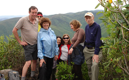
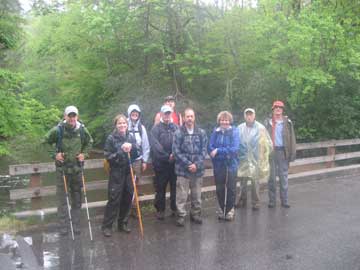
Photo by Stuart English
I had ten spots for the Cold Mountain hike, but at Westgate two dropped out due to the weather forecast of rain. When the eight of us got to the trail head I was considering canceling the hike. It had started raining and the trees were bending over from the wind. I imagined how bad it would be climbing the trail in the rain. So I asked the seven other hikers what they wanted to do. They all said they wanted to go on up, with the possibility of turning around if the rain continued. We all put on our rain gear in the cars for the hike. After a short way up the Art Loeb trail the rain stopped. The rest of the way up was rainless, but not mudless. The rain did bring out the salamanders, with eight eastern newts spotted on the trail. We made sure everyone knew where they were so none were casualties. At the top of Cold Mountain we enjoyed our lunch with great views. Kathy brought oatmeal cookies for the hikers. The hike down went fast with Angie rewarding us with more refreshments at the cars. -- Michael Cornn
ALL DAY NO. A0802-131 June 1
Laurel Mtn., Slate Rock Creek Trails *9:00 AM
(moderate)
Hike 8, Drive 55, 1500 ft. ascent, Rated B-B
Kathleen Hannigan, 828-230-4883, Kathleen.hannigan@pgnmail.com
P400 *Note later start time. From Yellow Gap, we’ll hike up the Laurel Mtn. Trail to Sassafras Gap, and then turn downhill to the Slate Rock Creek Trail, following this pretty mountain stream down to Yellow Gap Rd. Short car shuttle. Second meeting place: North Mills River Recreation area parking lot at 9:30 AM. $3 parking fee. Topo: Dunsmore Mtn.; also Nat’l. Geo. PRD map #780
Four hardy souls (5 if you count the bail-out at Westgate) drove with windshield wipers slapping to meet me for hiking in North Mills River. As the hike began, conditions worsened to include bright overcast to partly sunny skies, 67-71 degree temps, and light breezes. Bravely facing what nature was throwing at us, however, we forged ahead on the gently ascending Laurel Mountain Trail through tunnels of blooming mountain laurel that resembled pink and white lace. These hikers stoically continued on past hillsides of fern and glimpses of very blue mountains through the trees. Touched by their misery, I offered them homemade mocha cappuccino bars at the lunch break.
Okay, I'll stop, but this was yet another hike that proves you just never know what you are going to get weather-wise. After lunch we took an unnamed trail down to the Slate Rock Creek Trail. A couple of friendly bicyclists and their lethargic (NOT!) dog preceded us down this trail and we marveled at how they could navigate the steepness. Though we expected to see biker body parts, only tire trails were visible. The Slate Rock Creek Trail was lush and green. We saw lots of Cinnamon Fern and stopped to look at a place where a long portion of the creek ran over solid rock. After enjoying a couple of lovely small waterfalls, we explored a good campsite. Our small group finally reached the car, very satisfied that we had ignored the forecast, having enjoyed a great hike in near perfect conditions.--Kathleen Hannigan
Half Day Sunday
HALF DAY NO. H0802-043 May 25
Frying Pan Tower *1:30 PM
Hike 4, Drive 50, Rated C-C
Nonmembers, call leader, Rusty Breeding, 828-692-0359, bree_lw@planetusa.net
P400 *Meet at Westgate at 1:30 PM to form carpools, and meet leader at north end of parking area of Pisgah Inn at 2:00 PM. This is an easy in-and-out hike through a spectacular display of wild flowers to good views from the tower.
HALF-DAY NO. H0802-054 June 1
John Rock via the Old Horse Cove Trail *1:30 PM
Hike 4, Drive 72, Rated C-B, 1295 ft. ascent
Nonmembers, call leader, Laura Stallard, 828-697-1579
P400 *Meet at Westgateat 1:30 PM to form carpools, and meet leader at the Fish Hatchery in Pisgah National Forest on FS 475B off US 276 at 2:05 PM. This moderate in-and-out hike begins at the Fish Hatchery at the opposite end of the parking lot from the Wildlife Visitor Center onto the Horse Cove side of Cat Gap Trail (orange blaze). The John Rock Trail starts at a right hand junction off Cat Gap Trail.
All Day Wednesday
WEDNESDAY NO. W0802-208 May 28
Big Creek-Laurel Mtn. loop *8:20 AM
Hike 7.5, Drive 44, 2400 ft. ascent, rated B-AA
Larry Ballard, 828-891-4318, leballard@cytechcis.net
P400 From the Mt. Pisgah trail parking area, follow the parkway north around the Buck Spring tunnel to Big Creek trailhead (about 1/4 mile). Follow Big Creek trail down to Big Creek. At this point, an unnamed trail leads up to Laurel Mtn. trail at Good Enough Gap (no bushwhacking on this trail). Follow the Laurel Mtn. trail back to the parking area. A possibility of a side trip to a big waterfall if the group is willing. *Meet at Westgate at 8:20 AM to form carpools and proceed on the parkway to the Mt. Pisgah parking area. Leader will be at Pisgah ranger station at 8:30 AM. Final meeting place: Mt. Pisgah trail parking area at 9:00 AM. Topo: Dunsmore Mt.; also Nat’l. Geo. PRD map #780
Editor's Note: As often happens when people arrange to meet, there were some problems and two groups did the hike independently. Thus, two reports..
As seen from the sign-up sheet, only three hikers, including the leader, showed up for the hike. The weather was foggy and rainey off and on, the entire day. In the future I would suggest that the hike be done by going down Laurel Mtn. trail to Good Enough Gap and down from the gap. Then back up Big Creek trail to the Parkway. Big Creek Trail is less steep than the trail down from Laurel Mtn. trail -- Larry Ballard
The Wednesday hike (Big Creek -Laurel Mtn Loop) on May 28th. actually consisted of two different groups neither aware at any point in time where the other group was on the trail. In fact the first groups did not know the second group was even on the trail trying to catch up. The Asheville group from Westgate were confused by the hike write up as to where the second meeting place was. Consequently the two groups never got together but both hiked the same trail. Much of the hike was in the rain but was still enjoyable. At one point in particular where the trail was narrow with bushes jutting out onto the trail from both sides, it caused one of the members of the second group to describe the trip through the thicket as the same as going through a car wash. Since the second group had not scouted the trail and were on the trail for the first time, they relied on maps for directions. Their innate sense of direction and tracking techniques proved to be worthless but their maps and GPS saved the day. Little did the first group know that they had 5 sweeps.--Barth Brooker
WEDNESDAY NO. W0802-592 June 4
ALT – Butter Gap - Long Branch Loop *8:30 AM
Hike 10.5, Drive 80, 1950 ft. ascent, Rated A-A
Stu English, 828-883-2447, stuengo@citcom.net
P400 *Meet at Westgate at 8:30 AM to form carpools, and meet leader at the side parking lot of the Pisgah Forest Bi-Lo at 9:00 AM. This new CMC hike will start at Gloucester Gap and follow the Art Loeb Trail over Rich Mtn. to Butter Gap. At the gap, we'll turn downhill onto the Butter Gap Trail, then the Long Branch Trail and Cemetery Loop past the McCall Cemetery. There will be a short side trip to a beautiful, but rarely visited waterfall. We'll finish with a short road walk back to the trailhead. Topo: Shining Rock; also Nat'l. Geo. PRD map #780
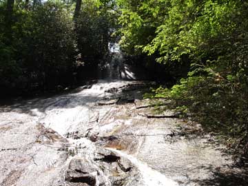
On a day promising 90 degree temperatures, 17 people met for this loop hike from Gloucester Gap to Butter Gap on the Art Loeb Trail, down the Butter Gap Trail and back up Long Branch Trail. As we made our climb up Chestnut Mountain, a nice cool breeze helped us along. As we started back up the Long Branch trail after lunch, it got hotter. Around midafternoon, we made a side trip down Searcy Creek Rd. to visit Long Branch Falls. Everyone agreed it was worth it. Then we made our last climb to McCall cemetary. By then it was sweltering. As we trudged back up FS road 475 to our cars, I seriously decided this hike needs to be a short car shuttle next time.--Stu English
All-day hikes submitted by Bruce Bente 692-0116, bbente@bellsouth.net
. Driving distance is round-trip from Asheville. All Saturday and
Sunday hikes assemble at Westgate Shopping Center near I-240 UNLESS
OTHERWISE NOTED.
Half Day hikes submitted by Paula Robbins 828-687-1651 paularww@bellsouth.net and Lucy Prim 828-693-6580 lucette32@mchsi.com. Wednesday Hikes are submitted by Charlie Ferguson, 828-398-0213 ccf108@gmail.com and Ann Gleason, 828-859-9387,
gleason.ann@gmail.com .
The meeting place for each hike will be designated by the hike leader and will appear in the hike description.
Driving mileage will be listed, round trip, from the first designated meeting place.
Leaders: Mail please mail your sign-up sheets. Meet at Westgate unless otherwise noted. |
 CMC Bi-Weekly Hike News