All Day Saturday and Sunday
ALL DAY NO. A0803-614 Aug. 3
Cheoah Bald from Stecoah Gap *8:00 AM
(strenuous)
Hike 11, Drive 170, 3100 ft. ascent, Rated A-AA+
Brent Martin, 828-369-7084, brent_martin@tws.org and Bruce Bente, 828-692-0116, bbente@bellsouth.net
*Meet at Westgate at 8:00 AM to form carpools, and meet leader at Stecoah Gap at 9:30 AM. We will hike in-and-out from Stecoah Gap to Cheoah Bald, a federally-inventoried roadless area. The views from Cheoah are some of the best in this region. We’ll have a chance to see the location for the proposed Corridor K four-lane highway and tunnel, which may radically change the appearance through Stecoah Gap. Second meeting place: Rest area on US 23/74 beyond Waynesville at 8:30 AM. Topo: Hewitt
ALL DAY NO. A0803-199 *Aug. 3
Black Mtn. Campground to Green Knob 8:30 AM*
(moderate)
Hike 7, Drive 85, 2000 ft. ascent, Rated B-AA
Janet Martin, 502-494-9309 (cell), jaykaymartin@msn.com
*Note later start time. Enjoy the beautiful woods as we climb Lost Cove Ridge on the Green Knob Trail from the Black Mtn. Campground to fantastic views and a first-class lunch spot atop Green Knob. After lunch it’s all downhill. Second meeting place: Parking lot adjacent to McDonalds at Exit 64 of I-40 at 8:50 AM. Topo: Old Fort; also USFS South Toe River, Mt. Mitchell & Big Ivy Trail Map
ALL DAY NO. A0803-604 Aug. 10
Splash Dam via Trace Ridge *8:30 AM
Hike 7.8, Drive 42, 1100 ft. ascent, Rated B-B
Dave Wetmore, 828-884-7296, dwetmore@citcom.net
P400 *Note later start time. Meet at Westgate at 8:30 AM to form carpools, and meet leader at Trace Ridge Trailhead at 9:00 AM. This moderate hike has been rescheduled and will be mostly on old roadbeds up the Big Creek Trail, to what appears to the uninitiated as only a rocky place. If those rocks could talk, they would tell a tale of long arduous months of labor, the pitfalls of succession, the striving of man with nature and the consequences of that effort. Several wet but easy stream crossings. Come and learn the secrets of Big Creek! Topo: Dunsmore Mtn.; also Nat’l. Geo. PRD map #780
Note: The North Mills River Trail may be closed because of dredging at the Hendersonville Dam. We will all meet at Westgate at 8:30 AM. If the dredging has been completed we will do the hike described above. If the trail is still closed we will do some other hike, possibly from the Parkway out to Blackrock Knob in the Plott Balsams. The view from Blackrock is spectacular.
--Back to Top
Half Day Sunday
HALF-DAY No. H0803-046 Aug. 3
Bent Creek Loop #12, MST side *1:00 PM
Hike 5, Drive 20, Rated C-C
Nonmembers, call leader, Tom Sanders, 828-252-6327, tomary2@charter.net
P400 *Note early start time. This loop hike will pass by Lake Powhatan and ascend to the Mountains-to-Sea Trail via the Sherman Stambaugh Trail. We will then descend on the Sleepy Gap Trail and wander along the Explorer and Pine Tree Trails.
HALF-DAY No. H0803-222 Aug. 10
Montreat Loop #3 *1:00 PM
Hike 5, Drive 40, 1200 feet ascent, Rated C-B
Nonmembers, call leader, Gail Lamb, 828-350-0450, galmb46@aol.com
*Note early start time. We will ascend by the Graybeard Trail to the Old Trestle Road at Pot Cove Gap, then follow a recently cleared and opened section of the Old Trestle Road (not on most Montreat trail maps yet) to Graybeard Falls. We will return to Pot Cove Gap by a short steep section of the Graybeard Trail, and then retrace our path to the parking area. There are ten dry-foot stream crossings on rocks and/or logs. Second meeting place: Parking lot adjacent to McDonalds off I-40 at Exit 64 at 1:20 PM.
--Back to Top
All Day Wednesday
WEDNESDAY NO W0803-357 Aug. 6
Pisgah Ridge Loop 9:00 AM
Hike 7.5, Drive 70, 1500 ft. ascent, Rated B-B
Joe Burchfield, 828-298-8413, burchfield@niu.edu
P400 We'll do a scenic circle of the entire Graveyard Fields area, using the Pisgah Ridge Trail and MST to lunch at a beautiful overlook. Then we'll follow the Graveyard Ridge Trail, with a side trip to one of the Yellowstone Falls. Possible early blueberry sightings.
Second meeting place: Cold Mtn. overlook on BRP at 9:40 AM. Topos: Shining Rock, Sam Knob; also Nat’l. Geo. PRD map #780 and USFS Shining Rock & Middle Prong Wilderness map
WEDNESDAY NO W0803-475 Aug. 13
Hump Mountain/Yellow Mountain Area *8:30 AM
Hike 9, Drive 140, 2400 ft. ascent, Rated B-AA
Adrian Lotherington, 828-484-9132, jaloth@charter.net
*ONLY MEETING PLACE: Rose's car park, across from McDonalds at the US 25/70 Weaverville Exit #19 at 8:30 AM. We will hike from Roaring Creek Road to Yellow Mountain Gap, at which point we join the AT along an open ridge to Little Hump Mtn. and on to Hump Mtn. where we will have lunch on a grassy bald at 5587 ft. We will return to Yellow Mtn. Gap and take the Overmountain Victory Loop back to the car park. The fabulous vistas and meadows full of flowers make the drive and moderately strenuous walk very much worthwhile. Topos: Carvers Gap, White Rocks Mtn.; also Nat’l. Geo. South Holston and Watauga Lakes map #783
Looking Back...
All Day Saturday & Sunday
ALL DAY NO. A0803-249 July 20
Haywood Gap - Buckeye Gap *8:30 AM
Hike 9, Drive 80, 1500 ft. ascent, Rated A-A
Stu English, 828-883-2447, stuengo@citcom.net
P400 *Note later start time. Meet at Westgate at 8:30 AM to form carpools, and meet leader at BRP Cold Mtn. Overlook at 9:10 AM We’ll hike the MST and the Buckeye Gap Trail in the Middle Prong Wilderness, down a ridgeline on an old logging railroad grade, then pass an old logging camp. At the junction with the Haywood Gap Trail, we’ll hike steeply up alongside Haywood Gap stream to Haywood Gap and follow the MST back to our cars. Wilderness area hike, limited to ten hikers—call leader for reservations. Topo: Sam Knob; also Nat’l. Geo. PRD map #780 and USFS Shining Rock and Middle Prong Wilderness map.
Photo by Stu English
It was a beautiful day when we started this counterclockwise loop on the MST and into the Middle Prong wilderness. The Buckeye Gap Trail was almost completely overgrown and hard to follow, especially where it left the old railroad grade. We passed the old logging camp at the head of the “incline” and soon reached our lunch spot on the Middle Prong of the Pigeon River. All agreed that one of the beauties of wilderness hiking was the sense of remoteness. After lunch the climb started up the Haywood Gap Trail and what a climb it was. It was hot and humid and we all got a workout from it. We were all relieved upon reaching the MST within sight of the Parkway. But there were at least two more miles to go and as always it seemed to take forever. On our way to the cars we saw the efforts of Barth Brooker’s trail crew on weed eating, sawing blow downs on this particular section. After the hike most of us enjoyed a meal at the Pisgah Inn.--Stuart English
SATURDAY NO. A0803-447 July 26
MST: Mt. Pisgah to Beaver Dam Overlook *9:00 AM
Hike 8.5, Drive 45, 1700 ft. ascent, Rated B-A
Victoria Tripp, 828-250-9094, torrose@gmail.com
P400 *Note later start time. This moderate hike will start with a round trip up and down Mt. Pisgah, and will then follow the MST northbound to Beaver Dam Overlook. Expect good views along the route, and a magnificent display of Turk’s Cap lilies in bloom. Short car shuttle. Second meeting place: BRP French Broad Overlook at 9:10 AM. Topos: Cruso, Dunsmore Mtn.; also Nat’l. Geo. PRD map #780 & MST Profiles, pg. 53-55
This hike was canceled due to rain. Anyone interested in hiking Mt. Pisgah to Beaver Dam Overlook can come on Saturday October 25th to enjoy the Fall Colors.--Victoria Tripp
ALL DAY NO. A0803-165 July 27
Mt. Le Conte via Boulevard, Alum Cave Trails 8:00 AM
Hike 13, Drive 150, 2600 ft. ascent, Rated AA-AA
Joe Cirvello, 828-252-2721, blaackhole@gmail.com
SB6K, 900M This classic and exciting hike features great views from the AT, Boulevard Trail, our lunch spot at Cliff Tops on 6593 ft. Mt. Le Conte, and the spectacular Alum Cave Trail. In addition, you can check out the Le Conte Lodge cabins, and see many interesting old photos in the common room of the Lodge, including one of a guy doing the entire hike to the summit carrying his mother seated on a chair strapped to his back! Plan on a long day and an optional stop for supper on the way home. Car shuttle. Second meeting place: Rear of Post Office parking lot in Maggie Valley at 8:30 AM, but call leader first. Topos: Clingman’s Dome, Mt. Le Conte; also Nat’l. Geo. GSMNP map #229
After placing cars at the Alum Cave trailhead, 16 hikers drove to Newfound Gap and began the hike on the AT to the Boulevard Trail and on up to Mt. Le Conte. The weather was perfect and although we were surrounded by scattered, low-hanging clouds, we enjoyed many great views. Enroute on the Boulevard Trail I began hearing a rumbling sound behind me and thought at first that we might be in for a storm. And in fact it was a storm, but instead of one of weather, it was one of protest. The rumbling sound was coming from the empty stomachs behind me and the storm of protest was a demand for lunch. So a lunch spot was hastily chosen and a mutiny narrowly avoided. Whew! We did not arrive at the lunch spot indicated in the hike description until 2:30 and if we had not lunched until then, I am certain the consequences for the leader, i.e. me, would have been dire.
At the highest point on the summit, called oddly enough, High Point, some of us placed stones on the growing pile that is intended to (someday) make this spot higher than Clingman's Dome; it did not appear that this would happen any time soon, and more rocks may have to be imported. We then proceeded to the overlook known as Cliff Tops, a rocky outcropping where folks gather to watch the sunset. Since this was the intended lunch spot, many of us felt an obligation to eat again. After enjoying the views, and our 2nd. lunch, we hiked about 10 minutes to the Lodge, and following that exertion some of us purchased Snickers bars there. We examined the photos on display, replenished our water supplies, got a look around, then hiked down to the Alum Cave Bluffs, and arrived at the cars at about 6 p.m. The leader escaped another possible lynching by a stop for dinner at Snappy's in Maggie Valley, where 14 of us relished a good dinner before returning to Westgate. A long day, but well worth it.--Joe Cirvello
--Back to Top
Half Day Sunday
HALF-DAY No. H0803-434 July 20
Laurel Mountain Trail *1:00 PM
Hike 4-5 miles, Drive 40, C-C
Nonmembers, call leader, Greg Goodman, 828-684-9703, greggoodman@bellsouth.net
P400 *Note early start time. Meet at Westgate at 1:00 PM to form carpools, and meet leader at the North Mills River parking area at 1:30 PM. This loop hike will start at FS 1206, go along a ridge trail toward Black Mountain, and return via the Laurel Mountain Trail. There should be good views of the Mills River Valley.
HALF-DAY No. H0803-578 July 27
Flat Laurel Creek, Little Sam Knob, MST Loop *12:30 PM
Hike 6.5, Drive 80, Rated B-B
Nonmembers, call leader, Gerry McNabb, 828-274-0057, gerrymcnabb@charter.net
P400 *Note early start time. This is a pleasant loop trail with views of Big Sam Knob, Fork Ridge and the lovely Flat Laurel Creek. We’ll begin on the Flat Laurel Creek Trail, which ascends gradually until we are hiking next to the creek, where we will stop for a snack. Little Sam Knob Trail, with views of Little Sam Knob and Sam Knob, connects to the Mountains-to-Sea Trail, which will take us back down to our starting point at NC 215. Second meeting place: Pisgah Inn, north end of parking lot, at 1:00 PM.
Photos by Ashok Kudva
We left on schedule at 12:30 from Westgate in sunny weather and arrived one hour later at the trailhead on Rt. 215 west of Devil's Courthouse. We picked up Ashok at the Pisgah Inn. There were only 10 of us in all. We started up the MST toward Chestnut Bald a little after 1:30. I changed the hike from the one planned because my scouting of the original loop indicated it would have taken the group way too long... 2 hours longer at least. So this was a 4-mile in-and-out hike to the resting place on Little Sam Trail near where it meets the MST.
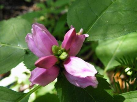
The woods up there, between 5000 and 5600 feet elevation, were cool and delightful. We saw a couple of joe pye weeds and turtlehead in bloom. The blackberries were tiny, dried out and the few ripe ones were nearly juiceless. The hike took 3 hours and we returned to Westgate at 6:45. Parkway traffic was heavy, especially with motorcycles. The Flat Laurel Creek loop, as described in the schedule, would make a good Wednesday hike, leaving at 9 or 10.-- Gerry McNabb
--Back to Top
All Day Wednesday
WEDNESDAY NO W0803-044 July 23
Lost Cove Stream Hike 8:00 AM
Hike 7.5, Drive 150, 1500 ft. ascent, Rated B-B
Brenda Worley, 828-684-8656, clworley@bellsouth.net
Everyone enjoyed this Sunday hike in the Wilson Creek area last year, so we're offering it on Wednesday for the first time. It features spectacular waterfalls and the best swimming anywhere. Bring your bathing suit. Be prepared for several wet-foot stream crossings. Optional supper afterwards at Little Siena. Second meeting place: Parking lot adjacent to McDonald's off I-40 at Exit 64 at 8:20 AM. Topo: Grandfather Mtn.; also USFS Wilson Creek map and Nat'l. Geo. Linville Gorge Mt. Mitchell map #779
A total of 18 hikers met at the Huntfish Falls trail head and began hike about 10:30 AM. The day started out sunny and pleasant, We hiked to first swimming hole, Huntfish Falls, where we took a long break and a few went swimming.
Then we hiked on to the next swimming hole and lunch spot on Grag Prong. Here more of our group took the opportunity to get in the water. Both areas are beautiful and there was plenty of water in the swimming holes and waterfalls.
After splashing around and having lunch, those who changed into swinning suits changed back into hiking clothes and immediately it began to rain. We decided to hike back to Huntfish Falls instead of climbing to the mountain ridge because of lightning. It was a good decision, as the rain continued until we were all as wet as we had been when swimming.
When we reached Huntfish falls it had stopped raining so we stayed there awhile before we hiked back to our cars. We reached the cars about 4:30PM.--Brenda Worley
WEDNESDAY NO W0803-249 July 30
Haywood Gap / Buckeye Gap *8:30 AM
Hike 9, Drive 80, 1500 ft. ascent, Rated A-A
Stuart English, 828-883-2447, stuengo@citcom.net
P400 *Meet at Westgate at 8:30 AM to form carpools, and meet leader at Cold Mtn. Overlook on BRP at 9:10 AM. We'll hike the MST and the Buckeye Gap Trail in the Middle Prong Wilderness, down a ridgeline on an old logging railroad grade, then pass an old logging camp. At the junction with the Haywood Gap Trail, we'll hike steeply up alongside Haywood Gap stream to Haywood Gap and follow the MST back to our cars. Wilderness area hike, limited to ten hikers—call leader for reservations. Topo: Sam Knob; also Nat'l. Geo. PRD map #780 and USFS Shining Rock and Middle Prong Wilderness map
The Wednesday group got to enjoy the wilderness today and a good day it was. All but one that signed up met us at Cold Mt Overlook and he caught up with us when one our hikers had to go back to look for a lost item at a trail break spot. I think we are making our mark on the overgrown Buckeye Gap trail. It’s getting easier to follow all the time. By the time Becky Smucker and her Saturday crew are finished it will be like a Smokies Trail. Everyone agreed that they understood the term “wilderness” after this hike. Again it was a brutally hot climb back up to the MST. But for a day that promised 50% chance of showers, we scarcely saw a cloud. But that was typical of the way everything worked out on this hike.--Stuart English
All-day hikes submitted by Bruce Bente 692-0116, bbente@bellsouth.net
. Driving distance is round-trip from Asheville. All Saturday and
Sunday hikes assemble at Westgate Shopping Center near I-240 UNLESS
OTHERWISE NOTED.
Half Day hikes submitted by Paula Robbins 828-687-1651 paularww@bellsouth.net and Lucy Prim 828-693-6580 lucette32@mchsi.com. Wednesday Hikes are submitted by Charlie Ferguson, 828-398-0213 ccf108@gmail.com and Ann Gleason, 828-859-9387,
gleason.ann@gmail.com .
The meeting place for each hike will be designated by the hike leader and will appear in the hike description.
Driving mileage will be listed, round trip, from the first designated meeting place.
Leaders: Mail please mail your sign-up sheets. Meet at Westgate unless otherwise noted. |
 CMC Bi-Weekly Hike News