
CMC Bi-Weekly Hike News
04/27/05
__________________________________________________________________________________
Looking Ahead....
All Day Saturday & Sunday
ALL DAY No. A0502-445 May 1 Pilot Mtn., Farlow Gap, Daniel Creek Trails 8:00 AM (strenuous) Hike 11, Drive 90, 1900 ft. ascent, Rated A-A Ruth Hartzler 828-251-0886 ruthmtn@aol.com P400 If our timing is right we will enjoy rare pink shell azaleas on Pilot Mtn. This diversified hike features good views from Pilot Mtn. and the beautiful Farlow Gap and Daniel Creek Trails. Second meeting place: Bi-Lo parking lot in Pisgah Forest at 8:30 AM. Topo: Shining Rock; also Nat’l. Geographic Pisgah Ranger District map
Hike Change Due to Road Closure
Pilot Mountain-Farlow Gap 8:00 AM (moderate) Hike 8, Drive 100, 2200 ft. ascent, Rated A-A Ruth Hartzler 828-251-0886 ruthmtn@aol.com P400 If our timing is right we will enjoy rare pink shell azaleas on Pilot Mtn. and a blanket of Trout Lillies at Farlow Gap. This hike features a steep 1800’ climb, then great views from Pilot Mtn. We will continue to Farlow Gap and return via a road and the Art Loeb Trail. Second meeting place: Bi-Lo parking lot in Pisgah Forest at 8:30 AM. Topo: Shining Rock; also Nat’l. Geographic Pisgah Ranger District map.
(While scouting this hike, we ran into two FS engineers, who said contractors were preparing to repair 475. The engineers were from Wyoming, part of a group brought in from the west to work on storm-damaged FS roads in WNC.)
ALL DAY No. A0502-273 May 1 Boogerman Trail 9:00 AM (moderate) Hike 8, Drive 90, 1000 ft. ascent, Rated B-B Renate Rikkers 828-298-9988 rerikkers@aol.com 900M Note later starting time. A lush forest with many wildflowers, giant old-growth tulip trees and remnants of pioneer life make this a favorite loop hike in the Cataloochee area of the Smokies. If we’re lucky we may spot some of the elk that have been introduced into this valley. Topos: Cove Creek Gap, Dellwood; also Nat’l. Geographic GSMNP map
WEEKEND No. A0502-446 May 6-8 Camping Weekend in the Smokies Friday evening Drive 200 Danny Bernstein 828-236-0192 danny@hikertohiker.org 900M Come and join us on a camping and hiking weekend based at a private campground in Townsend, just outside Great Smoky Mtns. Nat’l. Park. Participants must bring their own camping equipment. Register with the leader as soon as possible, as this weekend will fill up quickly. The cost is $26. Saturday: We will hike from the Abrams Creek entrance to the park. Two different levels of hikes will be offered; a moderate hike of 6-9 miles and a challenging hike of over 12 miles. Sunday: Hikes will be offered from the Cades Cove and Abrams Creek entrances. As an alternate, you may prefer to tour Cades Cove on your own. Topos: Wear Cove, Thunderhead Mtn., Cades Cove, Gatlinburg ; also Nat’l Geographic GSMNP map.
All-day hikes submitted by Bruce Bente 692-0116, bbente@cytechusa.com . Driving distance is round-trip from Asheville. All Saturday and Sunday hikes assemble at Westgate Shopping Center near I-240 UNLESS OTHERWISE NOTED.
Half Day Sunday
HALF DAY No. H0502-062 May 1 Daniel Ridge Loop 1:00 PM Hike 4, Drive 70, 1200-foot ascent, Rated C-B Pat Elias 828-687-1651 patelias@bellsouth.net P400 Note early start time. This pretty loop hike goes up along the Davidson River, then climbs up and over Daniel Ridge and ends at a spectacular 90-ft. waterfall. Second meeting place: Bi-Lo in Pisgah Forest at 1:30 PM.
Sunday, May 1, half day hike to Daniel Ridge changed due to weather-related, closed road
The alternate hike will meet at Westgate at 1:00 PM (second meeting place is Bi-Lo, Pisgah Forest, routes 280 and 276, at 1:35 PM. We will hike 5.3 miles at Cove Creek and Caney Bottom in the Pisgah Forest beyond the Fish Hatchery. After a pleasant walk through the woods, we will take our snack at picnic tables with a nice view of the surrounding hills. Our return walk will be along a stream with an interesting waterfall. There are several stream crossings on logs, some short ones without a railing. For further information, call Pat Elias, 828/687-1651 or email at patelias@bellsouth.net .
HALF-DAY No. H0502-451 May 8 MST from Beaverdam Overlook to Sleepy Gap 1:30 PM Hike 5.5, Drive 35, Rated C-C, 960-ft. ascent Sherman Stambaugh 828-254-1736 P400 A moderate hike on the Mountains-to-Sea Trail, with a climb to Ferrin Knob, site of a former fire tower. Easy hiking to Chestnut Cove, then over Truckwheel Mountain to Sleepy Gap. Short car shuttle. Second meeting place: Ingles on NC 191 across from Biltmore Square Mall at 1:45 PM.
Half Day hikes submitted by Paula Robbins 828-687-1651 paularww@bellsouth.net and Pat Elias 828-281-3253 patelias@bellsouth.net . Leaders: Mail please mail your sign-up sheets. Meet at Westgate unless otherwise noted.
All Day Wednesday
WEDNESDAY No. W0502-310 May 4 Jones Gap: Rim of the Gap Loop 8:00 AM* Hike 7, Drive 80, 1800 ft. ascent, Rated B-A Jo Anderson, 828-693-7081 jobob@mehsi.com Starting at Jones Gap State Park (NOTE: $2 fee per person for park entry), we will hike up the Rim of the Gap Trail with views of the Gap as we ascend. On top, a loop up on to the ridge, then down the # 8 connector to the river. *Meeting places: Meet at Westgate at 8:00 AM to form car pools, and meet leader at east side of Ingles Parking lot at 8:40 AM. (take I-26 to exit 53, then turn right on upward Rd. go 1 mile to Ingles at US 176. Additional meeting place: Jones Gap parking lot at 9:00 am. Topos: Cleveland, Table Rock; also Mountain Bridge Wilderness map.
WEDNESDAY No. W0502-456 May 11 AT: Stecoah Gap to Yellow Creek Gap 8:00 AM Hike 7.6, Drive 170, 1700 ft. ascent, Rated B-A Jack Fitzgerald, 828-685-2897 suejackfitz@bellsouth.net A moderate hike on the southern portion of the AT, between Stecoah Gap and Yellow Creek Gap. Guaranteed to see lots of wildflowers, including the rare yellow trillium and yellow ladyslipper. There will be a car key switch. Topos: Hewitt, Fontana Dam
WEDNESDAY No. W0502-457 May 18 AT: Brown Gap to Max Patch and return 8:15 AM Hike 7, Drive 100, 1100 ft. ascent, Rated B-B Ken & Carol Deal 828-281-4530 KMCDeal@aol.com Note later start time. An in and out hike on the AT, with a steep uphill for the first mile, then leveling off into moderate ups and downs, with a final climb to the top of Max Patch for lunch. If we’re lucky, it will be clear for the beautiful views. Second meeting place: Pilot Truck Stop, exit 24, off I-40 at 9:00 AM. Topo: Lemon Gap
Wednesday Hikes are submitted by Paula McNabb, 828- 274-0057 gcmcnabb@charter.net and Ann Gleason, 828-859-9387, cowbonetail@yahoo.com . The meeting place for each hike will be designated by the hike leader and will appear in the hike description. Driving mileage will be listed, round trip, from the first designated meeting place.
_________________________________________________________________________
Looking Back......
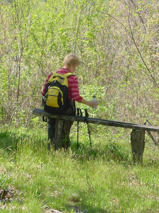
SATURDAY No. A0502-288 Apr. 23 Kanuga Conference Center 8:30 AM Hike 8.5, Drive 60, 800 ft. ascent, Rated B-C Barbara Passmore 828-667-8684 bpsss354@netzero.net We have been fortunate to receive permission to hike at Kanuga Conference Center for this pleasant hike over varied terrain. We will hike over well-maintained trails including the Doug Stirling Trail to the Wolf Mtn. overlook, with lunch on scenic Eagle Rock. Second meeting place: Parking lot at rear of Mountain Bank, corner of US 25 & White St. in Hendersonville. Topo: Horseshoe
Post Hike Report:
Thirteen people enjoyed a varied hike at Kanuga on Saturday and wondered all day
if the predicted snow were going to materialize
overnight. This prospect certainly seemed unlikely given the gorgeous, sunny
day perfect for hiking. Hikers climbed to a peerless lunch spot atop Eagle
Rock. During lunch, the ants mostly behaved themselves, only managing to carry
off the ONE expendable hiker. : ) After lunch, the temperature dropped in the
brisk wind, and the hikers were faced with a more concrete possibility of
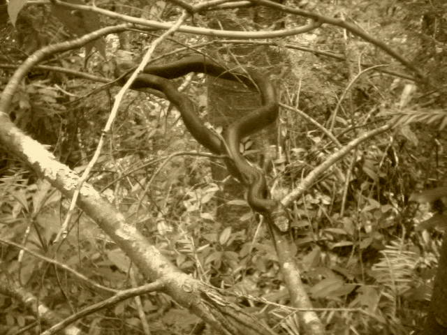
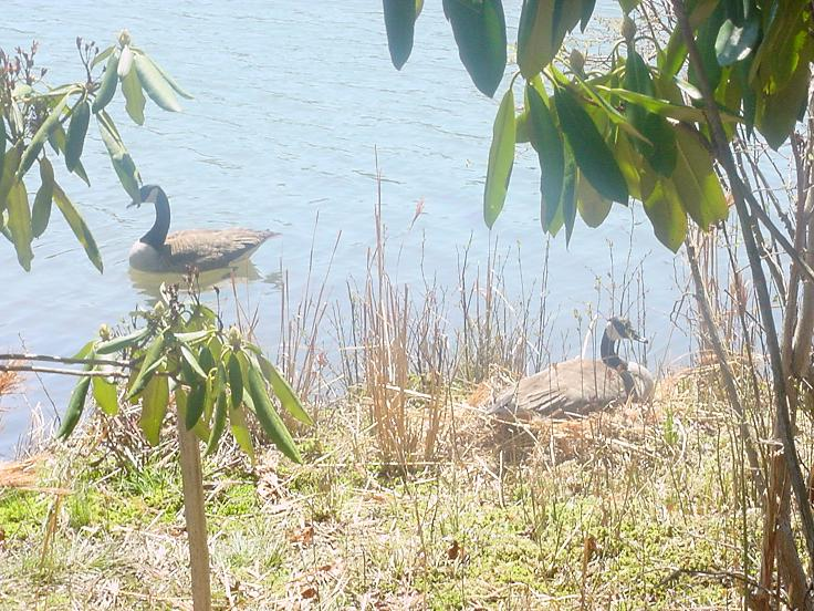
impending snow. At the edge of Kanuga Lake, a Canadian goose was sitting on her
nest, and further on, two new goslings were spotted with their parents. Spring
has arrived and all is well.
ALL DAY No. A0502-033 Apr. 24 Ramsey Cascades 8:00 AM Hike 8, Drive 160, 2000 ft. ascent, Rated B-AA Tom Sanders 828-252-6327 mel&tgs@main.nc.us 900M This is one of the classic spring wildflower hikes in the Smokies. Sixty-foot high Ramsey Cascades is located in a rich forested glen with an amazing variety of wildflowers and a grove of old-growth tulip trees. The drive and effort to reach this trail are a small price to pay for the reward. Second meeting place: Pilot Truck Stop at exit 24 off I-40 at 8:30 AM. Topo: Mt. Guyot
 Appalachian Trail in the Smokies!! See more Larry Modlin's Ramsey Cascades
Photos!
Appalachian Trail in the Smokies!! See more Larry Modlin's Ramsey Cascades
Photos!
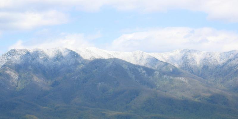
Post Hike Report: April 24 dawned, not with pre-summer as we expected, but with about an inch of snow in Asheville. Though this was surprising, we expected the snow-lovers (Stuart et. al) to show up in mass. However, there were only 5 of us at Westgate, and off we set for the Smokies to hike the Ramsey Cascades Trail. At the beginning there was about an inch of snow, but hardy yellow trillium and showy orchus were poking up to the great pleasure of the photographers in our group. There is about a 2000 ft elevation gain on this hike, and as we climbed higher the snow level increased. It was beautiful, and there are some enormous trees, chiefly Tulip Poplars on the route. We strung out, with Carroll K. setting a steady leading pace. Toward 12:30 the advance guard arrived at the falls which were spectacular with, by now, about 4-5 inches of snow around. After reuniting with the falls as lunch spot, we returned to the trailhead, encountering several hardly hikers coming up after us. You can't beat a hike with a reasonable amount of snow, because there's a special beauty, but who would have expected it on April 24? The rest of you CMC members who purport to be hikers really missed a great one! Tom
Half Day Sunday
HALF-DAY No. H0502-450 April 24 Graveyard Fields 1:30 PM Hike 4, Drive 40, Rated C-C Heather and Barry Fletcher 828-299-4776 hmflet@aol.com P400 Enjoy a moderate loop hike to the spectacular waterfall with a side trip to the Yellowstone Prong falls. Second meeting place: Graveyard Fields Parking Lot at BRP Milepost 418.8 at 2:15 PM.
Post Hike Report: The planned half-day hike was to begin at mile 418.8 of the Blue Ridge Parkway and follow the Graveyard Ridge loop trail with a side trip to Yellowstone falls. The trail, when scouted the previous week, was in good condition. Unfortunately, a spring storm with snow and high winds blew in on Saturday. By Sunday, temperatures were not far above freezing even in Asheville and a winter storm watch was in effect. The BRP information service warned of road closures north of our destination. Hence, it was impossible to drive to the trail head. No hikers appeared at the first meeting place (Westgate). One person e-mailed us later to say that we should have notified everyone that the Parkway was closed. We responded with the BRP information number (828-298-0398) and an admonishment to call the hike leader if the weather is doubtful. We regret any inconvenience caused by the need to cancel this hike.
All Day Wednesday
WEDNESDAY No. W0502-120 Apr. 27 Charlies’ Bunion-Kephart Prong 8:00 AM Hike 10.2, Drive 140, 1500 ft. ascent, Rated A-B Elisabeth Feil, 828-684-8719 hofeil@brinet.com 900M, SB6K? An outstanding rock outcrop along the AT, stunning views, and a great wildflower display are the highlights of the trip. Starting at Newfound Gap, we hike 4 miles to the Bunion, then along Dry Sluice Gap, Grassy Branch and Kephart Prong Trails down to US 441. (There is an optional side trip over Mt. Kephart (6000 ft) to The Jumpoff, which adds another 2 miles. We’ll make our decision when we get there.) This hike is moderate to strenuous about 1500 ft uphill and 2800 ft down. Car shuttle. Second meeting place: Quality Inn at Junction US 19 and US 276 in Maggie Valley at 8:40 am. Topos: Clingmans Dome, Mt Guyot, Smokemont; also Nat’l. Geographic GSMNP map
WEDNESDAY No. W0502-455 Apr. 20 Lower Mt Cammerer Trail 8:00 AM Hike 8, Drive 120, 1000 ft. ascent, Rated B-C Tom Sanders, 828-252-6327 mel&tgs@main.nc.us This moderate in and out hike from the Cosby Camp Ground area of the Great Smokies hopefully will coincide with yellow Trillium, Showy Orchis and Dwarf Iris which thrive here in late April. In any event, Lower Cammerer is a beautiful trail with a gradual incline up and then down. Second meeting place: Pilot Truck stop at Exit 24 of I-40 at 8:30 AM Topo: Hartford
Post Hike Report: Lower Mt. Cammerer Trail. Fifteen people enjoyed this hike on a beautiful day. For the record, on April 20, Yellow Trillium, Showy Orchus, and Dwarf Iris were abundant, though the Iris would be even more profuse in another week. In the woods Dogwood, Silverbell, and Mtn. Magnolia were also blooming. An easy, relaxed hike in 4 miles from Cosby Campground, lunch at Back Country Campsite #35, one of the best in the Smokies, and 4 miles return. Everyone had a great time. Tom
HikingNews....
_____________________________________________________________
FONTANA WEEKEND 2005
Two years ago, 50 CMCers' spent a relaxing September weekend at Fontana Village, NC, hiking nearby trails in the Smokies and enjoying a boat trip and tour of an abandoned town and the old Eagle Creek copper mine. We plan to schedule a similar trip this year. So set aside the weekend of Sept. 30 – Oct. 2 to join us. Additional information will be posted in the future in the E-Newsletter and in Let’s Go as plans develop. Please contact Bruce Bente at bbente@cytechusa.com for any questions or suggestions that you have about this trip.
HIKE PROBLEMS IN PISGAH NATIONAL FOREST
Some CMC hikes in the Pisgah Ranger District have recently been impossible to do as scheduled. Due to damage from the September 2004 hurricanes, certain Forest Service roads have been closed, requiring us to design replacement hikes. In each case, replacement hikes have been selected in the same general area, and have retained the same departure times and second meeting places. The replacement hikes have been described in the E-Newsletter, and it is suggested that you check the E-Newsletter whenever you’re planning to go on a hike scheduled for the Pisgah Ranger District. As of 4/17, these roads and trails are still closed: •FS 1206 Yellow Gap Rd. from Yellow Gap to Wolfe Ford Rd. •FS 475 from the Fish Hatchery to 1 mile north of Gloucester Gap •Daniel Ridge loop trail, due to concrete bridge at the trailhead being washed out; •Farlow Gap Trail, probably due to bridges washed out (not verified) The good news is that the National Forest folks are working on the problem, and we’ve been told that contracts for repairs have already been awarded. For the latest information on the closures, take a look at www.cs.unca.edu/nfsnc/press/storm.htm