ALL DAY No. A0701-424 Feb. 4 Hospital Rock to Pretty Place and Falls Creek 8:30 AM* (strenuous) Hike 9, Drive 80, 2000 ft. ascent, Rated B-A Michael Cornn, 828-685-3442, mcornn@aol.com *Note later start time. This is a challenging hike in Jones Gap State Park in S.C. After hiking up the Hospital Rock Trail, we will enjoy a great view at lunchtime from Pretty Place. After lunch we will return via the Falls Creek Trail past beautiful Falls Creek waterfall. Short car shuttle. Additional meeting places: NE corner of Cracker Barrel parking lot at exit 53 of I-26 at 9:00 AM; also Jones Gap State Park parking lot at 9:15 AM. $2 fee for park entry. Topos: Cleveland, Standingstone Mtn.; also Mountain Bridge Wilderness Area map
ALL DAY No. A0701-479 Feb. 4 Kagel Mtn. 8:30 AM* (moderate) Hike 9, Drive 80, 1100 ft. ascent, Rated B-B Chip Miller, 828-654-9331, backpacker54nc@bellsouth.net P400 *Note later start time. This loop hike will start from Cathey’s Creek Rd. and follow an overgrown forest road to the Art Loeb Trail, with lunch at the Butter Gap shelter. We’ll return via a no-name trail for variety. Nice winter views. Second meeting place: Bi-Lo in Pisgah Forest at 9:00 AM. Topos: Rosman, Shining Rock; also Nat’l. Geo. PRD map
ALL DAY No. A0701-418 Feb. 11 Newton Bald – Kanati Fork 8:00 AM Hike 11.5, Drive 120, 2800 ft. ascent, Rated A-AA Tom Sanders 828-252-6327 tomary2@charter.net 900M This great winter hike near Cherokee climbs Newton Bald, continues on Thomas Divide and then descends on Kanati Fork Trail. When CMC did this hike a few years ago, we had the neat experience of beginning the hike on dry ground, then hiking up onto trails covered by up to a foot of snow and then descending back onto dry trails. Short car shuttle. Second meeting place: back of Post Office parking lot on US 276 in Maggie Valley at 8:30 AM. Topo: Clingman’s Dome; also Nat’l. Geographic GSMNP map
HALF-DAY No. H0701-316 Feb. 4 Carl Sandburg 1:00 PM*
Hike 4, Drive 50, Rated C-CNonmembers, call leader, Lucy Prim, lucette32@mchsi.com , 828-693-6580
*Note early start time. Traverse the same trails that poet/biographer Carl Sandburg enjoyed by climbing Big Grassy Mountain behind his farmhouse. *Meet at Westgate at 1:00 PM to form carpools, and meet leader at parking lot of Carl Sandburg Park at 1:30 PM.
HALF-DAY No. H0701-064 Feb. 11Fletcher Creek 1:00 PM*Hike 6, Drive 48, Rated B-CNonmembers, call leader, Greg Goodman, 828-684-9703P400 *Note early start time. From the Hendersonville Reservoir, we will hike for a brief time on the Big Creek Trail, then take a loop using Spencer Branch, Middle Fork and Fletcher Creek Trails. The hike includes a few stream crossings.*Meet at Westgate at 1:00 PM to form carpools, and meet hike leader at parking area just before the North Mills River Recreation Area at 1:30 PM.
WEDNESDAY No. W0701-310 Jan. 31 Jones Gap State Park 8:15 AM* Hike 8.5, Drive 94, 1800 ft. ascent, Rated B-A Jo Anderson, 828-693-7081, jobob@mchsi.com Starting at Jones Gap State Park (NOTE: $2 fee per person for park entry), we will hike up the Rim of the Gap Trail with views of the Gap as we ascend. On top, a loop up on to the ridge, then down the Ishi Trail (#8) if doable. It is short, but steep. If it’s wet or icy we’ll go back down Rim of the Gap. *Meeting places: Meet at Westgate at 8:15 AM to form car pools, and meet leader at Jones Gap State Park parking lot at 9:00 AM. Topos: Cleveland, Table Rock; also Mountain Bridge Wilderness Area map
WEDNESDAY No. W0701-439 Feb. 7 Pounding Mill Trail 8:00 AM Hike 8-9, Drive 55, 950 ft. ascent, Rated B-C Greg Goodman, (828) 684-9703 P400 This hike takes the South Mills River Trail to the Pounding Mill Trail and on to Squirrel Gap Trail. Continue onto Pea Gap and then return on the South Mills River Trail. Second meeting place: Boyleston Baptist Church on NC 280 at 8:30 AM. Topo: Pisgah Forest; also, Na’l. Geo. PRD map
WEDNESDAY No. W0701-554 Feb. 14 Bent Creek Loop #12: MST - Arboretum 8:30 AM Hike 8.5, Drive 22, 1400 ft. ascent, Rated B-B Sherman Stambaugh, 828-254-1736 P400 This hike is a loop on some of the Bent Creek area trails, including Small Creek and a connector trail from the Lake Powhatan area to the MST. We'll then hike north on the MST to Hard Times Road and return to the cars through the Arboretum. Second meeting place: Ingles across from Biltmore Square Mall on NC 191 at 8:45 AM. Topo: Dunsmore Mt.; also Nat’l. Geo. PRD map and Bent Creek Trail map
CHRISTMAS EVE – NO HIKE SCHEDULED Dec. 24
MONDAY No. A0604-487 Dec. 25 Bent Creek Loop #9 9:00 AM Hike 9, Drive 20, 1600 ft. ascent, Rated A-A Lenny & Danny Bernstein, 828-236-0192, danny@hikertohiker.org
P400 Note later start time. Join us for a Christmas hike around Bent Creek, starting at the Hardtimes trailhead. A great close-in, cool weather hike suitable for everyone. Dinner at a casual Chinese restaurant for those interested. Topos: Dunsmore Mtn. , Skyland; also Nat’l. Geo. PRD map
For an easier hike, Jean Gard and Paula Robbins will lead a shorter version of this hike at Bent Creek for those who only wish to hike about five miles at a slower pace. They will join the other group for dinner. Contact Paula at paularww@bellsouth.net or 828-281-3253 if you would like to join them.
No hike since it rained. Instead we went to the movies and then out to dinner. Danny
HIKE CANCELLED – NO LEADER AVAILABLE Dec. 31
NEW YEARS DAY No. A0701-281 Jan. 1 Green River Gamelands 8:00 AM breakfast, 9:10 AM hike* Hike 6.5 or 8, Drive 20 (from Hendersonville), 1300 or 1500 ft. ascent, Rated B-B Bruce Bente, 828-692-0116, bbente@bellsouth.net *Meet at Westgate at 7:30 AM to form carpools and meet leader at times above at the Cracker Barrel in Hendersonville (exit 53 on I 26). After breakfast, we’ll do a pleasant loop on a series of trails around the Green River Gamelands. We’ll hike down to and along the Green River, with a late lunch at the big rocks on the Green River, and then hike up and out on the Pulliam Creek trail. Short car shuttle. Topo: Cliffield Mtn.; also Map of the Green River Gamelands Trails. if you are not a CMC member, you must call the leader.

Again the weather cooperated nicely for this hike. After heavy rain the day before, it cleared in time for our traditional New Years Day hike in the Green River Gamelands. 17 people enjoyed breakfast at the Hendersonville Cracker Barrel, then hiked a U-shaped route that started at a newly improved parking area the end of Big Hungry Rd. We hiked down to the river and were treated to the sight of the Green River nearly in flood stage from the heavy rains of the day before. The 3 miles of hiking along the river was impressive to see and hear, with fast-moving roaring water flows. The usual lunch spot at the big rocks on the river was different--the rocks we usually sit on were islands in the torrent and we sat on rocks that in other years were far from the water.
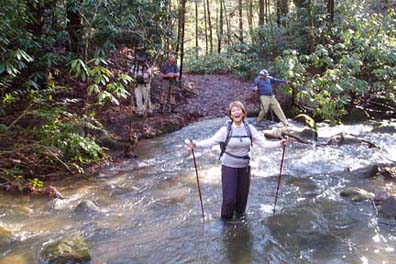
The hike out was notable at the crossing of Pulliam Creek. The floods had washed out the support logs, so some people waded the nearly knee-deep creek while the more agile people gingerly rock-hopped the creek. Bruce Bente
ALL DAY No. A0701-128 Jan. 7 Sam Knob Loop 8:00 AM Hike 9.8, Drive 80, 1500 ft. ascent, Rated A-A Paul Benson, 828-251-1909, pdbenson@charter.net SB6K, P400 This scenic loop will be great in winter weather, hopefully with snow on the ground. We’ll start at NC 215 and follow the MST, with a side trip to Devil’s Courthouse, to FS 816. Then we’ll loop back and ascend Sam Knob (6040 ft.) with its 360-degree views, then follow the Flat Laurel Creek Trail to NC 215. There will be a wet stream crossing at the end unless it is frozen. Topos: Shining Rock & Sam Knob; also Nat’l. Geographic PRD map
Cancelled because of rain. Paul
ALL DAY No. A0701-001 Jan. 14 Case Camp – Seniard Ridge Loop 8:00 AM Hike 8, Drive 80, 2000 ft. ascent, Rated A-A Kathleen Hannigan, 828-230-4883, kathleen.hannigan@pgnmail.com P400 This loop hike features a short steep climb up to the MST, some MST hiking, and 50-ft. frozen cascades along the closed BRP. After lunch with a great view of the surrounding mountains, we’ll hike through some beautiful woods on the Seniard Ridge trail. Second meeting place: Pisgah Ranger Station at 8:30 AM. Topo: Shining Rock; also pg. 50 of MST Profiles book and Nat’l. Geo. PRD map
No report.
ALL DAY No. A0701-545 Jan. 21 Bent Creek #11 - Boundary Trail 8:30 AM Hike 8.5, Drive 25, 1300 ft. ascent, Rated B-B Stuart English, 828-883-2447, stuengo@citcom.net P400 From Bent Creek Gap we will follow the MST to the Bent Creek Boundary Trail, on to Ingles Field Gap, to Ledford Branch Road and down to Deer lake Lodge Trail and the Rice Pinnacle parking lot. Great winter views. Car shuttle. Second meeting place: Ingles parking lot, across from Biltmore Square Mall on NC 191 at 8:45 AM. Topos: Dunsmore Mtn.., Skyland; also Nat’l. Geo. PRD map and Bent Creek Trail map
This hike was canceled because of weather or impending weather. Only two
people showed up at either meeting place. They were Tom and Joan and we
decided to do a shorter one closer home in Pisgah Forest. Stuart
SATURDAY No. A0701-546 Jan. 27 Coontree – Pressley – Thrift Cove Ramble 8:30 AM* Hike 8-9, Drive 70, 1700 ft. ascent, Rated A-A Dave Wetmore, 828-884-7296, dwetmore@citcom.net P400 This is a new CMC hike that starts by climbing to Coontree Gap, then down the Bennett Gap trail and up Pressley Cove Trail where we’ll take a short detour to visit a fine chimney. Next we’ll go down the Black Mtn. Trail for a short distance, then turn and descend on the Thrift Cove Trail. A nice low-elevation hike for a cold winter day. Short car shuttle. *Meeting places: Meet at Westgate at 8:30 AM to form carpools, and meet leader at Black Mtn. parking lot next to Pisgah Forest maintenance area at 9:00 AM. Topo: Pisgah Forest, Shining Rock; also Nat’l. Geo. PRD map
 The day started out cold and sunny, but soon turned balmy for the 16 hikers who were not intimidated by the early temperatures.
It was a crowded day. We met a group of very unhappy campers on East Coontree Creek who had spent the night out. They were not using the proper equipment and had picked the coldest place to camp they could have found. Going down Bennett Gap Trail we met a man with a dog. He (the man, not the dog) felt that there were too many of us.
After a historical moment at an old chimney we climbed to Hickory Knob summit, where we ate lunch in the warm sun. Here we saw the first of many of the bicyclists out on a warm Saturday. Then it was downhill on the Black Mountain trail, pausing for more history at an old insulator. Climbing up Thrift Cove Tom Bindrim discoursed on deer pastures and autumn olives. On the east side of the cove we inspected the culvert graveyard and the old cistern near the end of the hike.
The leader thanks Danny Bernstein and Tom Bindrim for their contributions to the historical moments. Dave.
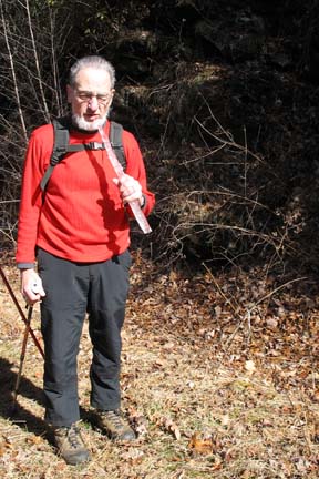
Picture by Danny Bernstein. Dave is eating an icicle.
ALL DAY No. A0701-255 Jan. 28 MST: NC 80 – Black Mtn. Campground 8:30 AM* Hike 8, Drive 90, 700 ft. ascent, Rated B-C Jim Reel, 828-738-0751, jimr57@yahoo.com Expect good winter views as we hike south on the MST from Buck Creek Gap at NC 80 to Black Mtn. Campground, crossing a couple of times over the BRP. *Meeting places: Meet at Westgate at 8:30 AM to form carpools, and meet leader at intersection of BRP and NC 80 at 9:20 AM. Car shuttle. *Topos: Old Fort and Celo; also PNF South Toe River, Mt. Mitchell & Big Ivy trail map.
Defying dire weather forecasts, 9 hikers, including two new hikers, showed up to hike the MST from NC 80 to Black Mtn. Campground. Susie Canonico led her first CMC hike after volunteering to replace Jim Reel (who is recovering well from his knee surgery). The weather turned out to be a bright sunny day and good hiking weather. The blowing winds and approaching cold front dropped the temperature continually during the hike. We saw the rhododendron leaves go from flat to curled as the temperature dropped, and our lunch stop was short and cold (see photo).
The views of the Black Mtns. from the trail were great and showed snow at higher elevations with a big snow cloud hanging over the range, only a couple of miles from our sunny day.
Many thanks to our CMC maintenance crew for clearing blowdowns from this trail in the week before the hike. -Typed by Bruce Bente, input from Susie Canonico
HALF-DAY No. H0701-320 Jan. 7 Warren Wilson College Ramble 1:30 PM
Hike 5.5, Drive 20, Rated C-C.
Nonmembers, call leaders, Barry and Heather Fletcher, 828-299-4776, hmflet@aol.com . This pleasant in-and-out walk is along the Swannanoa River and through wooded land of the Warren Wilson College campus, on the River and Dam Pasture Trails.
This is usually an excellent low altitude winter hike because of the trail’s proximity to Asheville, eliminating dependence on the sometimes closed Blue Ridge Parkway. However, on this day, the trail was wet, muddy and somewhat slippery owing to intermittent and continuing rain that began in the morning. However, four enthusiastic hikers showed up out of more than a dozen who had called during the previous week when the weather was exceptionally warm and sunny. The decision to hike was not made until the last minute when we arrived at the trail head and the rain momentarily relented. For most of the walk, along a path that begins on Warren Wilson College Road and meanders beside the Swannanoa River, we were sheltered from the drizzle by the forest canopy and a stand of rhododendrons. The second portion of the hike on the Dam Pasture Trail begins across Old Farm College Road and continues to the remnants of a dam formerly used to produce electricity for the college. On a fine day, this is a perfect place for a rest stop and to admire the fast-flowing Bull Run Creek.
Because of the weather, we elected to forgo a small loop past the dam and returned to the trailhead. Total hiking time was about 2 1/2 hours, a good pace considering the slippery, sodden conditions. Barry
HALF-DAY No. H0701-500 Jan. 14 MST: US 25 to I-26 1:15 PM*
Hike 3.2, Drive 15, Rated C-C
Nonmembers, call leader, Pat Elias, 828-687-1651, patelias@bellsouth.net
*Note early start time. A pleasant winter hike through the woods, parallel to the Blue Ridge Parkway between I-26 and US 25. Short car shuttle. *Meet at Westgate at 1:15 PM to form carpools, and meet hike leader at Ingles parking lot across from Biltmore Square Mall on NC 191 south of I-26 at 1:30 PM.
Seventeen CMC members, including three new members and one new sign-up, ventured out on a 3.2 mile hike, which turned out to be 5.2 miles. The discrepancy was the fault of the leader who got her bridges/overpasses confused, having in mind for the terminus of the hike the pull-off area just east of the Route 191 overpass. Aside from the additional two miles, which the hikers appeared to accept in stride, the hike went smoothly on a pleasantly warm winter day. We not only got our exercise, but had the opportunity to admire the fine work of CMC volunteers who constructed a bridge at a stream crossing, where the trail needed to be diverted to accommodate the Rambles development. A short snack break provided sustenance to finish up our extended hike. Pat
HALF-DAY No. H0701-168 Jan. 21 Pink Beds 1:00 PM*
Hike 4.2, Drive 65, Rated C-CNonmembers, call leader, Laura Stallard, 828-697-1579
P400 *Note early start time. This is an easy loop hike with little elevation change, off US 276, not far from the Cradle of Forestry. Second meeting place: Pisgah Ranger Station at 1:30 PM.
HALF-DAY No. H0701-499 Jan. 28 French Broad River Greenway 1:30 PM
Hike 4, Drive 10, Rated C-CPaula Robbins, 828-281-3253, paularww@bellsouth.net
Asheville’s Greenway System now provides several opportunities for city walking. The leader, a member of the Greenway Commission, will describe plans for extending this riverfront trail and other existing and planned greenways within the City.
Fourteen hardy folks, including several newcomers, joined a brisk walk along the French Broad River Sunday afternoon despite below-freezing wind chills. The leader, Paula Robbins, a member of the Asheville Greenway Commission, explained plans of the City Parks and Recreation Department to extend the greenway from the current French Broad River Park at Amboy Road and Riverview Drive to the West Asheville-RiverLink Bridge at Haywood Road along a Progress Energy right-of-way. At the other end of the walk, she showed where the trail will be extended from the end of Carrier Park (the old Speedway) to Hominy Creek Park. Along the way, they passed the former Edaco junkyard, recently purchased by RiverLink. Paula.
WEDNESDAY NO. NO. W0604-279 Dec 20 Montreat: RR trestle Grade to Pot Cove 9:00 AM* Hike 7, Drive 35, 1000 ft. ascent, Rated B-C Gerry McNabb,828-274-0057, gerrymcnabb@charter.net *Note later start time. An easy in and out hike to Pot Cove from the lookout Trail parking lot. Some internal loops for variety. Second meeting place: Parking lot adjacent to Black Mtn McDonalds just south of I-40 exit 64 at 9:30 AM. Topo: Montreat

For a gray day on Dec. 20, we had a surprising 21 hikers on the Pot Cove trip...an unusually genial group, at that. We split up at Sourwood Gap and about 60% of the group walked up over Rocky Knob, while the rest took the Old Mitchell Toll Rd. and met them at Long Gap further north. Gerry. Photo also by Gerry.
WEDNESDAY NO. NO. W0604-286 Dec. 27 Sycamore Cove Trails 8:10 AM* Hike 7, Drive 70, Rated B-B Pat Elias, 828-687-1651, patelias@bellsouth.net P400 *Meet at Westgate at 8:10 AM to form carpools; meet hike leader at entrance to Davidson River Campground parking lot on US 276 at 8:45 AM. An easy hike (some uphill) in the Pisgah Forest along several trails: Thrift Cove, Grassy Road.
After threatening weather reports for rain/snow, wind/cold, Wednesday turned out to be the perfect hiking day. Six hikers, all from south
of I-40, gathered at the Davidson River Campground parking lot well before the 8:45 AM meeting time. We waited until 9:00 AM for Westgate people thinking, perhaps, 35 minutes might be tight for the ride from Westgate to our meeting spot. No one showed, so we started our hike, walking for 10 minutes south on 276 to the Sycamore Cove trailhead, hiking counter-clockwise on the various trails in this area. It turned out that here was one hiker from Westgate, but it appears he overshot the Campground parking lot and missed us by just a few minutes. Although, he hiked alone, I understand he did a good 7-1/2 miles and enjoyed the day as we did. Pat.
WEDNESDAY No. W0701-186 Jan. 3 Little Pisgah Mountain 8:00 AM Hike 9, Drive 80, 1500 ft. ascent, Rated B-B Charlie Ferguson, 828-398-0213, ccf108@gmail.com A pleasant hike, close to home for our coldest month. We’ll hike from Hickory Nut Gap through an open meadow to see the view from the summit of Little Pisgah Mtn. Topo: Bat Cave
 Twenty four hikers went on a beautiful hike up to the top of Little Pisgah Mountain, near Hickory Nut Gap along Route 74A. The temperature was cool but not cold - warm in the sun. The skies were the clearest that I have seen in awhile. Most of the hike was along a gently sloping gravel road that provides access to private properties along the way and the radio transmitters at the top of the mountain. We were able to get off the road and hike on a few trail belong to and going through the Florence Nature Preserve. The road was gated at one point so there was not much traffic. About half way through the hike the Forest gave way to cow pastures and meadows. Then it opened up more and there were views of the distant surrounding mountains and valleys. Everyone enjoyed the views and we stopped occasionally to enjoy them. At the top we ate lunch around some boulders with great views to the east and north. We could see the Craggys, Mount Mitchell and some other Blacks, Grandfather Mountain and Linville Gorge. After a leisurely lunch we took a steep shortcut down the mountain with a little bushwhack, which saved us an hour. After that we returned pretty much the way that we came. Most people agreed that the beauty of this hike was understated in the hike description. Charlie
WEDNESDAY No. W0701-305 Jan. 10 Dupont Forest North Loop 8:00 AM Hike 10, Drive 82, 1000 ft. ascent, Rated A-B Jay Bretz, 828-658-1220, williambretz1220@msn.com . This low-altitude hike will traverse a loop on the northern side of Dupont Forest, from Lake Imaging to Stone Mtn., including Grassy Falls, the Thomas Cemeter and Wintergreen Falls. Second meeting place: Bi-Lo Pisgah Forest at 8:30 AM. Topo: Standingstone Mt.
 Thirteen hardy hikers gathered for a winter hike in Dupont Forest Even though there had been various snowfall levels around western North Carolina the previous day, there was no snow in Dupont Forest and the sun shined all day, making the chilly temperatures seem warmer. The group enjoyed sight seeing stops at Grassy Creek Falls, Winter Green Falls and at the top of Stone Mountain with no bothersome breezes. The hike, according to GPS calculations, ended up being 12 miles long with a total elevation gain of over 2000 feet. There were minimal complaints from the hardy group with an agreement that it was a wonderful day outdoors. Of course the hike ratings for this hike will be updated for future hike schedules. Jay Bretz
WEDNESDAY No. W0701-053 Jan. 17 East Fork Pigeon River 8:00 AM Hike 8, Drive 74, 1200 ft. ascent, Rated B-B Tom Sanders, 828-252-6327. tomary2@charter.net P400 A stroll along one of WNC's most beautiful streams, the East Fork of the Pigeon River, which is often spectacular in the winter. We will ascend to Dark Prong for lunch and then return. Wilderness area, limit 10, so contact leader for reservation. Second meeting place: Big East parking area on US 276, north of BRP at 8:45 AM. Topo: Shining Rock; also Nat’l. Geo. PRD map
With 14 people wanting to go on this hike, we broke into two groups, one of 9 and the other of 5. Greg Goodman and Barth Brooker kindly agreed to lead the second group. It was a very good day for a winter hike, around freezing and clear,though with some sun. Starting from US 276 we ascended the East Fork 4 miles to Dark Prong, where we had lunch, and then returned by the same route. The stream, with its many waterfalls, cataracts and pools was, as usual, beautiful, and especially on the return we stopped frequently to admire particular sections. This is a very easy hike with about an hour's drive each way and about 5 hours of walking. Tom
WEDNESDAY No. W0701-333 Jan. 24 Bearwallow Mtn. 8:30 AM Hike 9.2, Drive 30, 1950 ft. ascent, Rated A-A Bruce Bente, 828-692-0116, bbente@bellsouth.net This hike is an old CMC favorite. From Hickory Nut Gap on US 74A, we will hike over Ferguson Peak, then through undulating, open meadows before reaching our lunch spot at the fire tower on Bearwallow Mtn. Extraordinary views down towards the Lake Lure area. Topo: Bat Cave
 20 hikers ventured out on this cold and windy Wednesday to do an old CMC hike from Hickory Nut Gap to Bearwallow Mtn. We were fortunate to receive permission from landowners to hike this route over private property. The views were great on a strenuous 9-mile hike with 2800' of ascent on an up-and-down ridge hop. We first hiked up to the Ferguson Peak viewpoint, then up over open meadows, over 1/2 mile of road, and then the final steep climb up to the very windy Bearwallow Mtn. summit (see photo), where we found shelter from the wind behind an equipment container. A representative for the Broad River Initiative talked to us to describe what is being done to conserve the Broad River watershed. A big surprise on the way back was seeing violets blooming next to the trail at 3500' elevation (see photo). Bruce Bente, with photos by Ted Connors
WEDNESDAY No. W0701-310 Jan. 31 Jones Gap State Park 8:15 AM* Hike 8.5, Drive 94, 1800 ft. ascent, Rated B-A Jo Anderson, 828-693-7081, jobob@mchsi.com Starting at Jones Gap State Park (NOTE: $2 fee per person for park entry), we will hike up the Rim of the Gap Trail with views of the Gap as we ascend. On top, a loop up on to the ridge, then down the Ishi Trail (#8) if doable. It is short, but steep. If it’s wet or icy we’ll go back down Rim of the Gap. *Meeting places: Meet at Westgate at 8:15 AM to form car pools, and meet leader at Jones Gap State Park parking lot at 9:00 AM. Topos: Cleveland, Table Rock; also Mountain Bridge Wilderness Area map
All-day hikes submitted by Bruce Bente 692-0116, bbente@bellsouth.net . Driving distance is round-trip from Asheville. All Saturday and Sunday hikes assemble at Westgate Shopping Center near I-240 UNLESS OTHERWISE NOTED.
Half Day hikes submitted by Paula Robbins 828-687-1651 paularww@bellsouth.net.
Wednesday Hikes are submitted by Charlie Ferguson, 828-398-0213 ccferguson@email.com and Ann Gleason, 828-859-9387, gleason.ann@gmail.com .
The meeting place for each hike will be designated by the hike leader and will appear in the hike description.
Driving mileage will be listed, round trip, from the first designated meeting place.
Leaders: Mail please mail your sign-up sheets. Meet at Westgate unless otherwise noted.