|
Looking Ahead
All Day Saturday & Sunday
ALL DAY NO. A0702-033 May 27
Ramsey Cascades 8:00 AM
Hike 8, Drive 160, 2000 ft. ascent, Rated B-AA
Janet Martin, 812-738-8154, jaykaymartin@msn.com
900M This is one of the classic hikes in the Smokies. We will pass through a grove of old-growth tulip poplars on our way to sixty-foot high Ramsey Cascades, located in a rich forested glen. The drive and effort to reach this trail are a small price to pay for the reward. Second meeting place: Pilot Truck Stop at exit 24 off I-40 at 8:30 AM. Topo: Mt. Guyot; also Nat’l. Geo. GSMNP map
MEMORIAL DAY JOINT HIKE WITH SMOKY MTNS. HIKING CLUB
ALL DAY NO. A0702-089 May 28
AT: Max Patch to Lemon Gap and Return 8:00 AM
Hike 11, Drive 100, 1800 ft. ascent, Rated A-A
Becky Smucker, 828-298-5013, bsmucker@charter.net
Our annual joint hike with Smoky Mountains Hiking Club will begin and end at Max Patch to enjoy one of WNC’s most stunning views, hike along a beautiful section of the AT, and see the new AT shelter recently built by CMC. Second meeting place: Pilot Truck Stop at exit 24 off I-40 at 8:30 AM. Topo: Lemon Gap
National Trails Day
Celebrate National Trails Day by hiking in the Little Cataloochee Valley. Kevin Fitzgerald, Deputy Superintendent of the Great Smoky Mountains National Park, will be hiking with us. Choose from an easy half-day hike or a challenging climb.
SATURDAY ALL-DAY NO. A0702-561 June 2
Mt. Sterling from Cataloochee 8:00 AM
Hike 13.3, Drive 100, 3300 ft. ascent, Rated AA-AA
Danny Bernstein, 828-236-0192, danny@hikertohiker.org
900M The views on Mt. Sterling are awesome. Starting at the Little Cataloochee Trailhead, we’ll hike up the Long Bunk Trail past Hannah Cemetery. Then we turn on the Mt. Sterling Trail, an old jeep road, which makes the climbing easier than it sounds. There will be wildflowers and views as we go up. Second meeting place: Pilot truck stop at exit 24 off I-40 at 8:30 AM. Topo: Cove Creek Gap; also Nat’l. Geo. GSMNP map
SATURDAY HALF-DAY NO. H0702-557 June 2
Little Cataloochee Church 8:00 AM
Hike 5 miles, Drive 100, Rated C-C
Nonmembers, call leader, Jean Gard, 828-777-1814, jeangard@charter.net
900M Hike to the Little Cataloochee Church and cemetery on a good jeep road, with a short diversion to the Hannah Cemetery. Residents in this vibrant Little Cataloochee community had to leave when the area became the Great Smoky Mountains Nat’l. Park. After the hike, those who wish can drive to the Big Cataloochee valley and see the church, school and other structures. Second meeting place: Pilot truck stop at exit 24 off I-40 at 8:30 AM. Topo: Cove Creek Gap also Nat’l. Geo. GSMNP map
ALL DAY NO. A0702-449 June 3
Bald Mtns. Loop 8:00 AM
Hike 9.7, Drive 135, 2900 ft. ascent, Rated A-AA
Les Love 828-658-1489 lesrlove@aol.com
This is a beautiful Tennessee hike only 1 1/4 hours away. We'll hike from the Horse Creek Rec. Area to Pete's Branch Falls, then up Sarvis Cove along the creek to the AT at Cold Spring Mountain for lunch. We'll go back down an old jeep road that has great views. This hike is strenuous and has seven rock-hop creek crossings that may involve wading, so come prepared. Topo: Greystone; also Nat’l. Geo. French Broad & Nolichucky Rivers map
Half Day Sunday
HALF-DAY No. H0702-349 May 27
Buck Spring Trail 1:00 PM
Hike 6.2, Drive 50, Rated B-C
Nonmembers, call leader, Paula Robbins, 828-281-3253, paularww@bellsouth.net
This pleasant down-hill hike starts at the Pisgah Inn and ends at Rt. 276, with a car spot. Call the leader if you wish to join her for dinner at the Pisgah Inn after the hike. Second meeting place: Pisgah Inn parking lot near convenience store at 1:30 PM.
National Trails Day - Half day hike
SATURDAY HALF-DAY NO. H0702-557 June 2
Little Cataloochee Church 8:00 AM
Hike 5 miles, Drive 100, Rated C-C
Nonmembers, call leader, Jean Gard, 828-777-1814, jeangard@charter.net
900M Hike to the Little Cataloochee Church and cemetery on a good jeep road, with a short diversion to the Hannah Cemetery. Residents in this vibrant Little Cataloochee community had to leave when the area became the Great Smoky Mountains Nat’l. Park. After the hike, those who wish can drive to the Big Cataloochee valley and see the church, school and other structures. Second meeting place: Pilot truck stop at exit 24 off I-40 at 8:30 AM. Topo: Cove Creek Gap also Nat’l. Geo. GSMNP map
HALF-DAY NO. H0702-525 June 3
Dupont Forest: Corn Mill Shoals P.L. #2 12:30 PM*
Hike 4 miles, Drive 94, Rated C-C
Nonmembers, call leader, Becky Elston, 828-749-1886, belston@cytechusa.com
A pleasant hike over several trails up and over the granite slabs of Cedar Mountain with a break at the top of Bridal Veil Falls. *Note early start time. Meet at Westgate at 12:30 PM to form carpools, and meet hike leader at Hooker Falls Parking Lot at 1:15 PM.
All Day Wednesday
WEDNESDAY NO. W0702-491 May 23
Miami Mtns Watershed Hike 8:40 AM*
Hike 6, Drive 40, 1750 ft. ascent, Rated B-A
Tommy Boston, 828-686-5029 (cell after 8 AM, 279-8410), Tambee2@aol.com.
Strenuous hike! This is the second time the club will hike the Miami Mtns watershed from Ridgecrest Boys Camp to Christmount Christian Assembly. Some steep uphills and good views of the Craggys. *Meeting places: Meet at Westgate at 8:40 AM to form carpools, and meet leader at parking lot adjacent to McDonald's at exit 64 of I-40 at 9:00 AM. Topo: Black Mtn.
WEDNESDAY NO. W0702-447 May 30
MST: Mt. Pisgah to Beaver Dam Overlook 9:00 AM*
Hike 8, Drive 45, 1500 ft. ascent, Rated B-B
Joe Burchfield, 828-298-8413, Burchfield@niu.edu
P400 Note later start time. This moderate hike will start with a round trip up and down Mt. Pisgah, and will then follow the MST northbound to Beaver Dam Overlook. Expect good views along the route. Short car shuttle. Second meeting place: BRP French Broad overlook at 9:10 AM. Topos: Cruso, Dunsmore Mtn.; also Nat’l. Geo. PRD map & MST Profiles, pg. 53-55
WEDNESDAY NO. W0702-273 June 6
Boogerman Loop 9:00 AM*
Hike 8, Drive 90, 1000 ft. ascent, Rated B-B
Ashok Kudva, 828-698-7119, ashok.kudva@mchsi.com
900M *Note later start time. A lush forest with giant old-growth Tulip trees and remnants of pioneer life make this a favorite loop hike in the Cataloochee area of the Smokies. If we’re lucky we may spot one of the elk. Second meeting place: Pilot truck stop at exit 24 off I-40 at 9:30 AM, but call leader first. Topos: Cove Creek Gap, Dellwood; also Nat’l. Geo. GSMNP map
Looking Back......
All Day Saturday & Sunday
ALL DAY NO. A0702-560 May 13
Groundhog Creek, AT, Rube Rock Loop 8:00 AM
Hike 10, Drive 100, 1900 ft. ascent, Rated A-A
Stuart English, 828-883-2447, stuengo@citcom.net
A beautiful loop hike, rich in wildflowers. Located in the Harmon Den area of Pisgah Nat’l. Forest, we’ll hike up to and along the AT to Brown Gap, then descend and hike along the old railroad grade back to our cars. Second meeting place: Pilot Truck Stop offr I-40 at exit 24 at 8:30AM. Topo: Waterville
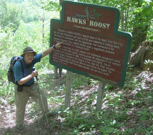 Ten people met to enjoy a perfect day hiking in a spectacular area: Harmon Den in the Pigeon River Gorge. We left a busy interstate and hiked up the beautiful Groundhog Creek to a shelter on the AT. Then a gradual climb to an overlook with views into Tennessee, down to Brown Gap, then along an old Forest Service Road to intersect the rugged Rube Rock Trail and back down into the gorge, the busy interstate and our cars. Becky Smucker reported 60 different wildflowers in bloom. A great group and a wonderful day. It doesn’t get any better than this. Stuart. Photo by Ashok Kudva. Ten people met to enjoy a perfect day hiking in a spectacular area: Harmon Den in the Pigeon River Gorge. We left a busy interstate and hiked up the beautiful Groundhog Creek to a shelter on the AT. Then a gradual climb to an overlook with views into Tennessee, down to Brown Gap, then along an old Forest Service Road to intersect the rugged Rube Rock Trail and back down into the gorge, the busy interstate and our cars. Becky Smucker reported 60 different wildflowers in bloom. A great group and a wonderful day. It doesn’t get any better than this. Stuart. Photo by Ashok Kudva.
SATURDAY NO. A0702-257 May 19
Hemphill Bald – Rough Fork Loop 8:00 AM
Hike 13.7, Drive 96, 3200 ft. ascent, Rated AA-AA+
Charlie Ferguson, 828-398-0213, ccf108@gmail.com
900M If this is a clear day, we will experience some of the most spectacular views in WNC. We will hike to Hemphill Bald for lunch, then down Caldwell Fork Trail and back up Rough Fork Trail, passing enormous old-growth tulip trees along the way. A strenuous hike, but the trails are well-graded. Second meeting place: Rear of Post Office parking lot on US 19 in Maggie Valley at 8:30 AM, but phone leader first. Topos: Bunches Bald, Dellwood; also Nat’l. Geo. GSMNP map
I got to substitute for Charlie Ferguson, because of his trip to Spain.
On Sat May 19 six members started from Westgate. At Maggie Valley three more joined the group, two being new members on their first club hike. We went on to Poll Gap off the Parkway to start the hike. We went 4.5 miles to Hemphill Bald for lunch. By then it had finally warm up and we enjoyed the great views from this spot. There is a picture on a table that lets you know what the hills in the distance are. After a nice lunch break it was downhill on the Caldwell Fork Trail. There is some old growth tulip trees that we all joined hand in hand to measure its size. After another short break it was up hill again on the Rough Fork tail. The first mile is up hill to you reach the path of an old railroad bed. The last two miles is a nice level grade path back to the cars. After the hike 3 enjoyed a dinner in Maggie Valley. Michael Cornn
ALL DAY NO. A0702-265 May 20
Panthertown Prowl #5 8:00 AM
Hike 8-10, Drive 120, 1200 ft. ascent, Rated B-B
Joe Cirvello, 828-252-2721, cirvello25@bellsouth.net
Rescheduled from last fall due to inclement weather, you now have an opportunity to see this beautiful area, located near Cashiers, in spring. This moderate loop hike has everything: waterfalls; granite domes with impressive cliffs; high-altitude bogs; a lovely valley floor; great views from the tops of Little Green and Big Green Mountains; and the probability of wildflowers. Second meeting place: Bi-Lo in Pisgah Forest at 8:40 AM. Topo: Big Ridge
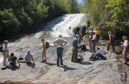 
Seventeen of us had a wonderful day of hiking with perfect weather in scenic Panthertown Valley. We began at the west entrance and shortly arrived at an overlook at about 4000 ft. where we had a spectacular panoramic view of the valley and the two peaks we were going to climb. We then hiked down into the valley and along Panthertown Creek past the point where Greenland Creek merges to form the Tuckasegee River and on to our first major stop to admire Warden's Falls. Our next stop was at the beautiful Schoolhouse Falls where some of us had fun taking the path behind the falls. We then hiked to the top of Little Green Mtn. (approx. 4080 ft.) where we had lunch while soaking up the terrific views of the valley around us. Much to our surprise and delight, one of the hikers discovered a patch of Pink Ladyslippers under a dwarfed, misshapen pine. We proceeded down the other side of Little Green, along the valley floor, and up to the top of Big Green Mtn. (approx. 4200 ft.) where we again enjoyed the great views. We then went down the other side of the mtn. and on to one more lovely falls along Frolictown Cr. and back up to our cars. Panthertown is managed by the Forest Service and is similar to a Wilderness Area in that there are no signs or blazes thus providing many opportunities for confusion. However, we had a great hike and 10 of us capped the day by having dinner together. Joe Cirvello. Photos, left by Ted Connors, right by Ashok Kudva
Half Day Sunday
HALF-DAY NO. H0702-170 May 13
Butter Gap Trail to Picklesheimer Fields 1:00 PM
Nonmembers, call leader, Gerry McNabb, 828-274-0057, gerrymcnabb@charter.net
Hike 5, Drive 40, Rated C-B, 1000-ft elevation gain
From the Fish Hatchery parking lot, we will follow the Cat Gap Trail .9 miles to its junction with the Butter Gap Trail for this in-and-out hike along Grogan Creek. Second meeting place: Fish Hatchery Parking Lot off US 276.
 About a dozen hikers appeared on a sunny Sunday afternoon at West Gate to
meet the leader and carpool to the fish hatchery for the Butter Gap hike.
In all, 24 hikers made the 5-mile hike without incident. Everything was on
schedule but the wildflowers. We saw none. There were more new faces and
younger hikers on this easy walk. Joe Cirvello showed up in his new Honda
Fit and looked proud to be one of the drivers. Gerry McNabb. Photo by Gerry. About a dozen hikers appeared on a sunny Sunday afternoon at West Gate to
meet the leader and carpool to the fish hatchery for the Butter Gap hike.
In all, 24 hikers made the 5-mile hike without incident. Everything was on
schedule but the wildflowers. We saw none. There were more new faces and
younger hikers on this easy walk. Joe Cirvello showed up in his new Honda
Fit and looked proud to be one of the drivers. Gerry McNabb. Photo by Gerry.
HALF-DAY NO. H0702-464 May 20
Greybeard Overlook to Balsam Gap 1:00 PM*
Hike 7, Drive 44, Rated B-C
Marlene Santa Maria, 828-299-9095, marlena98@hotmail.com
An in-and-out hike on this portion of the Mountains-to-Sea Trail, with 400 feet ascending and 700 descending, will provide great views midway. Many spring wild flowers likely. *Note early start time. Only meeting place: Folk Art Center lower parking lot.
Wednesday
WEDNESDAY NO. W0702-182 May 9
Green River Cove in the Green River Game Lands 8:45 AM*
Hike 7, Drive 80, 1000 ft. ascent, Rated B-B
Rusty Breeding, 828-692-0359, bree_lw@yahoo.com
This nice in-and-out hike goes along the Green River. Our break lunch spot is on the river and maybe kayakers on the Green River will provide some entertainment. *Note later start time. Meet at Westgate at 8:45 AM to form carpools, and meet hike leader at Texaco station off Exit 59 of I-26 at 9:30 AM.
Clear blue sky, puffy white clouds, leaves filled out and providing shade – who wouldn't have wanted to hike today? Ten turned up for the Green River Cove Trail, which was new to several. Three hikers took membership applications and said they enjoyed the hike. We saw one kayak accompanied by two canoes on the smooth part of the river but were not afforded the excitement of kayakers coming through the rocks at lunch. Wildflowers? – One unidentified that may be a "Green and Gold." Anything else? – Well, a timid green tree snake and a lizard that startled the leader as much as we startled him. -- Rusty, sub'ing for Becky
WEDNESDAY NO. W0702-216 May 16
AT: Sams Gap to Devil Fork Gap 8:30 AM
Ruth Hartzler 828-251-0886, ruthmtn@charter.net
Hike 8.5, Drive 90, 1400 ft. ascent, Rated B-B
This section of the AT features magnificent wildflower displays and nice views into Tennessee from the ridge line, traversing a series of knobs along an unusual section of the TN-NC state line where Tennessee is east of N.C. and the southbound hiker is actually traveling north. Car shuttle. Topo: Sams Gap
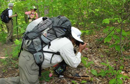
After our 40-minute car setup, 15 congenial hikers started south from Sams Gap on the AT. Given the forecast of possible severe weather, one group of four planned to turn back at lunch, and make the hike an out-and-back. When we scouted the hike the week before, we encountered 36 through-hikers and seven dogs. In addition, we saw the blankets of flowers that we hoped for when we scheduled the hike, but many of the masses of trilliums were past prime. So, we were hopeful, but didn’t know what to expect. Although rain threatened all day, and sprinkled on-and-off, we remained mostly dry. This was due to Stuart’s efforts of donning and removing raingear, a known method of warding off rain. We saw several through-hikers, and Danny pointed out several interesting aspects of the long and beautiful trail section that she and Lenny maintain. Two openings have been cleared to create mountain views. The highlight was the masses of flowers. Trilliums, lily of the valley, clintonia, Solomon’s plume, and Canada violets were in abundance. We also saw a patch of pink lady slippers, may apples and many others. -- Ruth. Photos, left by Ashok Kudva, right by Danny Bernstein.
All-day hikes submitted by Bruce Bente 692-0116, bbente@bellsouth.net . Driving distance is round-trip from Asheville. All Saturday and Sunday hikes assemble at Westgate Shopping Center near I-240 UNLESS OTHERWISE NOTED.
Half Day hikes submitted by Paula Robbins 828-687-1651 paularww@bellsouth.net.
Wednesday Hikes are submitted by Charlie Ferguson, 828-398-0213 ccf108@gmail.com and Ann Gleason, 828-859-9387,
gleason.ann@gmail.com .
The meeting place for each hike will be designated by the hike leader and will appear in the hike description.
Driving mileage will be listed, round trip, from the first designated meeting place.
Leaders: Mail please mail your sign-up sheets. Meet at Westgate unless otherwise noted. |
 CMC Bi-Weekly Hike News