|
Looking Ahead
All Day Saturday & Sunday
ALL DAY NO. A0801-594 March 2
KagleStone Ramble 8:00 AM*
(strenuous)
Hike 10.4, Drive 80, 2100 ft. ascent, Rated A-AA
Tom Bindrim & Joan Lemire, 828-273-3880
*Meet at Westgate at 8:00 AM to form carpools, and meet leaders at Pisgah Forest Bi-Lo side parking lot at 8:40 AM. This will be a moderately-paced hike (expect late return.), in a Figure 8 that will take us to the tops of two more granitic bubbles that together with their more famous companions, comprise our local pluton. Some off-trail hiking, even bushwhacking. Topos Shining Rock and Rosman; Nat’l. Geo. PRD trail map is marginally useful.
ALL DAY NO. A0801-595 March 2
DuPont 3 Waterfalls and 3 Lakes 8:30 AM*
(moderate)
Hike 9, Drive 86, 1200 ft. ascent, Rated A-B
Ashok Kudva, 828-698-7119, ashok.kudva@mchsi.com
*Meet at Westgate at 8:30 AM to form carpools, and meet leader at Pisgah Forest Bi-Lo, side parking lot, at 9:00 AM. Between the Lake Imaging and Buck Forest parking lots we will visit Grassy Creek Falls, High Falls, Triple Falls, Lake Imaging, Lake Dense and Lake Alford. The last two lakes are named for local executives in the DuPont Company's Imaging Systems Manufacturing Department. After an optional half-mile bushwhack to the summit of Joanna Mountain, we will stop for lunch on picnic benches at Lake Dense with a backdrop view of Joanna Mountain. Short car shuttle. Topo: Standingstone Mtn.; also DuPont Forest Trail map, 6/7/05 revision
ALL DAY NO. A0801-330 March 9
Raven Cliff Falls 9:00 AM*
Hike 8, Drive 95, 1450 ft. ascent, Rated B-B
Kathy Kyle-Cornn, 828-698-3672, knkyle@yahoo.com
*Note later start time and that this is the first day of Daylight Savings Time; meet at Westgate at 9:00 AM to form carpools, and meet leader at Bi-Lo in Pisgah Forest at 9:30 AM. We’ll do a pleasant walk to the pedestrian bridge over the top of a beautiful 250 ft. waterfall in Caesar’s Head St. Park in S.C. The hike will follow the Raven Cliff Falls Trail and a portion of the Foothills Trail to the bridge, and then return with a side trip to the spectacular overlook of the falls and Matthew Creek Gorge. Topo: Table Rock; also Mountain Bridge Wilderness Area trail map
Half Day Sunday
HALF-DAY NO. H0801-168 March 2
Pink Beds 1:00 PM*
Hike 5, Drive 80, 200 ft. ascent, Rated C-C
Nonmembers, call leader, Lucy Prim, 828-693-6580, lucette32@mchsi.com
P400 *Note early start time. Meet at Westgate to form carpools, and meet hike leader at Pisgah Ranger Station at 1:35 PM. This is an easy loop hike with little elevation change, off US 276, not far from the Cradle of Forestry.
HALF-DAY No. H0801-064 March 9
Fletcher Creek via Spencer Branch Trail 1:00 PM*
Hike 6, Drive 50, Rated B-C
Nonmembers, please call leader, Greg Goodman, 828-684-9703
P400 *Meet at Westgate at 1:00 PM to form carpools, and meet leader at pull-out just before Mills River Recreation Area at 1:30 PM. From the Trace Ridge Trailhead, we will hike in a moderate loop along the Big Creek Trail, past the Hendersonville Reservoir, and along the Spencer Branch, Middle Fork and Fletcher Creek Trails. There will be a few stream crossings.
All Day Wednesday
WEDNESDAY NO W0801-595 Mar. 5
DuPont 3 Waterfalls and 3 Lakes 8:30 AM*
Hike 9, Drive 86, 1140 ft. ascent, Rated A-B
Ashok Kudva, 828-698-7119, ashok.kudva@mchsi.com
*Meet at Westgate at 8:30 AM to form carpools, and meet leader at Pisgah Forest Bi-Lo side parking lot at 9:05 AM. Between the Lake Imaging and Buck Forest parking lots we will visit Grassy Creek Falls, High Falls, Triple Falls, Lake Imaging, Lake Dense and Lake Alford. The last two lakes are named for local executives in the DuPont Company's Imaging Systems Manufacturing Department. After an optional 0.6 mile bushwhack to the summit of Joanna Mountain, we will stop for lunch on picnic benches at Lake Dense with a backdrop view of Joanna Mountain. Short car shuttle. Topo: Standingstone Mtn.; also DuPont State Forest Map, June 7, 2005 revision
WEDNESDAY NO W0801-330 Mar. 12
Raven Cliff Falls 8:30 AM
Hike 8, Drive 95, 1450 ft. ascent, Rated B-B
Ruth Hartzler, 828-251-0886, ruthmtn@charter.net
We’ll do a pleasant walk to the pedestrian bridge over the top of a beautiful 250 ft. waterfall in Caesar’s Head St. Park in S.C. The hike will follow the Raven Cliff Falls Trail and a portion of the Foothills Trail to the bridge, and then return with a side trip to the spectacular overlook of the falls and Matthew Creek Gorge. Second Meeting Place: Pisgah Forest Bi-Lo side parking lot at 9:05 AM. Topo: Table Rock; also Mountain Bridge Wilderness Area trail map
WEDNESDAY NO W0801-600 Mar. 19
Pink Beds-Buckhorn Gap-South Mills River Loop 8:00 AM*
Hike 10, Drive 75, 1000 ft. ascent, Rated A-B
Jack Fitzgerald, 828-685-2897, suejackfitz@bellsouth.net
P400 *Meet at Westgate at 8:00 AM to form car pools, and meet leader at Pisgah Forest Ranger Station at 8:35 AM Hike starting on Pink Beds Loop to Barnett Branch (Art Loeb Trail), go up to Buckhorn Gap, then down to South Mills River. Hike to Gauging Station, then back to cars on the Pink Beds Loop trail. Lots of variety. Topo: Shining Rock; also Nat’l. Geo. PRD map
Looking Back......
All Day Saturday & Sunday
ALL DAY NO. A0801-592 Feb. 17
ALT – Butter Gap - Long Branch Loop 8:00 AM*
Hike 9, Drive 80, 1500 ft. ascent, Rated B-B
Stu English, 828-883-2447, stuengo@citcom.net
P400 *Meet at Westgate at 8:00 AM to form carpools, and meet leader at the side parking lot of the Pisgah Forest Bi-Lo at 8:30 AM. This new CMC hike will start at Gloucester Gap and follow the Art Loeb Trail over Rich Mtn. to Butter Gap. At the gap, we’ll turn downhill onto the Butter Gap Trail, then the Long Branch Trail and Cemetery Loop past the McCall Cemetery. There will be a short side trip to a beautiful, but rarely visited waterfall.We’ll finish with a short road walk back to the trailhead. Topo: Shining Rock; also Nat’l. Geo. PRD map
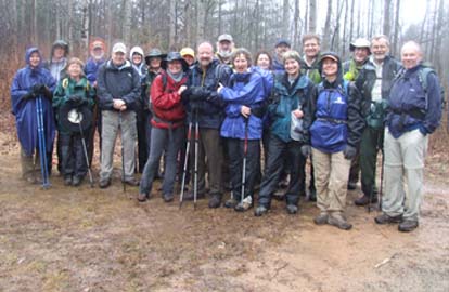
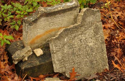
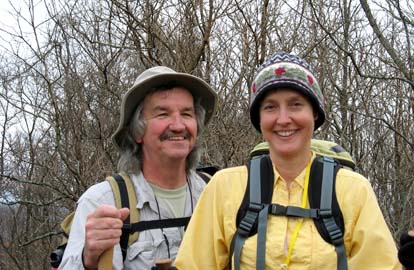
Twenty people met at Pisgah Forest Bi-Lo on an ominous looking morning for this hike, (completely astonishing the leader). At the trailhead was yet another; her name was Jude, which gave me the opportunity to say "Hey Jude" countless times for which I will be eternally grateful. The rain started on the way up Chestnut Mountain and we reached the top in fog obscuring the views. Or we reached what I thought was the top. After I told everyone that we had reached the high point of the hike, we then proceeded to climb another steep 200 feet. It rained steadily, but lightly and the temperature was in the high forties. When we reached the point where we made the side trip to the waterfall, almost everyone opted to go. We then returned to the Long Branch Trail, visited McCall Cemetery, and walked the Forest Service road back to our cars. It was a wonderful group and they warmed up a cool rainy day. Stuart.
Photo on the left by Ashok Kudva and on the right by Charlie Ferguson.
#780 SATURDAY NO. A0801-593 Feb. 23
AT: Lemon Gap – Bluff Mtn. 8:00 AM
Hike 7.6, Drive 120, 1900 ft. ascent, Rated B-AA
Don Walton, 828-654-9904, donwalton@bellsouth.net
This AT hike takes us past the historic Walnut Mtn. shelter (built in 1938 by CCC)
and recently cleared bald area, through Kale Gap and to the summit of Bluff Mtn.
We may also bushwhack to the real peak of Bluff Mtn. Second meeting place: Pilot Truck Stop off I-40 at exit 24 at 8:30 AM
Topo: Lemon Gap
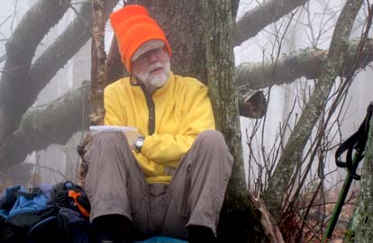
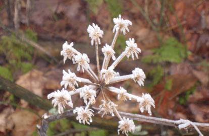
Eight hikers expected the same sunny 50+ degree hike as it was when we left Asheville.
But as we left I-40 the weather changed as we climbed to Lemon Gap.
There was either very light rain or much moisture coming off the trees all morning.
We stopped for lunch and very quickly ate and decided to return.
It must have gotten colder; I know it got foggier on the way back as we started to see ice on the trees and old flowers.
We arrived back at the cars before 2pm. According to Jim Reel’s new GPS we were moving at a fast pace.
It was sunny again as we got back on I-40 towards Asheville. Don. Photos by Don Walton.
ALL DAY NO. A0801-420 Feb. 24
AT: Allen Gap to Tanyard Gap 8:30 AM*
Hike 8.8, Drive 80, 2100 ft. ascent, Rated B-AA
Tish Desjardins, 828-656-2191, desraylet@aol.com
*Note later start time. Meet at Westgate at 8:30 AM to form carpools, and meet leader at parking lot on US 25 at intersection with NC 208 at 9:10 AM. Great views from Rich Mtn. tower, a visit to Spring Mtn. shelter and one of the prettiest sections of the AT in our area highlight this pleasant winter hike. Car shuttle. Topo: Hot Springs
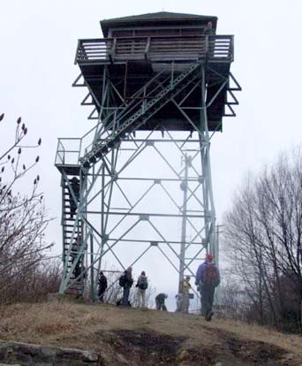
We started from Tanyard Gap rather than Allen Gap as it is a bit less of a climb.
Two blowdowns were observed about two miles from Allen Gap and Don Walton does know about them.
What started out as a lovely sunny day changed to a mixture of weather including a few snow flurries on top of Rich Mountain
and later a few minutes of icy mixture. Then light rain drops fell off and on.
The hike must be very pretty in the Spring when all of those rhododendrons and laurel are in bloom!
Lovely mountain and valley views! Tish. Photo on the left by Ashok Kudva, on the right by Danny Bernstein
Half Day Sunday
HALF-DAY NO. H0801-591 Feb. 17
Bent Creek Loop #10 1:00 PM*
Hike 5, Drive 20, 800 ft. ascent, Rated C-C
Nonmembers, call leader, Marcia Bromberg, 828-505-0471, mwbromberg@yahoo.com
P400 *Note early start time. A pleasant winter walk along lesser-hiked trails and roads in Bent Creek, including Sidehill Connector, Lower Sidehill Trail, South Ridge Road, Chestnut Cove and Explorer.
No report!
HALF-DAY NO. H0801-225 Feb. 24
Ingles Field Gap via Boyd Branch and Little Hickory Top Trails 1:00 PM*
Hike 6, Drive 20, Rated B-C
Nonmembers, call leader, Joe Burchfield, 828-398-8413, burchfield@niu.edu
P400 *Note early start time. A moderate loop hike up to Stradley Mountain following several of the trails in the Bent Creek Experimental Forest. Second meeting place: Ingles parking lot across from Biltmore Square Mall on NC 191 south of I-26 at 1:20 PM.
Despite an uncertain weather forcast, overcast sky, and occasional brisk wind,
nineteen hikers (including a couple of visitors and several new members)
gathered for the moderate climb up to Stradly Mountain from Boyd Branch.
Except for a few scattered drops as we approached Ingles Field Gap where we stopped for a snack, we were spared the predicted rain,
and although the sky remained overcast, we had good winter views as we hiked just below the ridge line
around Little Hickory Top as we began our return. On the whole a very plesant afternoon
in a part of Bent Creek that was new to many of the participants on the hike. Joe Burchfield
Wednesday
WEDNESDAY NO W0801-428 Feb. 20
Cane River Gap to Little Butt 8:30 AM
Hike 7, Drive 50, 2200 ft. ascent, Rated B-AA
Ruben Marshall, 828-299-1497, cmcrm08@yahoo.com
This hike begins with a 1200 ft. ascent to the ridgeline, then continues along the top of the ridge with a few gradual ups-and-downs. After Big Butt, we’ll follow the narrow ridgeline with good views to our lunch spot at Little Butt, which has a great view of the Black Mtns. range across the valley. Return via the same route. Topo: Mt. Mitchell; also USFS Big Ivy map
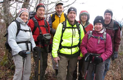 
As usual, I scouted this hike twice before the hike. Both times there were several downed branches, most of which could be kicked off, or, flicked off with two hiking poles. A few had to be lifted & muscled out of the way. I emphasized to the group that the first mile and a half was up with no significant relief - an ongoing and challenging demand with no significant let up for the mile and a half. The wind was a bit chilly this day but the demand of a serious climb for 1 1/2 miles warmed us. Along the ridge there were pleasant views, and the wide view at the turn around/lunch point was great. On the way down, the temperature dropped and the wind picked up - we kept moving with only brief stops. That last 1 1/2 miles down was nicely out of the sharp wind, but, also was demanding in its unrelieved, at times, sharp decline.
Ruben. Photo on left by Ruth Hartzler, on right by Ted Connors.
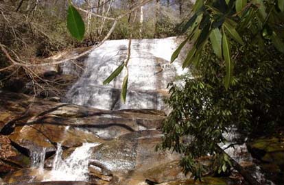
WEDNESDAY NO W0801-599 Feb. 27
Daniel Ridge-Caney Bottom – Cove Creek Falls Loop 8:30 AM*
Hike 10, Drive 80, 1000 ft. ascent, Rated A-B
Stuart English, 828-883-2447, stuengo@citcom.net
P400 *Meet at Westgate at 8:30 AM to form car pools, and meet leader at Pisgah Forest Ranger Station at 9:05 AM. We’ll start with the 4-mile Daniel Ridge Loop, ending at Toms Springs Falls, a 100 foot falls. From these falls, we’ll follow an old FS road, go down a perfectly good but unmapped trail to Caney Bottom Trail. Here we’ll loop around it to Cove Creek Trail and 60 foot Cove Creek Falls, then back to Caney Bottom Loop and eventually back to our cars on Davidson River Road (FS 475). Topo: Shining Rock; also Nat’l. Geo. PRD map #780
 Due to bad weather predictions and actual bad weather in Asheville only 4
people met for this hike. Although it was very cold, it was a beautiful day
in Pisgah Forest with blue sky and sunshine. Tom, Joan, Greg, and I hiked up
two of the most spectacular streams in the Pisgah Ranger district, visited
two of the most beautiful waterfalls in Transylvania County, and had a great
day in the woods. Our sympathies go out to those who let weather predictions
keep them away. I will lead this hike again on a Sunday in June. It will all
still be there. Stuart. Photo by Stuart English. Due to bad weather predictions and actual bad weather in Asheville only 4
people met for this hike. Although it was very cold, it was a beautiful day
in Pisgah Forest with blue sky and sunshine. Tom, Joan, Greg, and I hiked up
two of the most spectacular streams in the Pisgah Ranger district, visited
two of the most beautiful waterfalls in Transylvania County, and had a great
day in the woods. Our sympathies go out to those who let weather predictions
keep them away. I will lead this hike again on a Sunday in June. It will all
still be there. Stuart. Photo by Stuart English.
All-day hikes submitted by Bruce Bente 692-0116, bbente@bellsouth.net . Driving distance is round-trip from Asheville. All Saturday and Sunday hikes assemble at Westgate Shopping Center near I-240 UNLESS OTHERWISE NOTED.
Half Day hikes submitted by Paula Robbins 828-687-1651 paularww@bellsouth.net and Lucy Prim 828-693-6580 lucette32@mchsi.com.
Wednesday Hikes are submitted by Charlie Ferguson, 828-398-0213 ccf108@gmail.com and Ann Gleason, 828-859-9387,
gleason.ann@gmail.com .
The meeting place for each hike will be designated by the hike leader and will appear in the hike description.
Driving mileage will be listed, round trip, from the first designated meeting place.
Leaders: Mail please mail your sign-up sheets. Meet at Westgate unless otherwise noted. |
 CMC Bi-Weekly Hike News