|
Looking Ahead
All Day Saturday & Sunday
ALL DAY NO. A0802-008 May 25
Bee Tree Gap to Ox Creek Rd. *9:00 AM
Hike 7.9, Drive 38, 1500 ft. ascent, Rated B-B
Janet Martin, 812-738-8154, jaykaymartin@msn.com
*Note later start time. A moderate hike on the MST over Lane Pinnacle with excellent views, interesting rock formations and many wildflowers. There are several steep but short ups and downs and a long, well-graded descent. 8-mile car shuttle. Second meeting place: Craven Gap at 9:20 AM. Topo: Craggy Pinnacle
MEMORIAL DAY JOINT HIKE WITH
SMOKY MOUNTAINS HIKING CLUB
ALL DAY NO. A0802-606 May 26
Mt. Sterling via Big Branch or via Mt. Sterling Gap 8:00 AM
Hike 9 or 12.4, Drive 110, 2000 or 4100 ft. ascent, Rated A-A or AA-AA+
Becky Smucker, 828-298-5013, bsmucker@charter.net
900M This year, our annual joint hike with the Smoky Mountains Hiking Club offers options for a longer climb on an old manway or a shorter hike with a car shuttle.
Longer hike: We will access the Big Branch manway at the Baxter Creek trailhead, and climb this old but passable manway, paralleling Big Branch to the Mt. Sterling ridge. The ridge will be followed to rejoin the Baxter Creek Trail up to the summit for lunch and the good views from the fire tower. Our return will be via the Baxter Creek Trail.
Shorter hike: After an 8-mile car shuttle to Mt. Sterling Gap, we will hike up the Mt. Sterling Trail to the summit and join the other group. After lunch, we’ll all hike down the Baxter Creek Trail together. Second meeting place: Pilot Truck Stop at exit 24 of I-40 at 8:30 AM Topo: Waterville; also Nat’l. Geo. GSMNP map #229
ALL DAY NO. A0802-113 June 1
Cold Mountain 8:00 AM
(strenuous)
Hike 10.4, Drive 70, 3400 ft. ascent, Rated A-AA+
Michael Cornn, 828-698-3672, mcornn@aol.com
P400, SB6K Come and join us on this beautiful hike up Cold Mtn. From Camp Daniel Boone we will climb to the summit of this 6030 ft. peak and enjoy the great views along the way. Wilderness area, limited to 10, so call leader for reservation. Topos: Waynesville, Cruso; also Natl. Geo., PRD map #780
Half Day Sunday
HALF DAY NO. H0802-043 May 25
Frying Pan Tower *1:30 PM
Hike 4, Drive 50, Rated C-C
Nonmembers, call leader, Rusty Breeding, 828-692-0359, bree_lw@planetusa.net
P400 *Meet at Westgate at 1:30 PM to form carpools, and meet leader at north end of parking area of Pisgah Inn at 2:00 PM. This is an easy in-and-out hike through a spectacular display of wild flowers to good views from the tower.
HALF-DAY NO. H0802-054 June 1
John Rock via the Old Horse Cove Trail *1:30 PM
Hike 4, Drive 72, Rated C-B, 1295 ft. ascent
Nonmembers, call leader, Laura Stallard, 828-697-1579
P400 *Meet at Westgateat 1:30 PM to form carpools, and meet leader at the Fish Hatchery in Pisgah National Forest on FS 475B off US 276 at 2:05 PM. This moderate in-and-out hike begins at the Fish Hatchery at the opposite end of the parking lot from the Wildlife Visitor Center onto the Horse Cove side of Cat Gap Trail (orange blaze). The John Rock Trail starts at a right hand junction off Cat Gap Trail.
All Day Wednesday
WEDNESDAY NO. W0802-208 May 28
Big Creek-Laurel Mtn. loop *8:20 AM
Hike 7.5, Drive 44, 2400 ft. ascent, rated B-AA
Larry Ballard, 828-891-4318, leballard@cytechcis.net
P400 From the Mt. Pisgah trail parking area, follow the parkway north around the Buck Spring tunnel to Big Creek trailhead (about 1/4 mile). Follow Big Creek trail down to Big Creek. At this point, an unnamed trail leads up to Laurel Mtn. trail at Good Enough Gap (no bushwhacking on this trail). Follow the Laurel Mtn. trail back to the parking area. A possibility of a side trip to a big waterfall if the group is willing. *Meet at Westgate at 8:20 AM to form carpools and proceed on the parkway to the Mt. Pisgah parking area. Leader will be at Pisgah ranger station at 8:30 AM. Final meeting place: Mt. Pisgah trail parking area at 9:00 AM. Topo: Dunsmore Mt.; also Nat’l. Geo. PRD map #780
WEDNESDAY NO. W0802-592 June 4
ALT – Butter Gap - Long Branch Loop *8:30 AM
Hike 10.5, Drive 80, 1950 ft. ascent, Rated A-A
Stu English, 828-883-2447, stuengo@citcom.net
P400 *Meet at Westgate at 8:30 AM to form carpools, and meet leader at the side parking lot of the Pisgah Forest Bi-Lo at 9:00 AM. This new CMC hike will start at Gloucester Gap and follow the Art Loeb Trail over Rich Mtn. to Butter Gap. At the gap, we'll turn downhill onto the Butter Gap Trail, then the Long Branch Trail and Cemetery Loop past the McCall Cemetery. There will be a short side trip to a beautiful, but rarely visited waterfall. We'll finish with a short road walk back to the trailhead. Topo: Shining Rock; also Nat'l. Geo. PRD map #780
Looking Back......
All Day Saturday & Sunday
ALL DAY NO. A0802-216 May 11
AT: Sams Gap to Devil Fork Gap 9:00 AM*
Lenny Bernstein, 828-236-0192, lsberns@worldnet.att.net
Hike 8.5, Drive 90, 1400 ft. ascent, Rated B-B
*Note later start time. This section of the AT features magnificent wildflower displays and nice views into Tennessee from the ridge line, traversing a series of knobs along an unusual section of the TN-NC state line where Tennessee is east of N.C. and the southbound hiker is actually traveling north. Car shuttle. Topo: Sams Gap
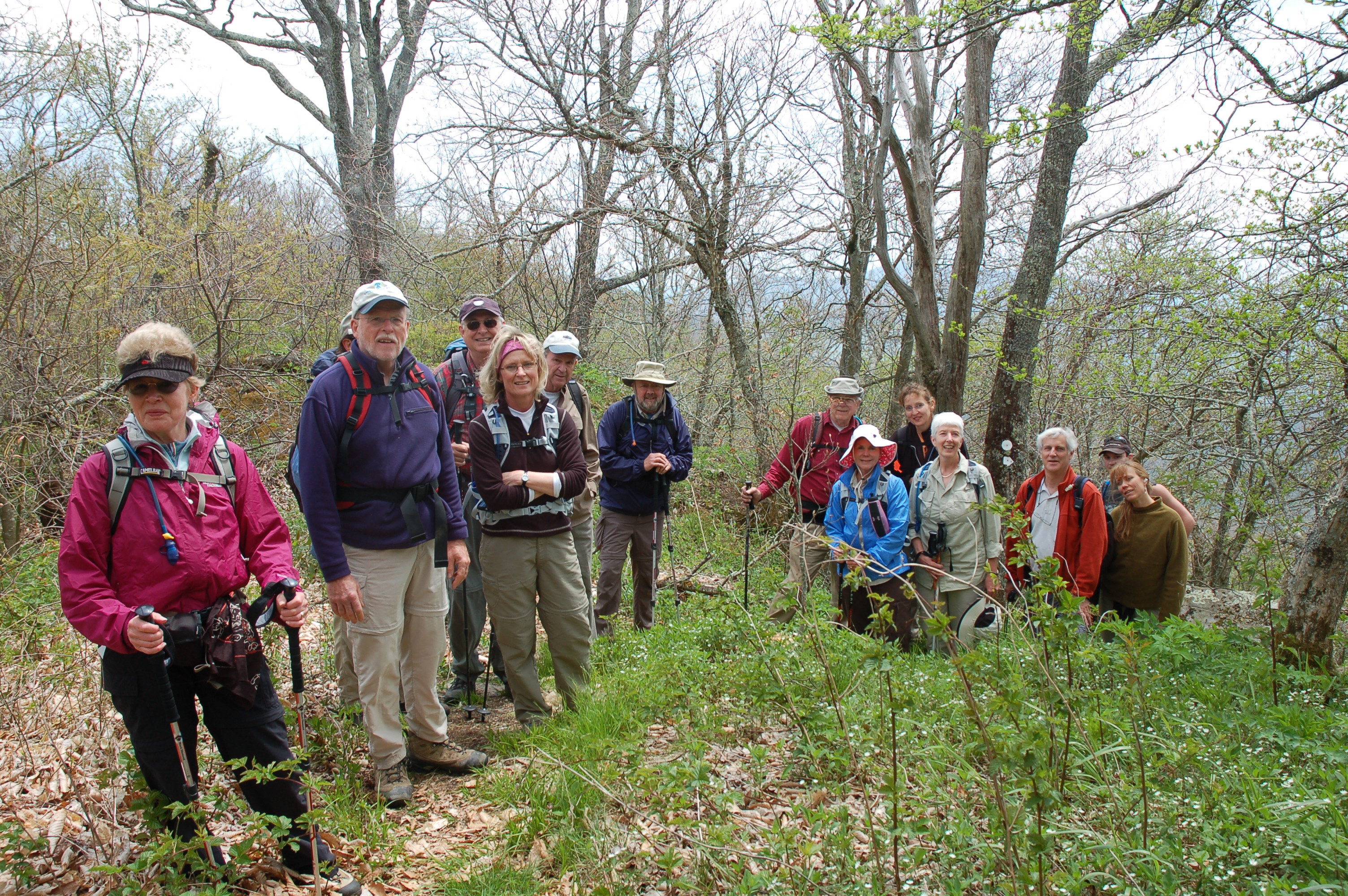
It was a dark and stormy day in Asheville, and your not so fearless leader thought seriously about canceling the hike. But five hikers showed, so he relented and led the hike. For the first hour of the hike I regretted that decision. By 11:30 it was raining steadily, so we headed for Hogback Ridge Shelter for an early lunch. I told the group that if it didn’t stopped raining by the time we finished lunch, we would head back to the cars at Sams Gap. If the rain stopped, we would continue the hike. That must have scared the rain gods, because as I took the last bite of my sandwich, the rain stopped. From then on, the weather improved steadily and by the time we reached Devils Fork Gap, it was bright sunshine.
The hike had been advertised as a way to enjoy the Spring flowers, and we were not disappointed. The group counted 44 species of wild flowers. The trillium looked like they were on steroids, and there were places where the whole trailside was a mass of purple larkspur and white Canada violets. Towards the end of the hike there is a small waterfall, which often either has no water or is reduced to a trickle. With all of the rain, it was in its full glory and very photogenic.
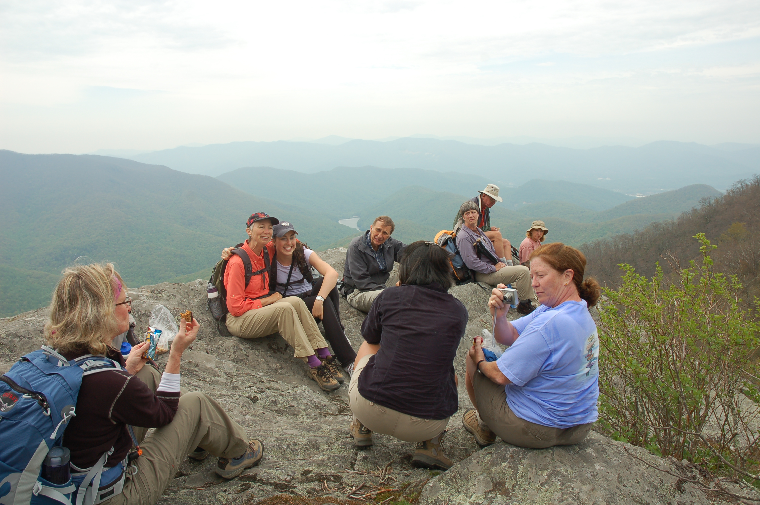
ALL DAY NO. A0802-214 May 18
Standing Indian Circuit 8:00 AM
Hike 11, Drive 170, 2800 ft. ascent, Rated A-AA
Cindy McJunkin, 828-213-9701, mcjfive@aol.com
The Standing Indian area in the Nantahala National Forest is known for its beautiful forest, rushing streams and excellent vistas. We’ll hike up the Kimsey Creek Trail to the AT, and the AT to our lunch spot, Standing Indian. At 5498 ft., it is the highest mountain on the AT south of the Great Smoky Mountains, with outstanding views. We’ll return on the Ridge Trail. Optional supper at the Jarrett House on the way home. Second meeting place: Rest Stop beyond Waynesville on US 23/74 at 8:30 AM. Topo: Rainbow Springs
Half Day Sunday
HALF-DAY NO. H0802-602 May 11
North Carolina Arboretum 1:30 PM
Hike 5, Drive 15, Rated C-C
Nonmembers, call leader, Paula Robbins, 828-281-3253, paulaww@bellsouth.net
A loop hike through the Arboretum, featuring native azaleas in bloom as well as other spring wild flowers. Second meeting place: Ingles parking lot across from Biltmore Square Mall at 1:45 PM.
I guess lots of folks saw the earlier weather forecast that included a tornado and heavy thunderstorm watch for this afternoon and decided to stay home. Nobody showed up at Westgate, and only two new inexperienced folks at Ingles, so I canceled the hike, feeling that they wouldn’t get the flavor of a regular CMC hike with just me.
HALF-DAY NO. H0802-603 May 18
Big Ivy 1:00 PM
Hike 5.5, Drive 55, 700 ft. ascent, Rated C-C
Nonmembers, call leader, Marcia Bromberg, 828-505-0471, mwbromberg@yahoo.com
This loop in the Big Ivy Creek headwaters area of the Pisgah National Forest begins 4.4 miles up FS74 at the Perkins Road Trail. We will hike up to the Laurel Gap Trail, turn right and walk to the Bear Pen Trail which will take us back down to FS74. We'll walk just under a mile to return to our cars. Expect to see late spring wildflowers along the way. Second meeting place: Ingles parking lot off I-26 in Weaverville at 1:15 PM.
We were 18 strong as we left our second meeting place in Weaverville. But as we drove towards the trail the sky darkened and the rains came. By the time we got to the trailhead it was raining pretty steadily and half the group decided to head home for a dryer afternoon.
The remining 9 hiked on, enjoying some lulls in the downpour and many beautiful wildflowers. However we cut the hike short, going up the first leg (Perkins Rd Trail) to Laurel Gap Trail and back down to the trailhead. Then we rewarded ourselves by eating a strawberry cake treat from the hike leader before heading home for hot showers and dry clothes.--MB
All Day Wednesday
WEDNESDAY NO. W0802-060 May 7
Pilot Mtn. – Farlow Gap 8:30 AM
Hike 8, Drive 80, 1900 ft. ascent, Rated B-A
Ruth Hartzler, 828-251-0886, ruthmtn@charter.net
P400 This hike is timed for what we hope will be the bloom of rare pink-shell azaleas and trout lilies. It starts with a steep climb to the summit of Pilot Mtn., then down to Deep Gap and a short climb over Sassafras Knob. It's nearly all downhill or level as we continue to Farlow Gap with its trout lily flower display. We'll return on a pleasant seldom-used graveled forest road. There will be several stops for photography along the way. Second meeting place: Pisgah Ranger Station at 9:10 AM. Topo: Shining Rock; also Nat'l. Geo. PRD map #780
 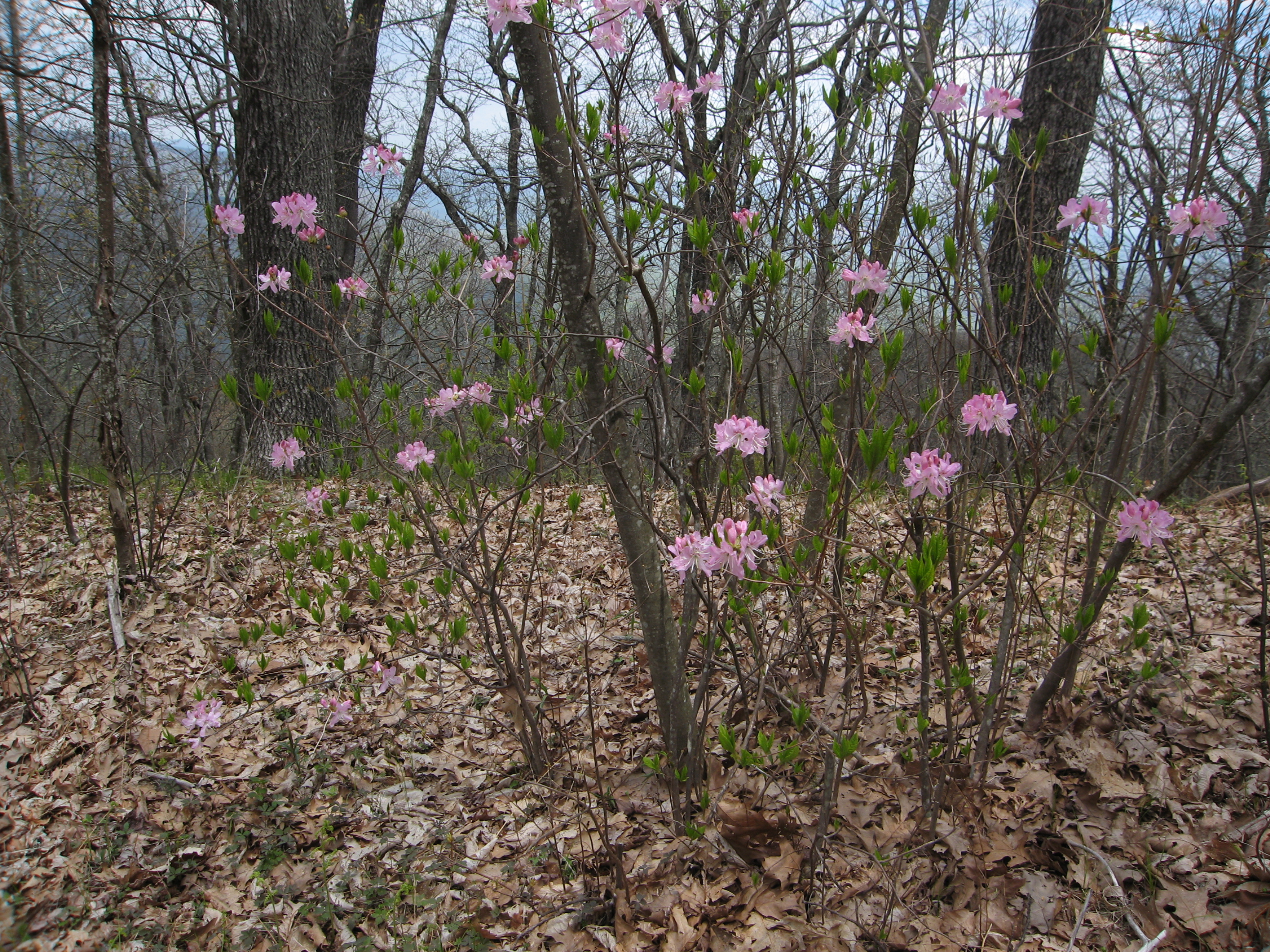
-- Photos by Ruth Hartzler
This was a rerun of the May 4th hike. However, unlike movie reruns, this
hike was even better than the original. Although fewer trout lilies were
blooming, more pink shell azaleas were blooming. Painted trilliums were
blooming. More wood anemones were blooming. And more hikers came out to
enjoy it all - 24, including a couple visiting from Florida. We split into
two groups at the trailhead. One group stopped more frequently to enjoy the
flowers and views. We all met at the top of Pilot Mountain for lunch and to
enjoy the almost 360 degree views. We met again at Farlow Gap and joined
groups for the stroll back to the cars. Mother Nature deserves an Oscar as
the star of this spectacular rerun. -- Ruth
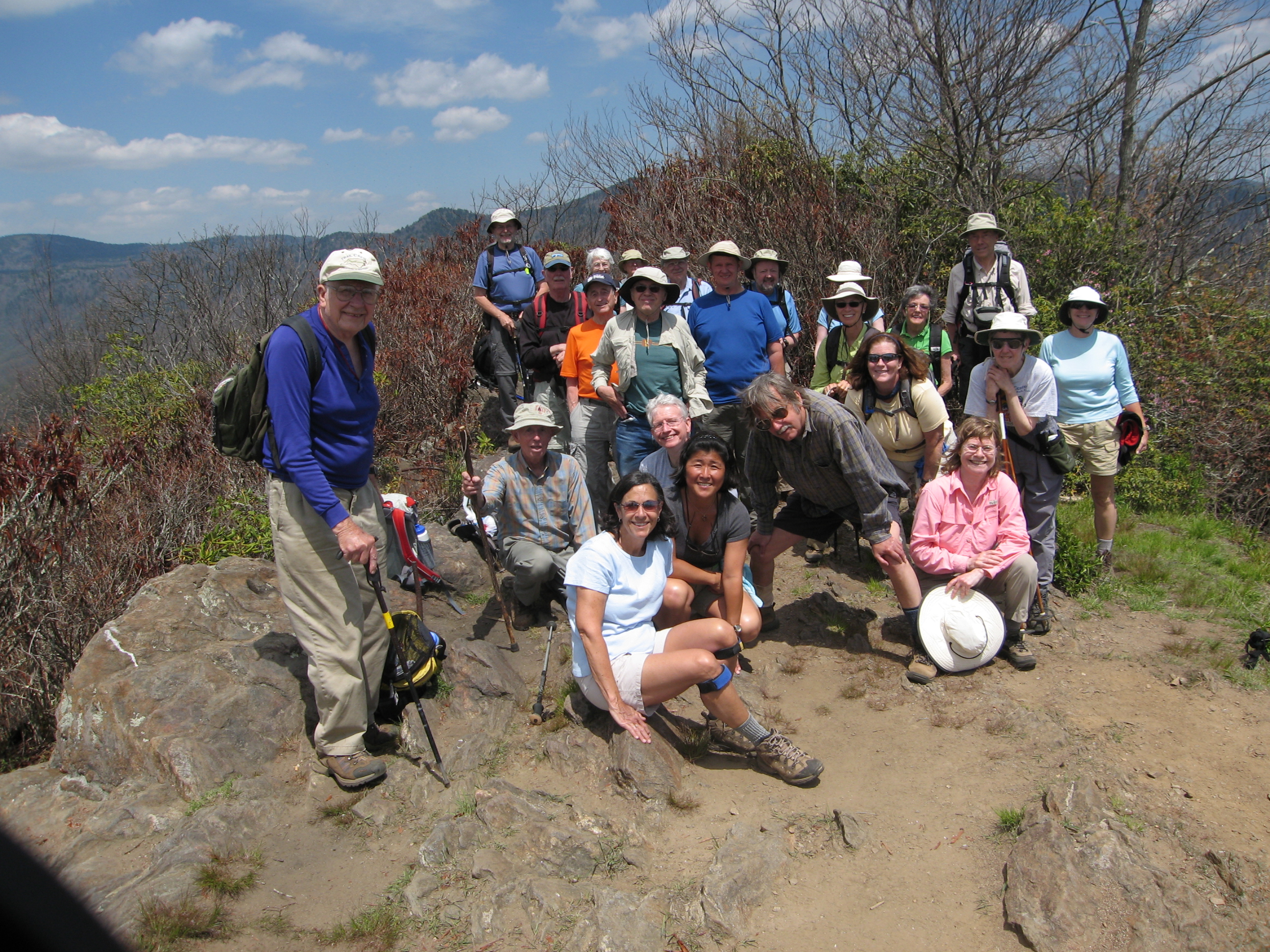
WEDNESDAY NO. W0802-008 May 14
Bee Tree Gap to Tanbark Tunnel *9:00 AM
Hike 6.2, Drive 30, 1300 ft. ascent, Rated C-B
Brenda Worley, 828-684-8656, clworley@bellsouth.net
A moderate hike over Lane Pinnacle with interesting rock formations. Highlights include beautiful wildflowers and mountain views. There are several steep but short ups and downs and a long, well-graded descent. Short car shuttle. *Only meeting place: lower parking lot of Folk Art Center on BRP.
-- Photos by Ted Conners
This was my first hike so I was very glad to have help from Ruth. Thirty people came and we divided into 2 groups of 15, she led one and I led the other. The day was cloudy and very pleasant. A light drizzle started around 1:30 but we were close to the end of the hike by then.
The wildflowers were abundant. We saw violets, several trillium such as different shades of pink and white and the purple wakerobin, louse-wort, squaw-root, pink lady's-slipper, what I believe is longspurred violet, chickweed, showy orchis, and others that I can't name.
WEDNESDAY NO. W0802-447 May 21
MST: Mt. Pisgah to Beaver Dam Overlook 9:00 AM
Hike 8.5, Drive 45, 1700 ft. ascent, Rated B-A
Joe Burchfield, 828-298-8413, Burchfield@niu.edu
P400 This moderate hike will start with a round trip up and down Mt. Pisgah, and will then follow the MST northbound to Beaver Dam Overlook. Expect good views along the route. Short car shuttle. Second meeting place: BRP French Broad overlook at 9:10 AM. Topos: Cruso, Dunsmore Mtn.; also Nat’l. Geo. PRD map #780 & MST Profiles, pg. 53-55
All-day hikes submitted by Bruce Bente 692-0116, bbente@bellsouth.net
. Driving distance is round-trip from Asheville. All Saturday and
Sunday hikes assemble at Westgate Shopping Center near I-240 UNLESS
OTHERWISE NOTED.
Half Day hikes submitted by Paula Robbins 828-687-1651 paularww@bellsouth.net and Lucy Prim 828-693-6580 lucette32@mchsi.com. Wednesday Hikes are submitted by Charlie Ferguson, 828-398-0213 ccf108@gmail.com and Ann Gleason, 828-859-9387,
gleason.ann@gmail.com .
The meeting place for each hike will be designated by the hike leader and will appear in the hike description.
Driving mileage will be listed, round trip, from the first designated meeting place.
Leaders: Mail please mail your sign-up sheets. Meet at Westgate unless otherwise noted. |
 CMC Bi-Weekly Hike News