SATURDAY No. A0601-280 Feb. 25
Art Loeb / North Slope Loop 8:00 AM Hike 8, Drive 60, 1300 ft. ascent, Rated B-B John Pawcio, 828-299-8126, jpawcio@tycovalves.com P400 A good winter hike and a pretty trip. We’ll follow the Art Loeb Trail from the Davidson River Campground up to Neil Gap, then down the connector and North Slope Trails to the campground. From here we’ll follow the river trail back to the cars. Second meeting place: Pisgah Ranger Station at 8:30 AM, but call leader first. Topos: Pisgah Forest, Shining Rock; also Nat’l. Geo. PNF map
ALL DAY No. A0601-504 Feb. 26
Lane Pinnacle from Bull Gap 8:30 AM* Hike 10, Drive 30, 2700 ft. ascent, Rated A-AA+ Kathleen Hannigan, 828-230-4883,
kathleen.hannigan@pgnmail.com *Note later start time. This will be a challenging winter hike on the MST, past the Rattlesnake Lodge site and up to good views from our lunch stop at Lane Pinnacle. Due to the substantial altitude change, we may find snow at the higher end. Second meeting place: Bull Gap at 9:30 AM Topo: Craggy Pinnacle; also pg. 63-64 of MST Profiles book
ALL DAY No. A0601-332March 5
Foothills Trail: Upper and Lower Whitewater Falls 8:00 AM* (strenuous) Hike 11.6, Drive 115, 1600 ft. ascent, Rated A-A Bruce Bente 828-692-0116 bbente@cytechusa.com Come to hike in the warm weather at the lower elevations! We’ll hike part of the Foothills Trail in NC and SC, featuring two of the region’s most stunning waterfalls. We will begin at the Upper Whitewater Falls parking lot, and hike to the footbridge over the Thompson River. We’ll partially retrace our steps, then take the side trail to Lower Whitewater Falls, and finish at the Duke Power Co. Bad Creek parking lot. Short car shuttle. *Meeting Places: Form carpools at Westgate at 8:00 AM, and meet leader at Bi-Lo in Pisgah Forest at 8:30 AM. Topos: Reid, Cashiers; also Foothills Trail map
ALL DAY No. A0601-076 March 5
Craggy to Little Snowball 8:00 AM (moderate) Hike 8.5, Drive 40, 2600 ft. ascent, Rated B-AA Don Walton, 828-654-9904 donwalton@bellsouth.net From Beetree Gap we will take the Snowball trail to High Rock, with its views, and then on to Snowball Gap. We will then follow an old road around Little Snowball Mtn. to the old lookout atop Little Snowball. There are great views from the top of Little Snowball. Topo: Craggy Pinnacle
HALF-DAY No. H0601-500 Feb. 26
Mountains-to-Sea Trail north from French Broad River 1:00 PM* Hike 5, Drive 15, Rated C-C Pat Elias, 828-687-1651, patelias@bellsouth.net *Note early start time. A pleasant winter hike through the woods, parallel to the Blue Ridge Parkway. We will have the opportunity to view some of the fine work that the CMC Trail Crews have recently completed in this area, including the 30-foot bridge constructed to accommodate the relocated trail. Short car shuttle. *Second meeting place: Ingles parking lot across from Biltmore Square Mall on NC 191 south of I-26 at 1:15 PM.
HALF-DAY No. H0601-432 March 5
Montreat loop *12:30 PM Hike 5, Drive 40, 1,000 ft. Ascent, Rated C-B Danny Bernstein, 828-236-0192, danny@hikertohiker.org *Note early start time. We will start on the Graybeard Trail, which has been partly relocated to parallel the creek. Once on the toll road, it is down, down, down with some beautiful views. We will end up on the Montreat campus and may stop at the chapel for a look at the frescoes. There is one small steep section and four stream crossings on rocks. The leader reserves the right to change the hike to suit the weather. See the March, 2006 issue of Rapid River, for more description of the area.
WEDNESDAY No. W0601-279 Feb. 22
Montreat Railroad Trestle Grade Hike to Pot Cove 9:30 AM Hike 6, drive 30, Rated B-C Gerry Mcnabb, 274-0057, gerrymcnabb@charter.net . An in-and-out hike to Pot Cove from the Lookout Trail parking area. Second meeting place: Parking lot adjacent to McDonald’s parking lot in Black Mountain at 10:00.
WEDNESDAY No. W0601-489 Mar. 1
Bad Fork - Trace Ridge Loop 8:30 AM* Hike 8, Drive 60, 1700 ft. ascent, Rated B-B Pat Elias, 828-687-1651, patelias@bellsouth.net P400 *Note later start time From Trace Ridge parking area, we will hike a short distance (10 minutes) along a gravel road to the Bad Fork Trail, which will take us to the BRP on a steep 800 ft. ascent. From the BRP, we will have a long, steady climb to Ferrin Knob, then down to Beaver Dam Overlook for lunch. After lunch, we continue down the Trace Ridge Trail. *Meet at Westgate at 8:30 AM to form carpools and meet leader at N. Mills River Recreation parking lot at 9:00 AM. Topo: Dunsmore Mtn; also Nat'l. Geo. PRD map.
WEDNESDAY No. W0601-509 Mar. 8
Dupont Forest: Sky Valley P.L. #1 8:40 AM* Hike 9+, drive 80, 1200 ft. ascent, rated A-B Rusty Breeding, 828-692-0359, bree@planetusa.net *Note later start time. This lovely hike will start at the Sky Valley parking lot in Dupont State Forest. It’s mostly easy, with a steep climb up to Stone Mountain, the highest peak in Dupont State Forest. *Meet at Westgate at 8:40 AM to form carpools, and meet the leader at 9:15 AM at the Bi-lo parking lot in Pisgah Forest. Topo: Standingstone Mtn.; also Dupont Forest Trail Map
ALL DAY No. A0601-417Feb. 12
Butter Gap, Art Loeb, Long Branch Trails Loop 8:00 AM Hike 12, Drive 72, ft. ascent, Rated A-A Becky Smucker, 828-298-5013, bsmucker@charter.net P400 Highlights of this low-altitude winter hike include the McCall Family cemetery and good views from Rich and Chestnut Mtns. and from the Art Loeb Trail. Second meeting place: Fish Hatchery at 8:40 AM, but call leader first. Topo: Shining Rock; also Nat’l. Geo. PRD map
Report on 2-12-06 hike
Long Branch, Art Loeb, Cat Gap Loop
On a cold day, seven hikers met at the Fish Hatchery for this hike. No one showed up from Asheville due to snowy conditions up north, although two hikers from Charlotte were there for the hike. The hiking group was unusual for CMC because of the absence of women.
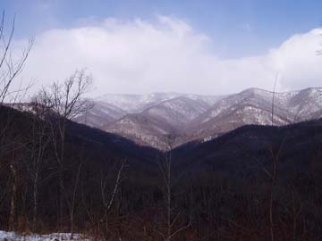
The entire hike was on snow-covered trails with temperatures in the 20s, in mostly sunny or partly-cloudy weather--a beautiful loop mostly on the Long Branch, Art Loeb and Cat Gap Loop (Horse Cove) trails. The scenery was great all along the way, especially at the lunch spot with a view of the mountains. See photo below.
We stopped to look at the 19th century graves at the McCall Cemetery, and wondered where the families lived who were buried there. There isn't any nearby land that looks flat enough to farm. An surprising sight to see in mid-February was a flock of robins feeding on berries on holly trees. Another curious sight at one spot was a single line of animal tracks in the snow. It looked like they were made by a two-legged animal but we all dismissed that theory, and decided that the animal was putting its rear legs into the same spots as its front legs. What type of animal does that?
After Gloucester Gap, the trail got more challenging as the Art Loeb Trail climbed over Rich and Chestnut Mtns, then steeply down to the Butter Gap shelter. Then on to Cat Gap and down on the previously-named Horse Cove trail. A GPS track taken during the hike claimed that the entire hike was 14 miles and 3400' of climbing, considerably more than the listing in the hike database. This will be checked versus the topo maps.
-reported by Bruce Bente, replacement hike leader (again!)
Here is the alternate report for this hike from Paul Benson
In spite of my instinct to roll over and go back to sleep on a snowy morning last Sunday, I loaded my cross-country skiing gear and headed to the high country on I-26. Travel was a little dicey but I ended up at Wolf Laurel. They keep the road up there in pretty good shape for the ski resort. Leaving the mob of downhill skiers behind I drove part way up Big Bald Road and parked at the condos on the ridge. From there the road was plowed, but the plow left behind a nice base of compacted snow - perfect for skinny skis. In a scene more reminiscent of New England than balmy NC, I skied to the top between 2-3' high banks of snow along the road. At the last gate it was true cross-county skiing to the top. Luckily a lone skier and a group of snowshoers were in front of me breaking trail. It was awesome on top!! Imagine my suprise when I took off my ski and post-holed to above my waist! Real snow! I made a snug snow cave on the lee side of a 6' drift with my trusty space blanket and watched the spectacle of whiteouts alternating with awesome views and even fast moving sunny patches coming from blue holes in the clouds. It was pretty cool being on the AT on top of Big Bald thinking about all the people afraid of pulling out of their driveways <g>.
If this sounds like your idea of fun, it occured to me that we should get
together an email contact group for people interested in x-country skiing
since it's the kind of trip impossible to schedule months in advance. I'm
sure plenty of CMC members have done it or would like to try it, and every
winter conditions are occassionaly good enough for it, particularily at the
high places on the state line like Roan Mountain. So if you're interested,
please e-mail me and I'll add you to the group. Then if anyone's planning a
trip and would like some company they can just e-mail an invitation to the
rest of us." Paul Benson pdbenson@charter.net
ALL DAY No. A0601-503 Feb. 19
Mt. Sterling via Baxter Creek Trail 8:00 AM Hike 12.4, Drive 110, 4100 ft. ascent, Rated AA-AA+ Chip Miller, 828-654-9331, backpacker54nc@bellsouth.net 900M This major climb in the Smokies is strenuous but on a gradual well-graded trail. After passing through a mixed forest followed by Balsam and Red Spruce, we’ll enjoy fine lunchtime views from the fire tower. With luck, we’ll find some snow at the higher elevations. Second meeting place: Pilot Truck Stop, exit 24 off I-40 at 8:30 AM. Topo: Cove Creek Gap; also Nat’l. Geo. GSMNP map
Five gentlemen, 2 from Asheville, 2 from Charlotte and one from Greenville SC met at Westgate to trek through the snow on the Baxter Creek Trail in the GSMNP. We began our ascent at 9:37am from the trailhead. We found the trail covered with 1" to 2" of snow at the low point. As we climbed higher the snow cover was 3" to 5" in some places. Temperature was 31 degrees most of the day. Mid way up the trail the sunshine finally broke through the clouds. By the time we reached the top the sky was clear and were able to get in those long range 360 degree views from the top of the firetower on Mt Sterling. Also very lucky in the fact there was no wind to speak of. We also found alittle ice in our water bottles when we stopped for a drink. The air was very cool and refreshing. After lunch and a long break at the tower we headed back down the trail and returned to our cars at 5:30pm. The only wildlife we saw were a few birds and a couple of red squirrels.For Charlotte's Mark Monroe this was his first visit to the Great Smokies. What an introduction!!!!
All-day hikes submitted by Bruce Bente 692-0116, bbente@cytechusa.com . Driving distance is round-trip from Asheville. All Saturday and Sunday hikes assemble at Westgate Shopping Center near I-240 UNLESS OTHERWISE NOTED.
HALF-DAY No. H0601-316 Feb. 12
Carl Sandburg Park, Big Glassy Mountain 12:30 PM* Hike 4, Drive 50, Rated C-C Becky Elston, 828-749-1886, belston@cytechusa.com *Note early start time. Hike the trail that Carl Sandburg enjoyed, up Big Glassy Mountain and see the goats or visit the house museum while you’re there. *Meet at Westgate at 12:30 PM to form carpools; meet leader at the Carl Sandburg Home parking area at 1:00 PM.
On a clear, but very cold day 4 brave souls decided to hike Sandburg and to Mt. Glassey. A nice view despite the wind chill.
Becky Elston
HALF DAY No. H0601-256 Feb. 19
Moore Cove Figure 8 1:20 PM* Hike 6, Drive 70, Rated B-B Bruce Bente, 828-692-0116, bbente@cytechusa.com P400 *Note early start time. This double-loop trail follows two old USFS paths that are not on the map. There are a couple of short steep sections and two minor creek crossings. There is a good view of Looking Glass Rock and other sights visible only in the winter. *Meet at Westgate at 1:20 PM to form carpools, and meet leader at the Pisgah Ranger Station side parking lot on US 276 at 2:00 PM.
hike report for 2-19-06
Moore Cove Figure 8 hike
It was a surprise on this gloomy cold cloudy day to have 17 hikers show up for the hike. We did a figure-8 shaped hike starting at the Moore Cove parking lot on US 276, first paralleling the highway on an old roadbed and hiking past an old quarry. Then uphill on the ridgeline to the "x" crossing point of the figure 8. Turning left here, we hiked down through a beautiful wooded cove, then turned right and went steeply uphill past an unnamed waterfall to FS 5012. Next we turned downhill on an old trail, still faintly blazed blue, past two more waterfalls, and then to Moore Cove Falls, where we were able to walk behind the waterfall and look at the icy spatter at the bottom of the falls. Then out on the "tourist trail" to waiting cars, and seven of us finished this nice day with supper at Twin Dragons in Brevard.
-reported by Bruce Bente
Half Day hikes submitted by Paula Robbins 828-687-1651 paularww@bellsouth.net. Leaders: Mail please mail your sign-up sheets. Meet at Westgate unless otherwise noted.
WEDNESDAY No. W0601-439 Feb. 8
Pounding Mill Trail 8:00 AM* Hike 8, Drive 55, Rated B-C Greg Goodman 828-684-9703 P400 This hike takes the South Mills River Trail to the Pounding Mill Trail and on to Squirrel Gap Trail. We’ll continue onto Pea Gap and then return on the South Mills River Trail. Moderate. *Meet at Westgate at 8:00 AM to form carpools, and meet leader at Boyleston Baptist Church on NC 280 at 8:30 AM.
WEDNESDAY No. W0601-399 Feb. 15
Loop around John Rock and Cedar Rock 8:00 AM* Hike 10, Drive 70, 1500 ft. ascent, Rated A-B Brad Van Diver, 828-669-2740, bravandi@cs.com P400 A lovely winter hike. Beginning at the Fish Hatchery, we first skirt the eastern side of John Rock to Cat Gap, then follow the Art Loeb Trail through Sandy Gap, and then pass the stunning white cliffs of Cedar Rock Mtn. We reach Butter Gap for lunch, then return to our starting point via Grogan Creek and Picklesimer Fields. *Meet at Westgate at 8:00 AM to form carpools. And meet leader at Pisgah Fish Hatchery at 8:40 AM. Topo: Shining Rock; also Nat’l. Geo. PRD map
24 CMC hikers had a lovely, sunny Wednesday for our hike around Cedar Rock. We left the Fish Hatchery at 9:00 and returned to our cars at 2:15. There was some ice along the trail, which created no major problems for our group. The hikers stopped to admire the cliffs at the base of Cedar Rock Mountain around 11:00 and then proceeded to the Butter Gap Shelter for lunch. We returned past lovely Grogan Creek Falls and through Picklesimer Fields. Hike led by Ken & Carol Deal because Brad Van Diver was out of town.
WEDNESDAY No. W0601-279 Feb. 22
Montreat Railroad Trestle Grade Hike to Pot Cove 9:30 AM Hike 6, drive 30, Rated B-C Gerry Mcnabb, 274-0057, gcmcnabb@charter.net An in-and-out hike to Pot Cove from the Lookout Trail parking area. Second meeting place: Parking lot adjacent to McDonald’s parking lot in Black Mountain at 10:00.
Wednesday Hikes are submitted by Paula McNabb, 828- 274-0057 gcmcnabb@charter.net and Ann Gleason, 828-859-9387, cowbonetail@yahoo.com . The meeting place for each hike will be designated by the hike leader and will appear in the hike description. Driving mileage will be listed, round trip, from the first designated meeting place.