All Day Saturday & Sunday
SUNDAY NO. A1101-684 March 20
Mackey Mtn. and Sugar Cove Creek Trail *8:00 AM
Hike 12, Drive 70, 3000 ft. ascent, Rated A-AA+
Jim Reel, 828-738-0751, jimr57@yahoo.com and Lisa Hart
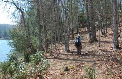
*Form carpools at Westgate, and meet leader at US 70/Curtis Creek Rd. intersection at 8:45 AM. A stop will be made at the Ingles parking lot at Exit 64 of I-40 for additional hikers. Mackey Mountain was part of the first purchase of national forest land under the Weeks Act of 1911 and is designated “Mountain Treasure” by the Wilderness Society. We will hike from the end of Sugar Cove Road up to the Mackey Mountain Trail. We’ll have great winter views and do a short bushwhack to the summit and then near bushwhack on a seldom used section of trail. This hike ends on private property with access permission for only this CMC hike. Topos: Marion West, Old Fort
SATURDAY NO. A1101-270 March 26
Cedar Rock Mtn.- John Rock Loop 9:00 AM
Hike 8, Drive 80, 2000 ft. ascent, Rated B-A
Les & Catherine Love, 828-658-1489, lesrlove@charter.net
P400, WC100 This trip features two of the spectacular bare rock faces in the Pisgah National Forest, with great views from both. Starting at the Fish Hatchery, we’ll have our major climb up to Cat Gap and then on to Cedar Rock for lunch enjoying the view. We’ll return via John Rock. Second meeting place: Pisgah Fish Hatchery at 9:40 AM. Topo: Shining Rock.
Our hike to Cedar Rock was cancelled due to rain and forecasted thunder storms. (One lady did show up at West Gate in hopes of acclimating for her upcoming, probably damp, trip to Ireland. Since she was the only one, we decided it wasn't worth the effort).--Les Love
SUNDAY NO. A1101-420 March 27
AT: Allen Gap to Tanyard Gap *8:00 AM
Hike 8.8, Drive 80, 2100 ft. ascent, Rated B-AA
Tish Desjardins, cell: 828-380-1452, desraylet@aol.com
*Form carpools at Westgate, and meet leader at parking lot on US 25 at intersection with NC 208 at 8:45 AM. After the hike there will be a soak at the Hot Springs Spa, and then a potluck supper in the nearby Bear River Community Lodge. Hikers are requested to contribute food for the supper. Food will be taken to a refrigerator before the hike. Please phone the leader to coordinate what food to bring. Great views from Rich Mtn. tower, a visit to Spring Mtn. shelter and one of the prettiest sections of the AT in our area highlight this pleasant spring hike. Car shuttle. Topo: Hot Springs
It was very iffy as to whether I was going to do the hike with all the forecasts of rain. But, surprisingly, no rain up here in this section of Madison County on Sunday -- just lots of mist in the mountains which still left you damp if you did not wear your goretex (I wore it). So, the hike began at 9:30 at Allen Gap. There were only five of us. Again, we ate lunch at the Spring Mountain shelter. Off and on all day the trail was busy with thru-hikers (fifteen to twenty of them). They were from LA, GA, IL, IN, MA, FL, and elsewhere as I did not talk in depth to every one of them. We ended the hike at 3:00 and went to get the car at Allen Gap afterward. Then, we headed to Hot Springs to the hot tub with our hor d'oeuvres and wine. The tub felt soooo good and the marinated shrimp was delicious!!! Then, we enjoyed dinner at the Iron Horse Station.--Tish Desjardins
SUNDAY NO. A1102-719 Apr. 3
Mackey Creek / Buckeye Knob 8:00 AM
Hike 9, Drive 75, 2000 ft. ascent, Rated A-AA
Jim Reel, 828-738-0751, jimr57@yahoo.com and Lisa Hart, 828-450-6986, tiw.south@gmail.com
The Mackey Mtn. / Buckeye Knob Area was part of the first purchase of national forest land under the Weeks Act of 1911 and is designated “Mountain Treasure” by the Wilderness Society. Hike from Curtis Creek Road and descend steeply to Mackey Creek on a rough non-maintained trail. Hiking poles are recommended. Water shoes are also recommended for the several creek crossings. From the creek we ascend steeply on the Connector Trail to Lead Mine Gap. At Lead Mine Gap we take the Buckeye Knob Trail. Several ups and downs along the trail across Buckeye Knob as we follow the ridge line back to the trailhead. Optional dinner at Fatz in Marion after the hike Second meeting place: Ingles parking lot off Exit 64 of I-40 at 8:20 AM. Topo: Old Fort
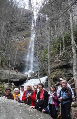
SUNDAY NO. A1101-631 Apr. 10
Dupont Forest Buck Forest P.L. #2 (3 Falls & 2 Lakes) *8:30 AM
Hike 9, Drive 80, 1500 ft. ascent, Rated B-B
Ashok Kudva, 828-698-7119 cell:828-674-1374, ashok.kudva@att.net
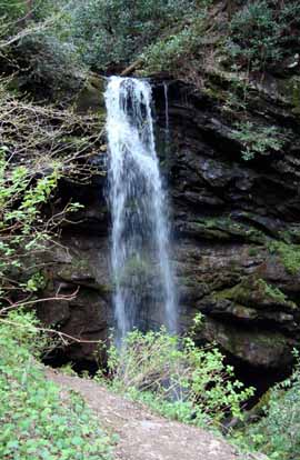
WC100 *Form carpools at Westgate, and meet leader at Pisgah Forest Bi-Lo at 9:05 AM. This hike goes to three of the best waterfalls and two lakes in the Dupont State Forest. We will be going to Triple and High Falls and then to Lake Dense. We will use Conservation Road to get to the south part of the Little River, then cross the dam to Lake Julia. After lunch at Lake Julia we hike to the old airstrip, horse barn and then the beautiful cascade of water over Bridal Veil Falls. Car shuttle. Second meeting place: Bi-Lo at Pisgah Forest at 9:05 AM. Topo: Standingstone Mtn.; also DuPont State Forest Map
Photos by Ted Connors
Ted Connors and I were the only two hikers on a gorgeous spring day.
We visited High Falls, Lake Denise, the dam next to Lake Julia and a well traveled no-name trail next to the lake.The path ended at remnants of old Camp Summit (1960s-1980s) which was bought by Dupont in the late 1980's. Lunch was at Bridal Veil Falls. There were more bikers and horses than walkers on the trails. Airstrip trail, funded by the International Mountain Bikers Association, was very smooth and led to the senic view at the old airstrip which supported Camp Summit. Our GPS track measured the hike as 10.4 miles with 1,000 feet of ascent/descent.--Ashok Kudva
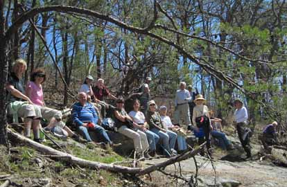
WEEKEND NO. A1102-i Apr. 15-17
Cades Cove Weekend
Janet Martin, 502-494-9309, jaykaymartin@msn.com
Bid goodbye to ole man winter and welcome spring with a CMC weekend at a group campground in Cades Cove. Tent sites are reserved from 1:00 PM Friday to noon on Sunday. Campers need to bring their own food, beverages, tents and personal gear. Flush toilets and cold water are available but not showers. Contact the leader to register and for info about meeting location and time. Topos: Cades Cove, Thunderhead Mtn., Wear Cove; also NatGeo map #316
SATURDAY NO. A1102-720 Apr. 16
Scott Mtn.
Hike 11, 2300 ft. ascent, Rated A-AA
Janet Martin
This hike starts with a level warm-up along Rich Mtn. Loop followed by a steep climb up Crooked Arm Ridge mostly along a creek, then along a gentle grade down Scott Mtn. Trail, and a rolling walk along Schoolhouse Gap to access Turkeypen Ridge Trail down to Laurel Road. Car shuttle.
SATURDAY NO. A1102-721 Apr. 16
Anthony Creek – Russell Fields loop
Hike 13.2, 3100 ft. ascent, Rated AA-AA
Bob Hysko
This hike goes up Anthony Creek and Russell Field Trails to the AT, north on the AT, and then down Bote Mtn and Anthony Creek Trails to the trailhead.
SUNDAY NO. A1102-722 Apr. 17
Chestnut Top – Schoolhouse Gap
Hike 6.4, 1300 ft. ascent, Rated B-B
Janet Martin
This hike will climb steadily along Chestnut Top Trail and then take Schoolhouse Gap Trail to Laurel Road. Car shuttle.
Photos by Janet Martin
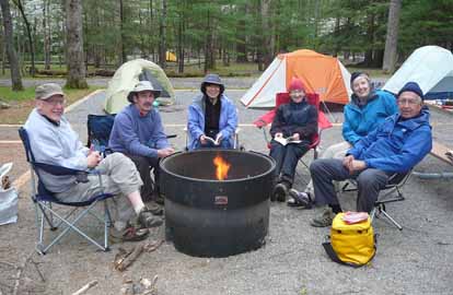
Thirteen was a lucky number for the hikers and campers participating in the Cades Cove weekend. On Friday, the early arrivals ventured into the uncharted Whiteoak Sink and were rewarded with a broad carpet of wildflowers dominated by fragrant wild blue phlox, exterior views of bat caves, and a lovely waterfall disappearing into a sinkhole. On Saturday half the group hiked trails north of Laurel River Road and the others trekked south of the road. On Sunday, each hiker had to decide between views from a challenging hike along the A.T. between Newfound Gap and Clingmans Dome with several blowdowns or a leisurely stroll up a cliffside littered with wildflowers followed by higher elevation walk with the first flame azaelas of the season in bloom. No rain fell during any of the hikes and mealtimes were free of rain. Temperatures were pleasant for both hiking and camping. Sawako compiled a list of more than 50 wildflowers on one hike!
Barbara and Don cohosted a cooking show for their respective omelets with fresh spinach and hamburgers. John S made a run into Townsend for refreshments to accompany his sausage and cheese spread. A special thanks to Bruce for bringing kindling and logs for bonfires. The other John S provided hotdogs filled with cheese to grill over the fire, and Kathy and Mike provided marshmallows for all to toast. Kevin regaled us with stories about hiking and canoeing. Linda and Martha gleefully reported that the showers in Townsend were wonderful. When a strong wind lifted a tent off the ground early Friday afternoon, Bob tackled it quickly, but for a split second it looked as though he was about to become a human kite.
The newly renovated campground has level, well-drained campsites and walkways with new picnic tables on gravel pads. So, no puddles during or after Friday night's steady sleep-inducing rain followed by a full moon on Saturday night.--Janet Martin
SUNDAY NO. A1102-215 Apr. 24
Mt. Cammerer via Low Gap and Lower Cammerer Trails *7:30 AM
Hike 15.5, Drive 140, 2600 ft. ascent, Rated AA-AA
Jeff McGurk, cell: 864-921-6469, jbsbestfan@hotmail.com
900M, LTC *Note earlier starting time. This is a beautiful but tough hike from Cosby campground, first climbing to the AT, then following the AT to Mt. Cammerer. After our lunch stop on the summit, we will return down the Lower Mt. Cammerer Trail to our starting point. This long hike will end late and we’ll probably stop for supper on the way back. Second meeting place: Pilot Truck Stop at Exit 24 off I-40, at 8:00 AM. Topos: Luftee Knob and Hartford; also NatGeo map #317
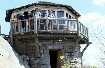
Photo by Jeff McGurk
Six of us enjoyed a long, long hike on Easter Sunday. We started the uphill journey around 9:00 a.m. and soon reached a beautiful forest floor at Low Gap where we joined up with the Appalachian Trail. The work was not done yet as we continued mostly uphill for almost 3 more miles before we finally reached our lunch destination at the Mt. Cammerer fire tower. (picture enclosed). After a leisurely lunch, we rejoined the A.T. and then the Lower Mt. Cammerer Trail for a mostly down hill, 9 mile hike. The weather was great except for one hot spell near the end. We enjoyed some beautiful flowers during the day, and I am going on record as saying that this is the easiest 15.5 mile, 3,000 foot elevation gain hike there is, and worth every step. Sorry my scout report with the baby bear picture did not get published but we did not see any of our furry friends on the real hike.--Jeff McGurk
SATURDAY NO. A1102-723 Apr. 30
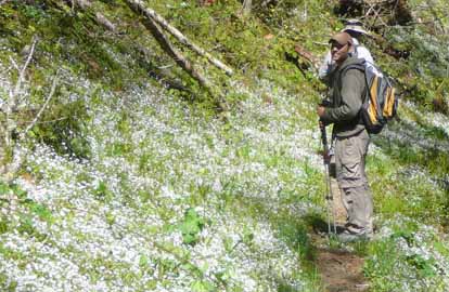
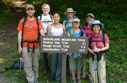
Sugarland Mountain Trail 7:30 AM
Hike 11.9, Drive 200, 800 ft. ascent, Rated A-C
Mike Knies, 828-628-6712, knies06@att.net
900M This spectacular hike will feature a dramatic seasonal change and abundant wildflowers as we descend from 5900 ft. to 2300 ft. Great views of Mt. LeConte and Chimney Tops. Hikers must register with leader beforehand so that car shuttle arrangements can be made. Long car shuttle (or key swap if anyone volunteers to climb 3500 ft.) Topos: Clingmans Dome, Mt. LeConte, Gatlinburg; also NatGeo maps #317 and 316
Photos by Sawako Jager
We had a great group of 8 including a member of the Margaret Stevenson Club of Knoxville, all who all braved the long drive and shuttle. The weather was great with not a cloud in the sky, 53 at the start and about 70 at the end. We think we set a record with 65 wild flowers counted and also in that Jenny, a new member, drove 7 hours that morning to the meeting place which must be a same day record. The trail is mostly downhill, very soft, frequently follows a ridgeline with views in both directions and a lot of variety in landscapes and ecosystems. What more could you ask for? A truly wonderful experience shared by all.--Mike Knies
SUNDAY NO. A1102-724 May 1
Blackrock Mtn. and Yellowface via Rocky Face *8:40 AM
(Bernard Elias Favorite Hike Series #9) (strenuous)
Hike 7, Drive 105, 2650 ft. ascent, Rated B-AA
Ted Snyder, 864-638-3686, tedsnyderjr@bellsouth.net
SB6K *Form carpools at Westgate, and meet leader at rest area beyond Waynesville on US 23/74 at 9:15 a.m. Short distance but a steep climb up the face of the Plott Balsam escarpment., on a new location for Bernard’s original route. If access road is muddy, add one mile and 760 feet of ascent. Then we curl around the bowl of a high watershed, in open woods. Short off-trail segment. Glorious 360 degree views from exposed rock summit (5810 ft.). Exit on knife-edge ridge with abrupt ups and downs, topping Yellow Face (6032 ft). Short car shuttle. Topo: Sylva North; also NatGeo map #785
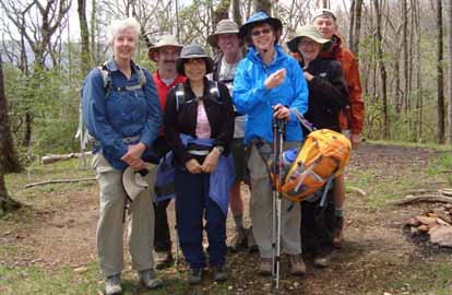
Thirteen of us had a very rewarding hike. It was a slow one, due to the altitude gain. Seven hours were used, with little stopping. The highlight was the rock outcropping known as Blackrock. Many peaks in the layered ridges around us were identified. Many of the members also ventured to the alternate peak nearby. While this required some assistance in surmounting one high rock, the flat surface of this peak and even better views were exhilarating. The weather was overcast, cool, strong wind on the summit and Plott Balsam Ridge. The trip out the ridge to our shuttle car was a series of abrupt ups and downs. Yellowface (6030) is a big briar patch, and no views were forthcoming there.
Several Plott Hounds were seen. The leader handed out a picture of the champion Plott, Blackrock Waylon, noting the curious coincidence of his name and our objective.
The spring pring ephemerals were blooming profusely. Among others, we saw Vasey's Trillium; Great White Trillium; Wake Robin (red and white varieties); Painted Trillium; Trout Lily; Perfoliate Bellwort; Dutchman's Pipe; Sweet Shrub; Pinkshell Azalea; Clinton's Lily; Showy Orchis; Spring Beauty; Mayapple; Toothwort; Foamflower; Wild Geranium; Lousewort; Squaw Root; Bluets; Virbunum; many varieties of violet.--Ted Snyder
SUNDAY NO. A1102-725 May 1
Birding at Tesentee Farm *7:00 AM
(easy)
Hike 2+, Drive 150, minimal ascent, Rated C-C
Becky Smucker, cell: 828-231-2198, bjsmucker@gmail.com and Brent Martin, 828-587-9453, brent_martin@tws.org
*Note early start time. This mild meander will take birders along Tesentee Creek and the Little Tennessee River for outstanding birding. It occurs on the Land Trust for the Little Tennessee’s 64-acre farm about ten miles west of Franklin, and will finish by noon. One of the best birding spots in western North Carolina. Possible afternoon hike on nearby Bartram Trail. Second meeting place: Franklin Bi-Lo at 8:30 AM. Topo: Franklin
Six CMC’ers showed up early to hike the birding trail at Tessentee Farm in Macon County, NC. Walking along Tessentee creek and the LittleTennessee River, we saw a wide variety of neotropical migrants such as Yellow Billed Cuckoo, Yellow Breasted Chat, Indigo Bunting and a wide variety of Warblers; along with swallows, geese, crows, red winged blackbirds, and more. It was a successful day of birding and everyone felt like they had seen as diverse an array of birds as can be seen in one place in southern Appalachia.--Bret Martin
--Back to Top
Half Day Sunday
HALF-DAY NO. H1101-675 *March 20
Rainbow Falls - Jones Gap S.P. 12:30 PM
Hike 4.6, Drive 90, 1200 ft. ascent, Rated C-B
Nonmembers, call leader: Sawako Jager, 828-687-2547 (cell: 828-674-4067), baiko70@aol.com
WC100 *Form carpools at Westgate, and meet leader at Cracker Barrel at Exit 53 of I-26 at 1:00 PM. We will follow the Jones Gap trail along the Middle Saluda River, then follow the Rainbow Falls Trail uphill to beautiful Rainbow Falls. Return the same way. This is one of the most spectacular falls in the area. $2 fee per person.
Photos by Sawako Jager
Eleven eager hikers turned out on a chilly and overcast day with a mid-afternoon temperature of 62 degrees. Although the leader agonized over the notorious shortage of parking space at the Jones Gap State Park, fortunately we could park easily.
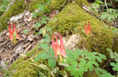
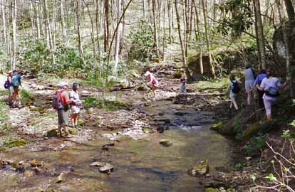
The hike began at 1:45 by walking along the scenic Middle Saluda River on the very rough and rocky Jones Gap Trail. Then we took Rainbow Falls Trail and our long and serious 1,200 ft climb was rewarded when the beautiful 100 ft Rainbow Falls came into view at 3:00. We admired the waterfalls and some early spring wildflowers such as Bloodroot, Sweet Betsy (Purple Toadshade), White Trillium, Crested Dwarf Iris, Chickweed,and Serviceberry.
We spent for 20 min. of snack/lunch time then cruised down the hill and finished the hike at 4:50. We enjoyed each other's company and it was a great way to spend a Sunday afternoon! Many thanks to Marianne Stephens for being a greeter at the Westgate and then a sweep for us.--Sawako Jager
HALF-DAY NO. H1101-101 March 27
Lower Big Laurel River to Runion 1:00 PM
Hike 6, Drive 60, 300 ft. ascent, Rated C-C
Nonmembers, call leader: Jorge Munoz, 828-658-0606, jorgemunoz1927@hotmail.com
This in-and-out hike near Hot Springs follows a beautiful rushing stream to the historic logging camp at Runion. Second meeting place: Trailhead at intersection of US 25/70 at NC 208 at 1:45 PM. Topo: Hot Springs; also USFS Hot Springs Map
Four hikers ignored the forecast and had a good time. The trail was just wet but in very good condition. Some good soul had taken care of a 13" Oak and before that the big Monster Oak at Runion . With all that maintenance the trail was clear though quite rocky on a few stretches. Little flowers were showing off and I enjoyed the expertise of my three fellow hikers. Very few hikers were out, due to the iffy weather forecast but on our way back we enjoyed and admired the expertise and courage of four middle age kayakers who challenged the river at a very fast, rocky and dangerous spot. We applauded them and cheered to express our admiration. Quite a show. On our way back we got off the trail and gave a thorough study to the two railroad cars that somebody dared to set down on tracks, advancing all kinds of theories on how they got these cars to a most unbelievable place. Got off the trail at 5.00 P.M. with the sense of good company, experts on flowers and good hikers.-- Jorge Munoz
HALF-DAY NO. H1102-346 Apr. 3
Folk Art Center to Haw Creek overlook *12:30 PM
Hike 5, Drive 0, 500 ft. ascent, Rated C-C
Nonmembers, call leader: Lucy Prim, 32lucette@gmail.com
*Only meeting place: back parking lot of Folk Art Center. A pleasant walk in the woods and a nice overlook at the turn-around point. Topo: Oteen
Photos by Lucy Prim
It was such a splendid day for our hike to Haw Creek Overlook. Sixteen of us started out up the trail, and in a little while we came upon a fancy looking hunting dog. He was all by himself, no owner in sight. He kept on walking along with us, sometimes going up ahead a little, and then coming back to walk with us again. He smelled the ground a lot, and trotted along looking like he knew what he was doing. But where was his master? At the overlook we tried to call the phone number on his tag, but the person who answered the phone said the dog didn't belong to them. We walked on back to the Folk Art Center and the dog walked along with us the entire way. When we got back to the cars, Gale O'Neal put the dog in her car and drove him to the address on his collar, so he got home safe and sound thanks to Gale. Three cheers for Gale! At the overlook Jorge told us an interesting story of when he'd been right there years ago and seen many, many fringe trees blooming! But since that one time he's not seen them, probably since the blossoms were spoiled by frost.--Lucy Prim
HALF-DAY NO. H1102-384 Apr. 10
FS 816 to Skinny Dip *12:30 PM
Hike 5.3, Drive 70, 500 ft. ascent, Rated C-C
Nonmembers, call leader: Tom Joyce, 828-885-2152 (Note: description is expanded from Let's Go version)
P400 *Form carpools at Westgate, and meet leader at Cold Mtn. Overlook at 1:10 PM. This will be a pleasant, mainly downhill ramble along the MST from Black Balsam Rd.(FS 816). The trail follows an old RR grade, slabs over a shoulder of Black Balsam Mtn. and proceeds rather steeply down to Dark Prong Gap. It continues behind Graveyard Ridge, descends to the Pigeon River which it crosses at Skinny Dip Falls. From there it's a short walk to Looking Glass Overlook at MP 417 on the BRP. Car shuttle. Topo: Shining Rock; also NatGeo map #780 and MST Profiles, pg. 36-37
HALF-DAY NO. H1102-434 Apr. 17
Laurel Mountain Trail *12:30 PM
Hike 5.4, Drive 70, 950 ft. ascent, Rated C-C
Nonmembers, call leader: Greg Goodman, 828-684 9703, greggoodman@bellsouth.net
P400 *Form carpools at Westgate and meet leader at N. Mills River Rec. area parking lot at 1:00 PM. This loop hike will start at FS 1206, go along a ridge trail toward Black Mountain, and return via the Laurel Mountain Trail. There should be good views of the Mills River Valley. Topo: Dunsmore Mtn.; also NatGeo map #780
Great hike, great views, 20 hikers, but the trail was very bad at the rock crossing.--Greg Goodman
HALF-DAY NO. H1102-603 Apr. 24
Big Ivy - Perkins, Laurel Gap & Bear Pen 12:30 PM
Hike 5.5, Drive 55, 700 ft. ascent, Rated C-C
Nonmembers, call leader: Marcia Bromberg, 828-505-0471, mwbromberg@yahoo.com
This loop in the Big Ivy Creek headwaters area of the Pisgah National Forest begins 4.4 miles up FS 74 at the Perkins Road Trail. We will hike up to the Laurel Gap Trail, turn right and walk to the Bear Pen Trail which will take us back down to FS 74. We’ll walk just under a mile to return to our cars. Expect to see spring wildflowers along the way. Second meeting place: Rose’s parking lot off Exit 19 of I-26 at 12:45 PM. Topos: Mt. Mitchell, Montreat
Photos by Ashok Kudva
Beautiful weather, abundant wildflowers, flowing streams and great hikers! The hike was as close to perfect as one could be. Although the water was down from my Monday scout, the cascades were lovely and made for a couple of challenging crossings. Thanks to the 17 hikers who joined me with good spirits and high energy--especially to those who squeezed into back seats so that we could get 18 people into 4 cars!--Marcia Bromberg
HALF-DAY NO. H1102-049 May 1
Big Creek in the Smokies 12:00 PM
Hike 6, Drive 110, 500 ft ft. ascent, Rated B-B
Nonmembers, call leader: Renate Rikkers, 828-298-9988, rerikkers@aol.com
900M, WC100 Big Creek, a spectacular mountain stream in the Smokies, offers hikers and walkers an opportunity to slow down and appreciate the wild beauty of this part of the park. The comfortable roadbed meanders along rushing rapids, a waterfall, huge boulders, and deep swimming holes. A beautiful forest and wildflower environment makes for a special experience. An easy in-and-out hike. Bring your camera! Second meeting place: Pilot Truck Stop, off I-40 at Exit 24 at 12:30 PM. Topos: Luftee Knob, Cove Creek Gap; also NatGeo map #317
Ten hikers enjoyed the 3-hour, 6-mile hike along beautiful Big Creek in the Smokies. The group enjoyed a slower-than-usual pace to identify and photograph wildflowers along the way and to cheer on a group of teenagers ready to plunge into Midnight Hole for the first swim of the year. Temperatures in the low 70s, partly cloudy, Big Creek lively and beautiful after recent rains, good company .... a perfect afternoon!--Renate Rikkers
--Back to Top
All Day Wednesday
New Wednesday Hikes--The MST Series
Barth Brooker, the president of the CMC, will is leading a series of relaxed pace, medium length hikes of the MST on Wednesdays. The series covers most of the MST which the CMC is responsible for maintaining - from Mount Mitchell to Balsam Gap near Waynesville. It is expected that it will take a number of months to complete the series. There will be a pause in the winter while the Blue Ridge Parkway is closed. The meeting place for each hike will be at the Folk Art Center - milepost 382 on the Parkway at 10:00 AM. Meeting at the trailhead for each hike may be possible. The distance covered will be of easy to medium difficulty. The pace will be relaxed so the hikes will end anywhere from 2:00 - 3:30. Most hikes will involve a short car shuttle. These hikes are not be announced in the Let's Go newsletter so check the Wednesday hike schedule on the Web site for updates. Great for those who want a short relaxed hike or would like to see what hiking is like. Hikes will be added on each Wednesday as they are developed and experience with the first ones are evaluated.
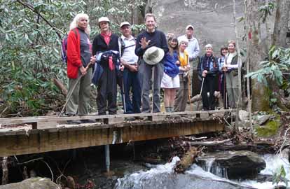
WEDNESDAY NO. W1101-515 March 16
AT - Brown Gap to I-40 8:00 AM
Hike 10.6, Drive 100, 2000 ft. ascent, Rated A-A
Bob Hysko, 828-243-3630, rhysko@yahoo.com
Starting at Brown Gap on the AT, we'll go over Deep gap, Turkey Gap, Wildcat Top, a great view from Snowbird Mtn. and a long descent into the Pigeon River Gorge. Car shuttle. Second meeting place: Pilot Truck Stop at Exit 24 of I-40 at 8:30 AM. Topos: Lemon Gap, Waterville.
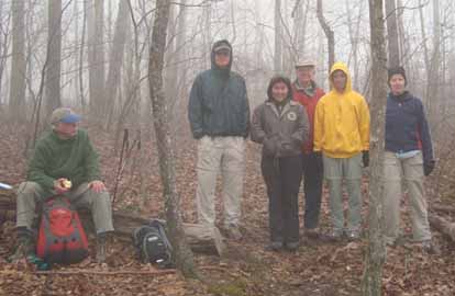
Photo by Janet Martin
A misty, foggy morning greeted nine hikers at the Brown's Gap trailhead. The fog provided a protective cocoon for the entire hike.
Although the enveloping fog precluded any distant views, several hikers expressed delight with the stillness. As we approached the fire tower, some hikers commented that it looked like a flying saucer thru the fog. As the temperature was freezing at the tower, we dropped off the top for lunch out of the wind. After only fifteen minutes, the hike leader was surprised that all but three hikers had stood up and donned their packs already. As the three squatters each had a thermos of hot tea, the hiker leader got the hint.
Others enjoying the A.T. included sixteen thru hikers, two day hikers, and six dogs. Wildflower sightings included cinquefoil blooms within a carpet of white, unidentified blooms and a jack-in-the pulpit. About a mile from I-40, several patches of crown vetch were blooming. (As this is invasive, are hikers allowed to jerk it out of the ground within the forest? Otherwise, in ten years, the crown vetch may cover all the ground and choke out the native species.)--Janet Martin
WEDNESDAY NO. W1101-420 March 23
Allen Gap to Tanyard Gap *8:30 AM
Hike 8.8, Drive 80, 2700 ft. ascent, Rated B-AA
Tish Desjardins, 828-380-1452, desraylet@aol.com
*No limit to number of hikers, but call leader first. Form carpools at Westgate, and meet leader at parking lot on US 25 at intersection with NC 208 at 9:10 AM. Great views from Rich Mtn. tower, a visit to Spring Mtn. shelter and one of the prettiest sections of the AT in our area highlight this pleasant hike. Car shuttle. Topo: Hot Springs
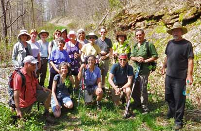
We started the hike at 10:00 from Allen Gap, southbound on the AT. We had lunch at the Spring Mountain shelter where there was a thru-hiker also having lunch. He was from Whitinsville, MA to my surprise. That town is about a half hour from where I lived most of my life. After lunch we continued on and up to the Rich Mountain fire tower. The views were nice and clear on that sunny spring day. We continued on toward Tanyard Gap and observed a few wildflowers now and then -- one type being Trailing Arbutus. We ended the hike at 3:30 and the drivers were driven to Allen Gap to get their cars. One hiker traveled the far to hike with us -- from Scotland. There were twelve of us.--Tish Desjardins
WEDNESDAY NO. W1101-713 March 30
Bent Creek Experimental Forest 8:30 AM
Hike 6, Drive 20, 800 ft. ascent, Rated B-C
Lenny Bernstein, 828-236-0192, lsberns@att.net
P400 Ever wonder what kind of research they do at Bent Creek? This is your chance to find out. We’ll start with a one-to-two hour outdoor tour led by a member of the Forest Service staff, and then take a short hike from the Hard Times Trailhead. This hike was originally scheduled for last October, but cancelled by the Forest Service. Map: USFS Bent Creek Trail Map

Photo by Passer By
Overcast sky and a forecast of rain limited attendance at this hike to four, which was a shame because we had an interesting two hours with Katie Greenberg and Julia Murphy of the Forest Service as they showed us some of the experiments underway at the Bent Creek Experimental Forest. Obviously they weren’t used to having hikers on their tours since they explained in great detail the risks (heat stress, hypothermia, twisted ankles) that me might face , made us wear hard-hats, and asked whether we were up to walking the half mile or so that the tour involved.
Katie and Julia explained the wildlife management benefits of various types of forest cutting, including clear cutting. Some species of birds, including many of the migrating birds that are currently in decline, do not do well in fully developed forest. They need the more varied brush and forest that develops after an area has been opened to sunlight. Katie and Julia also showed us data they collected on the role that birds play in distributing the seed of invasive plants, many of which provide food for birds during the winter, when native plants don’t.
Since a mile didn’t qualify as a hike, when Katie and Julia were finished, we went to the Hardtimes Trailhead and did a six mile loop along Hardtimes and Bent Creek Roads.
I intend to lead this hike again next year. I hope the weather will be better and more CMC’ers will show up for this very interesting day.--Lenny Bernstein
WEDNESDAY NO. W1102-731 Apr. 6
Baxter Creek & Big Creek Wildflower Hike 8:30 AM
Hike 8, Drive 110, 1400 ft. ascent, Rated B-B
Marianne Newman, 828-257-2136, marianneln@att.net
900M, WC100 This new hike goes about 2 miles up Baxter Creek to the overlook and back, then 2 miles up Big Creek to Mouse Creek Falls and back. A major goal is to enjoy the multitude of flowers that bloom in that area in early April. Flowers along the two trails are quite different. Second meeting place: Pilot Truck stop at I-40, Exit 24 at 9:00 AM, but call leader first. Topo: Cove Creek Gap
 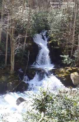
Photos by Stan Endlich
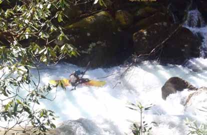
The thirteen hikers in the Big Creek area on April 6 were at least as astonished by the water as by the wildflowers. The flowers were great, as expected, but the streams, rivulets, and waterfalls gushing down the hillsides both amazed us and changed our plans. We first walked up Big Creek to the bridge and back, stopping to admire an unrecognizable Midnight Hole, a raging Mouse Creek Falls, and three "extreme" kayakers who dashed by. Dwarf crested iris, showy orchis, fringed phacelia, and air perfumed with yellow trillium were among the flower treats.
After a cushy lunch at real picnic tables, we started up Baxter Creek Trail amidst a wealth of different flowers. At the second, usually placid, stream crossing, we decided that wading knee-deep water with several more stream crossings to go wasn't our goal that day. Instead, we finished out the hike on the Chestnut Branch Trail, where the flowers weren't as prolific but there were some we wouldn't have seen otherwise. Flexibility on everyone's part led to a lovely day.--Marianne Newman
WEDNESDAY NO.W1102-732 April 13
Eastatoe Creek Heritage Preserve – Twin Falls *8:30 AM
Hike 5, Drive 140, 1200 ft. ascent, Rated C-B
Jack Fitzgerald, 828-685-2897, suejackfitz@bellsouth.net
WC100 *Form carpools at Westgate, and meet leader at Cracker Barrel (near Upward Rd.) at Exit 53 of I-26 at 9:00 AM. Visit beautiful, hidden gorge with a waterfall in Eastatoe Creek Heritage Preserve. Maybe see Oconee Bells in bloom. Then on to Twin Falls. Stop at Bob’s Place on way home, an authentic Biker Bar. Topo: Eastatoe Gap
Ten hikers visited the Eastatoe Creek Heritage Preserve in South Carolina. This is a beautiful, hidden valley, with a primitive campground, river, and waterfall tumbling though a narrow gorge. There were a multitude of spring flowers, including trilliums, violets, and may apples. The round trip was 6 miles, on well maintained trails. After that, we drove a short distance to Twin Falls, one of the falls on the Waterfall Challenge list. Two of our hikers climbed halfway up along the waterfall to a rock shelf. The rest viewed from a wooden platform.--Jack Fitzgerald
WEDNESDAY NO. W1102-128 April 20
Chestnut Bald & Sam Knob via MST and Flat Laurel Creek Trails 8:30 AM
Hike 9.8, Drive 90, 1500 ft. ascent, Rated A-A
Barbara Morgan, cell: 828-460-7066, bcmorg@hughes.net
SB6K, P400 Trail begins where MST crosses NC 215. Follow MST north, bushwhack up Chestnut Bald, continue on MST to/on FS 816, climb Sam Knob, return via Flat Laurel Creek, Little Sam Knob, and MST to start, making a wide loop. Second meeting place: Trailhead at 9:45 AM, but contact leader first. Topos: Sam Knob, Shining Rock. Also NatGeo #780.
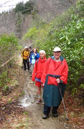
Photo by Barbara Morgan
Despite a not-so-good weather prediction, six hikers joined me for this hike. There were a few drops of rain as we put our boots on, and by 15 minutes into the hike, we donned our rain-gear and continued on. We were still far from the ridge when we started hearing the low rumble of thunder and saw a couple of undefined flashes of lightning. But, it wasn't long before the storm stopped, and hiking became more pleasant.
Wanting to err on the side of caution, I changed the route of the hike to skip the parts where a return of the lightning would be dangerous. We took the Little Sam Knob Trail across to Flat Laurel Creek Trail back to the cars, cutting the loop down to a pleasant, but muddy five miles.--Barbara Morgan
WEDNESDAY NO. W1102-164 Apr. 27
Hawkbill Flower Hike 8:00 AM
Hike 8.4, Drive 54, 2870 ft. ascent, Rated B-AA
Carroll Koepplinger, 828-667-0723, CarrolKoepp@bellsouth.net
LTC This great wildflower hike follows a rough trail up alongside Hawkbill Creek to the top of the cove, then a very steep 400 ft bushwhack up to Hawkbill Rock. Then hike along the ridge line to site of Little Snowball Tower and follow old roads and trails down to the trailhead. The wildflowers and ramps have been spectacular every time CMC has done this hike. Topo: Craggy pinnacle
Due to potential weather situations and the nature of this hike (steep ascent bushwack, ridge hiking & short steep descent) the safety of the hikers was of foremost importance and the hike was cancelled. As this would have been my first ever leading an all day Wednesday hike I was disappointed!--Carrol Koepplinger
WEDNESDAY NO. W1102-076 May 4
Craggy to Little Snowball 8:30 AM
Hike 7.2, Drive 38, 2630 ft. ascent, Rated B-AA
Brenda Worley, 828-684-8656, CLWorley@bellsouth.net
Hike from Bee Tree Gap, then right onto Snowball Trail over High Rock (Hawkbill Mtn) to the Little Snowball tower site and great views. Hopefully, we will also be viewing beautiful wildflowers this time of year. Topo: Craggy Pinnacle
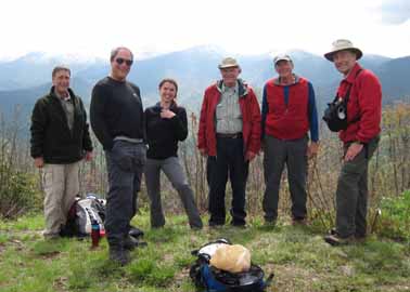
Photo by Brenda Worley
The wind was blowing and the thermometer said 34 degrees. Still seven of us met to hike from Bee Tree Gap to Little Snowball lookout tower site. The trees were sparkling with rime ice and we saw many trillium, a few Jack-in-the-pulpit, painted trillium, pink lady slippers, witch-hobble and several flowers I could not identify. The day continued breezy and chilly and mostly cloudy but we got some good views and had an enjoyable hike and good workout. We got on the trail and 9:30am and the last of us back to the cars at 2:20pm.--Brenda Worley
Email your hike reports to Dave Wetmore. The deadline for reports is 9:00 p.m. on the Tuesdays before an eNews comes out. Reports for Wednesday hikes during the eNews publication week will appear in the following eNews--The Editor.
--Back to Top
All-day hikes submitted by Bruce Bente 692-0116, bbente@bellsouth.net . Driving distance is round-trip from Asheville. All Saturday and Sunday hikes assemble at Westgate Shopping Center near I-240 UNLESS OTHERWISE NOTED.
Half Day hikes submitted by Bonnie Allen, 828-645-0357, bonnie@allencats.com
Wednesday Hikes are submitted by Charlie Ferguson, 828-398-0213 ccf108@gmail.com and Ann Gleason, 828-859-9387,
gleason.ann@gmail.com .
The meeting place for each hike will be designated by the hike leader and appears in the hike description.
Driving mileage is round trip, based on the first designated meeting place. Meet at Westgate unless otherwise noted. |
