
CMC Weekly Hike News
02/04/04
__________________________________________________________________________________
Looking Ahead....
All Day Sunday
ALL DAY No. A0401-136 Feb. 8 Winter Star via Colbert Ridge Trail and Deep Gap 8:00 AM Hike 9, Drive 90, 3400 ft. ascent, Rated A-AA+ Paul Benson 828-251-1909 pdbenson@charter.net SB6K NOTE: Hikers must be prepared for strenuous winter hiking, including snow, ice and slippery trails. Winter Star (6212') is an appropriate destination for what promises to be an exciting winter hike up into the snow. We will climb over 3000 ft. from Carolina Hemlocks Recreation area up Colbert Ridge to Deep Gap, on to the summit and return. From rock outcroppings we will enjoy outstanding views of the Blacks, South Toe River valley, the Roans and Grandfather Mtn. Second meeting place: Burnsville Ingles at 8:30 AM, only if leader is phoned beforehand. Topos: Celo, Mt. Mitchell; also Pisgah Nat'l. Forest South Toe River Trail Map
 I hear that Paul is taking reservations for a Hot Springs Hot Tub return
visit after his hike on Feb 8. Please contact him for details.
I hear that Paul is taking reservations for a Hot Springs Hot Tub return
visit after his hike on Feb 8. Please contact him for details.
All-day hikes submitted by Bruce Bente 692-0116, bbente@cytechusa.com . Driving distance is round-trip from Asheville. All Saturday and Sunday hikes assemble at Westgate Shopping Center near I-240 UNLESS OTHERWISE NOTED.
Half Day Sunday
HALF-DAY No. H0401-035 Feb. 8 Looking Glass Rock 12:30 PM Hike 6.2, Drive 70, 1700 ft. ascent, Rated C-B Elisabeth Feil, 828-684-8719 Note early start time. A moderately difficult, well-graded trail leads to the top of this interesting mountain. There are excellent view points along the way. Second meeting place: Pisgah Ranger Station new parking lot at 1:15 PM.
Half Day hikes submitted by Paula Robbins 828-687-1651 paularww@bellsouth.net and Pat Elias 828-281-3253 peliasy@aol.com . Leaders: Mail please mail your sign-up sheets. Meet at Westgate unless otherwise noted.
All Day Wednesday
ALL DAY No. W0401-309 February 11 Pounding Mill Trail 8:30 AM Hike 8, Drive 3, Rated B-C Greg Goodman, 828-684-9703 P400 This hike takes the South Mills River Trail to the Pounding Mill Trail and on to Squirrel Gap Trail. We'll continue on to Pea Gap and then return on the South Mills River Trail. Moderate. Meeting place: Boyleston Baptist Church on Route 280. Map: Nat'l. Geographic Pisgah Ranger District
Wednesday Hikes are submitted by Kenneth & Carol Deal, 828- 281-4530, KMCDeal@aol.com and Paula McNabb, 828- 274-0057 gcmcnabb@charter.net. The meeting place for each hike will be designated by the hike leader and will appear in the hike description. Driving mileage will be listed, round trip, from the first designated meeting place.
_________________________________________________________________________
Looking Back......
All Day Sunday
ALL DAY No. A0401-329 Feb. 1 Blackrock Mtn. via Fisher Creek Trail (strenuous) 8:00 AM Hike 7.4 or 10.8, Drive 96, 2900 ft. ascent, Rated B-AA or A-AA Dave Wetmore 828-884-7296 dwetmore@citcom.net SB6K? This new hike for CMC starts at the end of Fisher Creek Rd. east of Sylva and climbs to the summit of Blackrock Mtn. The trail, mostly old logging roads, is steep and rocky in places, but the views from Blackrock Mtn. are superb. If there isn't much snow, we may go on to Yellowface (3.4 additional miles on ridgeline) and make this a SB6K hike. If there is lots of snow we may climb to the Pinnacle instead, with the same trailhead but only 2100 feet of elevation gain. Second meeting place: Rest area on US 23/74 near Waynesville at 8:30 am. Topo: Sylva North
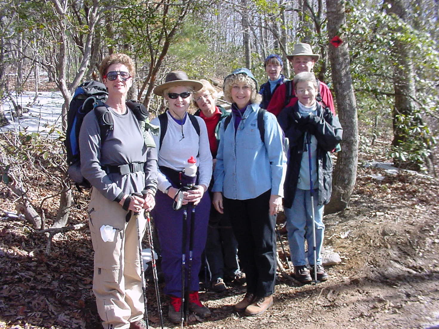
Post Hike Report: There were thirteen of us, so we had good luck with the weather. After a sometimes steep, sometimes icy climb we had beautiful 360-degree views from Blackrock Mountain. On the way up the mountain Paul Benson demonstrated his rock climbing technique and while coming down Tom Sanders showed us a new style of cross-country travel. It only works in the winter where it's icy! Dave
ALL DAY No. A0401-330 Feb. 1 Raven Cliff Falls (moderate) 8:30 AM Hike 8, Drive 95, 1450 ft. ascent, Rated B-B Barbara Passmore 828-230-2670 bpsss@netzero.net Note later start time. We'll do a pleasant hike to the pedestrian bridge over the top of a beautiful 250 ft. waterfall in Caesar's Head State Park in S.C. The hike will follow the Raven Cliff Falls Trail and a portion of the Foothills Trail to the bridge, and then return with a side trip to the spectacular overlook of the falls and Matthew Creek Gorge. Second meeting place: Bi-Lo in Pisgah Forest at 9:00 AM. Topo: Table Rock
Post Hike Report: I have a mix of feelings about the hike to Raven Cliff Falls. I enjoyed myself, and I believe the other seven hikers did as well. The hikers were wonderful, compassionate, understanding, and intrepid February sweethearts. The trail was almost ALL completely snow and ice-covered. It was so bad that about a half-mile into the hike, I asked the hikers if they wanted to continue, and they indicated that they did. Right before the suspension bridge, I had to turn back because the steps leading to it were solidly covered with ice with no foothold AT ALL. After lunch at the trail junction, we decided to try the trail to view the falls from across the gorge. We made a valiant attempt , but this section also had to cancelled at the bottom of the trail because it was too steep to negotiate the solid ice. We did not get to enjoy ONE glimpse of Raven Cliff Falls AT ALL. However, the weather and the company were peerless, and the snow and ice were pristinely radiant. I was refreshed by the starkly white, crystalline glory of the ice and snow. Despite the treachery of the "white stuff," we completed almost all the mileage of the hike. "All's well that ends well." Barbara
HALF-DAY No. H0401-318 Feb. 1 East Fork, Pigeon River 12:30 PM Hike 5-6, Drive 90, Rated C-C Richard and Anita Walkey, 681-2967, Walkey@juno.com Note early start time. An in-and-out walk along one of Western NC's most beautiful rushing streams, perhaps ringed with ice and snow. We'll see how far we get within the time limits, but, hopefully, to a large rock in the middle of the river. Second meeting place: Big East Fork parking area on US 276, north of the Blue Ridge Parkway at 1:30 PM.
Post Hike Report: Eight daring souls showed up for the Sunday half day hike. The trail was quite icy in spots, with a frozen crust of snow in others. After scouting it on Saturday, we were tempted to cancel. Not wishing to waste a beautiful clear day, we ran the hike as planned. By starting the hike a little earlier than usual, we were able to take a slower pace and still get to our usual spot on the river. A few elected to stay at the big bend of the river (about halfway in) and enjoy the sun while the rest forged on to the "big rock". The river was beautiful with lots of clear water and ice. No one fell (amazing!), and we deemed the hike a success in spite of the tricky trail conditions. This has become a Winter tradition for us. The beauty of the river in February makes for a spectacular hike. Richard and Anita Walkey
All Day Wednesday
ALL DAY No. W0401-308 February 4 MST:, Ox Creek to Rich Knob 9:00 AM Hike 8, Drive 26, 1850 ft .ascent, Rated B-A Elisabeth Feil, 828-684-8719 Starting at Ox Creek Road (near Bull Gap Overlook on the BRP, MP 375.6), and climbing to Rich Knob via Rattlesnake Lodge. This is an easy-to-moderate in-and-out hike, with a total climb of about 1850 ft. Meeting place: Westgate Shopping Center.
Post Hike Report: A short scouting trip showed icy conditions on this trail. Cancel? Not after several hikers called in. Thinking that there may less snow somewhere else, I decided to take the group (12 persons in all) from Lake Powhatan up to Sleepy Gap and then down to the French Broad Overlook for a 7- mile hike. Was I wrong! There was some bare ground, but the snow was really not too bad. Trekking poles and hiking boots with good soles were definitely helpful. Nobody fell, but three of us decided to take the Parkway back to the cars. It was actually a good, refreshing hike, reminding me of the wish that was often expressed on former schedules - 20 or more years ago: "Let's hope for snow. We didn't have any last year." Elisabeth
ALL DAY No. W0401-170 January 28 Cedar Rock Scramble 9:00 AM Hike 10, Drive 0, 2000 ft. ascent, Rated A-A Brad and Bev Van Diver, 828-669-2740 Bravandi@cs.com P400 A lovely winter hike, first skirting the eastern side of John Rock to Cat Gap, then following the Art Loeb trail through Sandy Gap, where we'll scramble to the top of Cedar Rock (4056 ft.) for lunch with a view. Back down to the trail, we'll continue to Butter Gap and return via Grogan Creek and Picklesimer Fields. Topo: Shining Rock; also Nat'l. Geographic Pisgah Ranger District Map. Meeting place: Fish Hatchery.
Post Hike Report: Owing to the high winds and low temps on the morning of Jan 28, only three hikers turned up at the fish hatchery meeting place at 9 am. For the four of us, the hike turned out to be beautiful, with blue sky and sun overhead and almost no wind. However, the snow cover was 4-6" and very hard-crusted, so we really had to stomp our feet for nearly the full distance of about nine miles. All together, it was a great trip. We didn't go to the top of Cedar Rock because the Forest Service wanted us to stay off of the unmarked, unmaintained trail leading from Sandy Gap. We left the hatchery at 9 am and returned at 2 pm. Best wishes, Brad
ALL DAY No. W0401-307 January 28 ALTERNATE HIKE MST:, Asheville Area 9:30 AM Hike 6, Drive 1, 400 ft ascent, Rated B-C Nancy Walter, 828-251-1309, seynan@bellsouth.net An in and out stroll through the winter woods, starting from the Blue Ridge Parkway bridge over Highway 25, and going south along the Mountains-to-Sea Trail. Meeting place: Harris Teeter parking lot on US 25, north of the BRP entrance.
HikingNews....
_____________________________________________________________
Backpacking trip to the Smokies
SB6K in the Smokies: There will be a three-night trip into the Smokies to do Chapman, Tricorner and Marks Knob. Depending on several factors, arrangements might be made to do Sequoyah, Luftee, and Big Cataloochee as well. We will leave Cataloochee on the morning of February 19th and return on the morning of the 22nd. We will stay the first and last nights at Laurel Gap Shelter and the middle night at Tricorner Knob. If there is much snow up high the trip may be cancelled. Cold weather, if dry, will not cause a cancellation. If you wish to come, please notify Dave Wetmore at 828-884-7296 no later than January 19th.