
 Store
Store Member Login
 Search
The Lookout Tower Challenge (LTC) encourages hikers to visit 22 historic lookout towers across Western North Carolina. These towers reward hikers with breathtaking 360-degree mountain views while preserving the legacy of an era when fire lookouts served as sentinels protecting our forests.
The challenge spans every region of Western North Carolina and includes hikes ranging from easy walks to strenuous mountain climbs. Participants who complete all 22 towers earn formal recognition from the Carolina Mountain Club, but the greatest reward is experiencing these remarkable places firsthand.
For information and inquiries about LTC, contact Adrianne Chang at LTC@carolinamountainclub.org.
Note: Membership in both CMC and FFLA is required to received recognition for the LTC. See below for details.
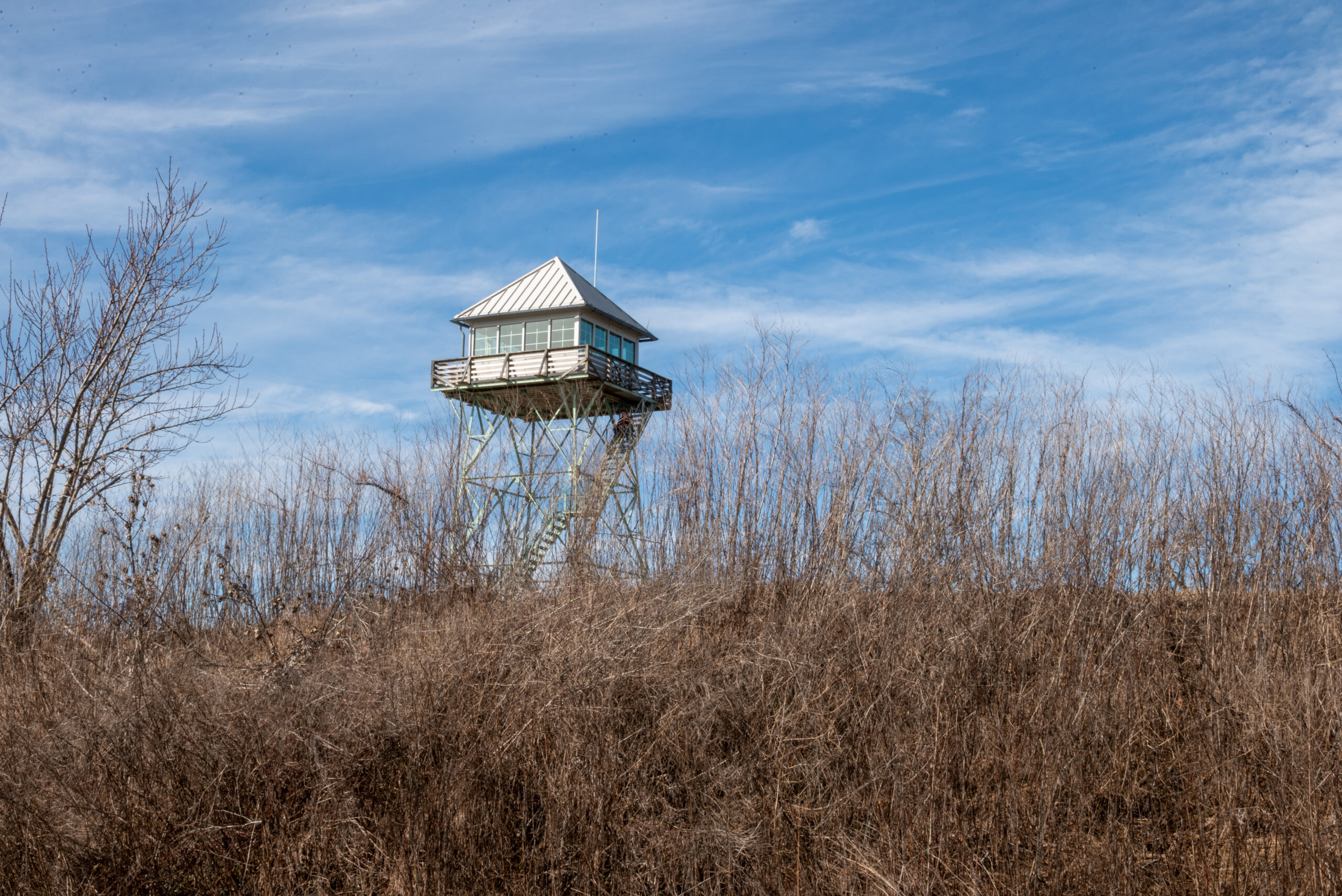
Photo by Amber Gibbs
Challenge Rules
- Each qualifying hike must include at least 1 mile round-trip, except for the Little Snowball Historical Site.
- Climbing the tower itself is not required.
If you choose to climb a tower, you do so at your own risk. Tower conditions and public access may change. Never climb a tower that is closed, posted, or appears unsafe. - Reaching a tower by automobile does not qualify toward completing the challenge.
Preserving North Carolina’s Lookout Towers
The Lookout Tower Challenge is closely connected to the mission of the Forest Fire Lookout Association (FFLA), whose North Carolina chapter works to preserve the state’s remaining fire lookout towers.
Although no longer used for fire detection, these historic structures remain important landmarks. Many have deteriorated because of vandalism, weather, and a lack of maintenance funding. More than one-third of North Carolina’s lookout towers have already been lost.
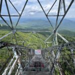
Photo by Sarah Jones Decker
The FFLA works to:
- Preserve remaining lookout towers
- Restore towers threatened by deterioration or removal
- Recruit volunteers for maintenance projects
- Secure public and private funding for restoration
- Improve public access where appropriate
Lookout towers are more than historic structures—they are scenic destinations that connect visitors to North Carolina’s natural and cultural heritage.
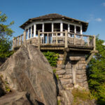
Photo by Sarah Jones Decker
Location & Terrain
In addition to their historic value, lookout towers offer scenic vantage points of the surrounding forest—often wild and beautiful land that we hold dear as a natural and recreational resource. Their 360 degree views provide breathtaking vistas, often hard earned after a climb up a mountain. The towers also serve as a public symbol of forest fire prevention and natural resource conservation.
Access
Many towers in the state are restricted from public access and many others lack the ability to enjoy the views from their cabs and catwalks. The NC chapter of FFLA seeks to continually improve access to lookout towers for the public, particularly those in western North Carolina with the most sought after panoramas.
Liability
Though the towers no longer detect fires, their value for public recreation and interpretation remains high and it is a goal of the chapter to promote lookouts as hiking and travel destinations.
Western North Carolina
Lookout Towers
Nanatahala National Forest
Mileages are listed one way; double the distance for round trip length. Various routes are listed, depending on the hiker’s desire as to length of trip. Many can be incorporated into loops or shuttle hikes. Any of the routes are acceptable to meet the Challenge requirement. For some towers, other routes are possible but must meet mileage requirements. Check with the Challenge Committee to confirm other routes in question.
LOOKOUT TOWERS:
Wayah Bald
Panther Top
Joanna Bald
Albert Mountain
Wesser Bald
Cowee Bald
Yellow Mountain
 Situated along both the Appalachian Trail and Bartram Trail, Wayah Bald was built by the CCC in the 1930s. Once a 53-foot tall, three story stone lookout, faulty mortar led to its decommissioning in the 1940s. Later, the USFS removed half of its structure for conversion to a public observation tower. Wayah Bald features breathtaking views of the entire Nantahala National Forest and extends to the Great Smoky, Unicoi, and Great Balsam mountain ranges as well as into Georgia.
Appalachian Trail via Wine Spring Bald access trail from FS 69B (1.5)
Appalachian Trail from Wilson Lick Ranger Station (3.2)
Appalachian Trail from Wayah Gap at Wayah Crest Picnic Area (4.2)
Appalachian Trail from Burningtown Gap (4.5)
Bartram Trail From Nantahala Lake (7.3)
Bartram Trail From FS 713 at Harrison Gap (5.3)
Panther Top
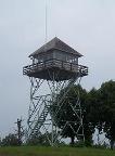 A 30 ft. live-in USFS lookout, Panther Top it the western most NC fire tower and sits perched on a peninsula jutting out into the Hiwassee Lake. Built in 1940 by the CCC, its road accessing the summit is opened for vehicular access for several weekends each autumn by the Tusquitee District of the Nantahala National Forest. The tower features a stone monument underneath the tower commemorating its listing in the National Historic Lookout Register. Panther Top was staffed by the USFS until 1971 and then periodically by the NCFS thereafter. The tower is accompanied by a popular ‘geocache’ located nearby.
FS 85 Access Road (0.75)
Joanna Bald
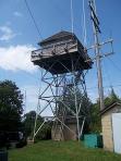 Rising high between Andrews and Robbinsville at the crest of the Snowbird Mountains, Joanna Bald is a 31ft. live-in lookout built in 1952 which replaced a wooden lookout house with a cupola. Staffed through the early 2000s, its use for fire detection ceased due to state budget cuts. This lookout was staffed by FFLA member Marshall McClung during the late 1960s and early 1970s. Upon completion of structural repairs, McClung will once again staff the tower as a volunteer during periodic lookout tower access dates. Joanna Bald features spectacular views of the Nantahala, Snowbird, Unicoi, and Cheoah Mountains.
Joanna Bald FS 423B Access Road (0.6)
Albert Mountain
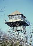 Albert Mountain took over fire detection duties from the lookout house on nearby Standing Indian Mountain on the opposite rim of the Nantahala River Basin in 1951. Built to compliment a lookout cabin on the summit, it also replaced a wooden lookout tower one half mile north on the peak of Big Pinnacle Mountain. It overlooks the deep Nantahala River Basin to the west and the steep sloped Coweeta Hydrological Laboratory to the east. Over 10 other current or former lookout tower summits are visible from this tower. Its views also extend into Georgia as well as the Great Smoky Mountains. Located directly on the Appalachian Trail, one route to this tower features a brutally steep, hand-over-hand climb up abrupt slopes that lives in infamy among AT thru-hikers.
Bearpen Trail & AT (2.9)
Albert Mountain Access Trail & AT (0.5)
Albert Mountain Short Loop /w FS 69 (1.0)
AT From Mooney Gap (2.5)
Wesser Bald
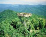 Built 1936 by the CCC, this 30 ft. former live-in lookout on the Appalachian Trail offers stunning views of the Nantahala, Snowbird, Unicoi, and Great Smoky Mountains while hovering just above the canyon-like southern rim of the Nantahala River Gorge. Most are unaware of Wesser Bald’s significance in revitalizing the Appalachian Trail when first ever thru-hiker Earl Shaffer spent the night in the tower during his 1948 epic journey. In awe of his quest, the tower watchman radioed ahead to lookouts further north on the trail and word eventually spread into trail towns and into the media. Becoming overgrown and forgotten during a post-World Ward II slump, the AT gained national popularity after word of Shaffer’s hike got out from the Wesser Bald lookout. The live-in cab was destroyed by arson in 1979 and replaced in the early 1990s by the USFS with an observation deck for hikers.
AT From Tellico Gap (1.9)
Old Jeep Road from Tellico Gap (0.9)
AT from Nantahala Gorge (6.5)
Wesser Creek Trail (4.3)
Cowee Bald
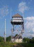 Steeped in Native American and pioneer history, the summit of Cowee Bald hosts another 30 ft. live-in USFS lookout tower. Built in 1933 by the CCC at the crest of the Cowee Mountains, it overlooks the Macon County seat of Franklin with superb views of the Nantahala, Great Smoky, Plott Balsam, and Great Balsam Mountains. Used for fire detection through the mid-1990s, Cowee Bald look also overlooks the nearby Big Laurel, a peculiar high altitude “hanging valley”. Accessible within a half mile by vehicle, Cowee Bald shares the summit with numerous other communication and meteorological towers.
FS 70 Access Road (0.5)
Yellow Mountain
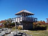 Atop the highest peak in the Cowee Mountains, this 1934 CCC-built stone lookout house is among only two of its kind remaining in the southeastern United States. Staffed until 1969, Yellow Mountain lookout tower fell into disrepair until the mid-1980s when USFS employee Ron Carnes led a restoration effort to rehabilitate the tower to its former condition. Its central location among mountain ranges enables a spectacular vantage point of the Great Smoky Mountains, Plott Balsams, Cowees, Nantahalas, and Great Balsams as well as into the Georgia and South Carolina high country. Reach it by hiking the 5 mile Yellow Mountain Trail starting near the quaint town of Highlands.
Yellow Mountain Trail (4.9)
Steward Cove/Buck Creek Trail (4.2)
Great Smoky Mountains & Vicinity
Mileages are listed one way; double the distance for round trip length. Various routes are listed, depending on the hiker’s desire as to length of trip. Many can be incorporated into loops or shuttle hikes. Any of the routes are acceptable to meet the Challenge requirement. For some towers, other routes are possible but must meet mileage requirements. Check with the Challenge Committee to confirm other routes in question.
Lookout Towers
Shuckstack
Clingman’s Dome
Mount Cammerer
Mount Sterling
Barnett Knob
Shuckstack
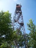 A Public Works Administration effort completed in 1934, the Shuckstack lookout tower had a bird’s eye view of the start to finish construction of Fontana Dam, just 2 miles south, from 1941 to 1944. The tallest dam in the eastern United States was finished in just three years using work shifts encompassing 24 hours per day as an war effort project during World War II. Shuckstack also witness the subsequent flooding of the Little Tennessee River and creation of the 35 mile long Fontana Lake – one of, if not the most, dramatic landscape changes ever seen in western North Carolina. Incorporated into the route of the Appalachian Trail in 1946-47, Shuckstack offers the first glimpse of the massive Great Smoky Mountains range soon to be traversed for northbound thru-hikers. Standing 60 ft. tall, this steel tower has suffered grave structural deterioration and is in desperate need of restoration.
AT from Fontana Dam (3.5)
Twentymile Creek Trail (5.5)
Lakeshore & Lost Cove Trail (8.5)
Lakeshore & AT Loop (12.0)
Clingmans Dome
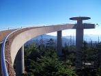 At 6,643 ft., Clingmans Dome stands as the highest peak in the Great Smoky Mountains National Park, the state of Tennessee, as well as on the entire 2,100+ mile Appalachian Trail. An abstract concrete observation tower crowns the summit after replacing an earlier wooden surveyor tower in the 1920s and a wooden observation tower in the 1930s. Built in 1959 as part of the National Park Service “Mission 66” initiative, Clingmans Dome receives over 4 million visitors each year, the highest among all state high points. A 375 ft. ramp leads to the top of the 45 ft. tower for the most all-encompassing view of the wild and rugged Great Smoky Mountains.
Clingmans Dome Summit Trail (0.5)
Clingmans Dome Bypass Trail (1.0)
Clingmans Dome Summit Loop (1.5)
AT From Collins Gap (1.7)
Mount Cammerer
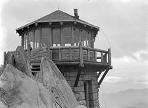 More resembling a lighthouse or castle turret, Mt. Cammerer lookout tower is perched perilously on a rocky promontory at the eastern edge of the Great Smoky Mountains range. An octagonal stone lookout house, completed in 1939 by the CCC, has become one of the most endearing symbols of the Great Smokies following its 1995 restoration. Two decades of deterioration followed its decommissioning in the 1970s until the 1970s until a restoration effort restored it to its former glory in the 1990s. The project was the first undertaking of the group that soon became the Friends of the Smokies, the national park’s leading fundraising organization. Formerly known as White Rock, Mt. Cammerer is often debated as the best view in the Great Smoky Mountains National Park and is located just a half mile off of the Appalachian Trail.
Low Gap Trail & AT (5.6)
Big Creek Loop (16.9)
Lower Cammerer Loop (15.0)
AT from Davenport Gap (5.2)
Mount Sterling
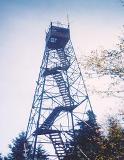 Another CCC lookout in the Great Smoky Mountains National Park, this 60 ft. steel tower stands at the highest elevation of any true fire tower remaining in the eastern United States. Built in 1935, the tower overlooks the Cataloochee Valley, the location of the recent reintroduction of elk to western North Carolina. Known as the Devil’s Bedchamber to early Cherokee hunters, Mt. Sterling can be reached with a three mile hike via its former jeep access road or a six mile epic ascent on the Baxter Creek Trail, debated as the most strenuous and demanding trails in the southeast. Because of a backcountry campsite located at the tower base, hardy backpackers can enjoy the sunrises and sunsets from the top of the tower following a night camped atop the 5,842 ft. summit. Mt. Sterling lookout boasts the highest elevation of any remaining true fire lookout in the eastern United States.
Mt. Sterling Trail (2.7)
Baxter Creek Trail (6.1)
Pretty Hollow Gap & Mt. Sterling Ridge Trails (7.4)
Barnett Knob
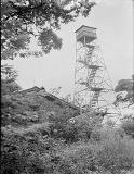 Another fire tower on the Cherokee Indian Reservation, this lookout is just a half mile off of the Blue Ridge Parkway and overlooks both Cherokee, NC and the Great Smoky Mountains National Park. Built in 1932 by the CCC, this 60 ft. tower was manned for fire detection until 2004. The lookout and its breathtaking views of the Plott Balsams and the Great Smoky Mountains may be incorporated into the 700 mile North Carolina Mountains-To-Sea Trail in the future. Accompanied by a watchman’s cabin, Barnett Knob is reached with just a half mile hike off of the Blue Ridge Parkway between the Great Smoky Mountains National Park and Maggie Valley.
Barnett Fire Tower Access Road (0.6)
Central NC Highlands
Milages are listed one way; double the distance for round trip length. Various routes are listed, depending on the hiker’s desire as to length of trip. Many can be incorporated into loops or shuttle hikes. Any of the routes are acceptable to meet the Challenge requirement. For some towers, other routes are possible but must meet mileage requirements. Check with the Challenge Committee to confirm other routes in question.
LOOKOUT TOWERS:
Rich Mountain
Camp Creek Bald
Rich Mountain
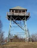 Just off of the Appalachian Trail, the Rich Mountain lookout tower was used for fire detection through the 1980s. Built by the USFS in 1932 straddling the NC/TN state line, a 30 ft. live-in tower overlooks the quaint mountain town of Hot Springs, NC where the Appalachian Trail shares the sidewalk as it passes through downtown. Amazing views of the Bald and Black Mountains, including the east’s tallest Mt. Mitchell, are seen from this lookout.
AT from Tanyard Gap (2.6)
AT From Hurricane Gap (1.1)
Roundtop Ridge Trail (4.3)
Roundtop Ridge/AT Loop (11.6)
Camp Creek Bald
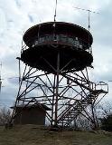 North Carolina’s oldest remaining lookout, Camp Creek Bald was built in 1928 with a standard square live-in cab supported by a 21 ft. steel tower. Prior to replacement with a proprietary circular live-in cab in the 1960s, this tower – like Wesser Bald, hosted Earl Shaffer for a night during his first ever 1948 Appalachian Trail thru-hike. Once threatened by a ski resort development gone bust, this lookout offers views of Mt. Mitchell and the Black Mountains as well as the Highlands of Roan.
Camp Creek Bald Jeep Road (0.8)
AT from Jones Meadow (1.3)
Hickey Fork & Pounding Mill Trails (5.5)
White Oak Flats Trail (6.4)
Blue Ridge & Black Mountains
Mileages are listed one way; double the distance for round trip length. Various routes are listed, depending on the hiker’s desire as to length of trip. Many can be incorporated into loops or shuttle hikes. Any of the routes are acceptable to meet the Challenge requirement. For some towers, other routes are possible but must meet mileage requirements. Check with the Challenge Committee to confirm other routes in question.
LOOKOUT TOWERS:
Fryingpan Mountain
Bearwallow Mountain
Little Snowball
Mt. Mitchell
Green Knob
Fryingpan Mountain
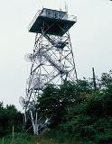 An easy hike off of the Blue Ridge Parkway or from the Pisgah Inn, Fryingpan Mountain is the tallest USFS lookout tower in western North Carolina at 70 ft. tall. Built in 1941 and supporting a steel live-in cab, this tower features the most stunning view of nearby Cold Mountain than anywhere else in the area. Its views of Mt. Pisgah, the Shining Rock Wilderness, the Cradle of Forestry, the Pisgah National Forest, and distant Mt. Mitchell and the Black Mountains are equally impressive.
FS 450 Access Road (0.7)
Big Bald/Fryingpan Mountain Trail from Pisgah Campground (1.6)
Bearwallow Mountain
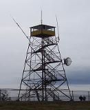 Built in 1934 and standing 47 ft. tall, the steel Bearwallow Mountain lookout tower straddles the Eastern Continental Divide in the southern Blue Ridge Mountains range. It hovers above a scenic bald mountaintop which features panoramic views of the city lights of both Asheville and Hendersonville as well as the deep Hickorynut Gorge and Lake Lure. The Great Balsam, Craggy, and Black Mountains are all visible from its perch. Reached by a mile hike on its access road, the mountain’s central location among North Carolina’s highest ranges offers the opportunity to identify a seemingly innumerable amount of nearby and distant peaks.
Bearwallow Mountain Trail (1.0)
Little Snowball
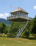 Little Snowball is perhaps one of the most fascinating lookout stories in western NC. Built by the Big Ivy CCC camp in 1934, this 21 ft. live-in fire tower stood on a spur of the Great Craggy Mountains, north of the Blue Ridge Parkway. Staffed by only two tower operators until its use for fire detection ceased in 1980, it was earmarked for removal and schedule for demolition. Local resident Lloyd Allen, who grew up in the Big Ivy community below and had fond childhood memories of the tower, bid $300 for the lookout and spent the next year dismantling it by hand. After sitting in storage for over a quarter decade, Little Snowball was re-erected and restored on the Big Ivy Historical Campus in 2006, the site of the CCC camp that built it and in the valley that it once protected. Today, it stands as the most historically complete lookout tower remaining in western NC
Big Ivy Historical Campus – This tower must be driven and does not have a trail. Douglas Falls is nearby; Craggy Gardens is nearby and is the location of the Little Snowball Trail, which is also required for the challenge.
Little Snowball Trail (3.6)
Mt. Mitchell
The summit of Mt. Mitchell boasts a more extensive history than any other southern Appalachian peak. At 6,684 ft., ?Mitchell?s Peak? is the highest mountain in the eastern United States. Preceded by four different lookout towers, the squat stone observation tower atop Mt. Mitchell is scheduled for completion in Fall 2008 after construction closed the summit for over two years. Replacing the 35 ft. former tower that faced structural deterioration and inaccessibility, a new 10 ft. lookout will soon offer views from the rooftop of North Carolina.
Old Mitchell Trail (2.0)
Mt. Mitchell Trail from Black Mountain Campground (6.1)
Black Mountains Crest Trail From Bowlens Creek (12.0)
Green Knob
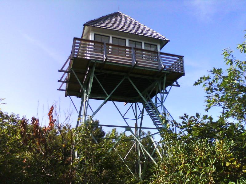 The Green Knob lookout boasts the best viewing point of the rugged and tall Black Mountains range, including Mt. Mitchell, North Carolina?s highest peak. Accessible by a half mile trail from the Blue Ridge Parkway, or for a hardier workout – a grueling 3 mile ascent from the Black Mountain campground, 5,000 ft. Green Knob hosts a 21 ft. former live-in lookout tower built by the USFS in 1931. Staffed through the late 1970s, Green Knob was restored in the 1990s but has again suffered deterioration and desperately needs additional rehabilitation. Straddling the Eastern Continental Divide, the tower also features stunning views of the Great Craggy Mountains, Table Rock, Grandfather Mountain, and the North Carolina Piedmont.
Green Knob Trail/Lost Cove Ridge Trail (3.3)
Green Knob Trail from BRP overlook (0.5)
Snooks Nose Trail & Green Knob Trail (4.4)
Northwestern North Carolina
Mileages are listed one way; double the distance for round trip length. Various routes are listed, depending on the hiker’s desire as to length of trip. Many can be incorporated into loops or shuttle hikes. Any of the routes are acceptable to meet the Challenge requirement. For some towers, other routes are possible but must meet mileage requirements. Check with the Challenge Committee to confirm other routes in question.
LOOKOUT TOWERS:
Flat Top Mountain
Rendezvous Mountain
Moores Knob
Flat Top Mountain
The highest point on the former estate of denim king and textile tycoon Moses H. Cone and his wife Bertha, Flat Top Mountain first hosted a 1900 built wooden lookout tower that served as an observatory for Cone and guests to his elaborate Flat Top Manor. Following the death of the Cones, their estate was given to the National Park Service who removed the wooden tower and replaced it in 1954 with a 40 ft. modified steel lookout tower for visitor use to the park now incorporated into the Blue Ridge Parkway. Reach this observation tower via a 3.5 mi. carriage trail that begins at the steps of the Cone?s impressive colonial revival mountain mansion and incorporates a piece of the North Carolina Mountains-To-Sea Trail.
Flat Top Tower Trail (2.7)
Rendezvous Mountain
Rendezvous Mountain received its name for its use as a meeting point for Colonel Benjamin while summoning the local militia to organize against the threat of invading British forces. Above 350 Patriot militia organized on the summit and marched south to join the Overmountain Men who later took part in the victorious Battle of Kings Mountain. The lookout, a 60 ft. steel structure built by the nearby Camp James CCC camp in 1936, is accompanied by a CCC cabin adjacent to the tower. Both are incorporated into the North Carolina Forest Service Rendezvous Mountain Education State Forest, an interpretive park designed to educate visitors about the importance of forest conservation and management in the past, present, and future.
Mountain Ridge Trail (3.5)
Moores Knob
The highest point in Stokes County and the Sauratown Mountain range, Moores Knob is crowned with a former stone lookout tower that features awe-inspiring views of the Winston-Salem skyline, Virginia, and the Blue Ridge Mountains. Use for fire detection for only a few years, hurricane damage caused its decommissioning and eventual conversion to a observation tower. The lookout was preceded by a steel fire tower built by the CCC in the 1930s later destroyed by fire. Located in Hanging Rock State Park, one of NCs most popular, the lookout is just one feature in the park that features hiking trails to a variety of fascinating caves, waterfalls, cliffs, and rock formations.
Moores Knob Trail (1.9)
Moores Wall Loop Trail (4.5)
Recognition
After hiking to all 22 lookout towers and meeting the minimum hiking requirements, email a scan or photo of your completed checklist (or comparable hiking log) to Adrianne Chang at LTC@carolinamountainclub.org with the subject line “LTC Completion.” Paper submissions are not accepted.
Successful participants receive:
- An LTC patch
- A certificate of completion
- Recognition at the Carolina Mountain Club Annual Meeting
Awards can also be mailed upon request.
Please allow 4–6 weeks for your application to be reviewed and processed.
Completers must also be current members of both CMC and the Forest Fire Lookout Association (FFLA). If you are already a member of CMC (please make sure to confirm), you need only join the FFLA. Click here to join FFLA. Make sure to denote “North Carolina chapter.” Membership in both organizations is required to received recognition for the LTC.
CMC Lookout Tower Completers
See the participants who were brave enough to complete the challenge!
View ListFAQs
Several towers can only be reached by relatively short hikes. Requiring additional road walking simply to increase mileage was considered unnecessary. While some towers are reached by short hikes, others—including Yellow Mountain, Mount Cammerer, Mount Sterling, and Shuckstack—require much longer and more strenuous climbs.
No. Towers that can be reached by vehicle must still be approached on foot to qualify for the challenge. Some locations make excellent shuttle hikes—for example, Rich Mountain, Wayah Bald, Camp Creek Bald, and Rendezvous Mountain.
Some towers are located on private property, are structurally unsafe, contain communications equipment, or are otherwise closed to public access. Towers may be added or removed from the challenge as conditions change.
The Carolina Mountain Club cannot require participants to climb structures that may present safety risks. You’re welcome to climb open towers, but only at your own discretion.
The original Little Snowball Lookout Tower was dismantled and later reconstructed by the Big Ivy Historical Society. The challenge includes both the restored tower and a hike to its original mountaintop location, highlighting both preservation success and the history of towers that have disappeared.
Not necessarily. While the minimum mileage is shorter than some CMC challenges, many lookout tower hikes involve significant elevation gain. Because the towers are spread across the region, most require separate trips, giving participants the opportunity to explore a wide variety of mountain landscapes.
Lookout towers combine spectacular views, rewarding hikes, and an important piece of Southern Appalachian history. They offer some of the finest mountain panoramas in the region while helping hikers appreciate the role these structures played in protecting our forests.
Many towers no longer receive maintenance funding and continue to deteriorate. Others have already been removed. Supporting organizations like the Forest Fire Lookout Association helps preserve these historic landmarks for future generations.
Public access to Mount Noble ended in 2018, and Chambers Mountain closed in 2019. Both have been removed from the challenge and are no longer required for completion.
Questions about the Challenge?
For questions regarding the CMC & FFLA Lookout Tower Challenge, please contact Adrianne Chang.
CMC is a volunteer organization, so please allow 10 business days for a response to general inquiries.
Contact Adrianne