
 Store
Store Member Login
 Search
The South Beyond 6000 (SB6K) encourages hikers to climb the forty peaks in the Southern Appalachian Mountains that rise above 6,000 feet.
The privilege of belonging is earned and shared among those who have reached these summits on foot. The program was established by the Tennessee Eastman Hiking and Canoeing Club after studying similar peakbagging challenges in the White Mountains of New Hampshire and the Adirondacks of New York.
For information and inquiries about SB6K, contact Henry Kassell at SB6K@carolinamountainclub.org.
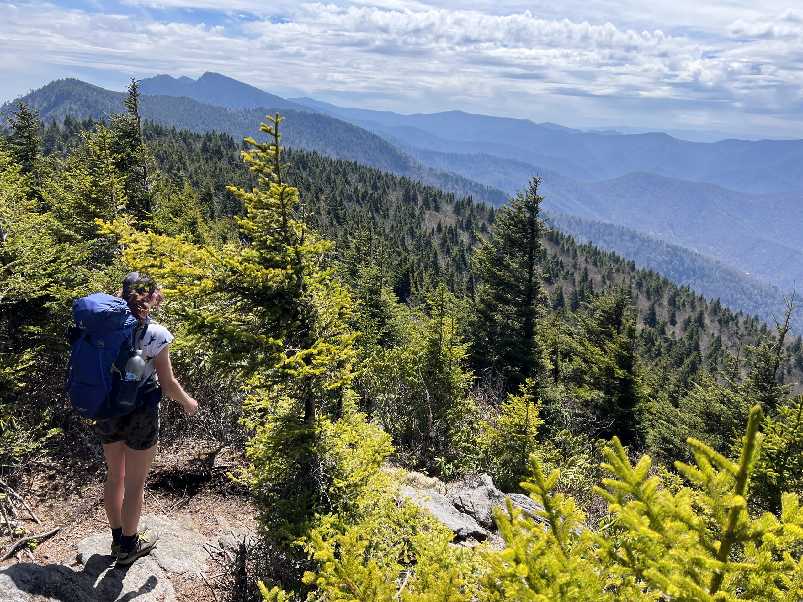
Photo by Sarah Jones Decker
Challenge Rules
- The true summit of each mountain must be reached. (Note: The summit of Mt. Hardy lies beyond the USGS benchmark.)
- Each qualifying hike must include at least 5 miles of distance and 500 feet of elevation gain. These requirements apply per hike, not per peak. Multiple peaks may be completed in a single qualifying hike. Travel must be continuous and entirely on foot.
- Alternate routes may be submitted for approval to ensure they meet SB6K standards.
- Applications must include:
- A completed Ascent Record
- The applicant’s name as it should appear on
- the certificate
- The date of the final qualifying hike
Applications should be emailed to the SB6K program chair (Henry Kassell). Please allow 4–6 weeks for review. - Applicants must be current members of the Carolina Mountain Club. Non-members must submit a membership application and dues.
- Upon approval, participants receive an SB6K patch and certificate. Awards are presented at the CMC annual meeting or mailed upon request.
CMC periodically leads hikes that include SB6K peaks. These are listed in the club’s quarterly hiking schedule.
History & Introduction
In 1968, Hugh Thompson of the Tennessee Eastman Recreation Club Hiking Club (now the Tennessee Eastman Hiking and Canoeing Club) began developing a challenge program focused on the high peaks of the Southern Appalachians. He enlisted A.L. Edney, Leroy Fox, John Davis, and Ed Dunn to help select qualifying peaks and routes.
The first South Beyond 6000 Handbook was issued on January 1, 1997. The program has been jointly sponsored by the Tennessee Eastman Hiking and Canoeing Club and the Carolina Mountain Club.
Although more than 60 summits in the region exceed 6,000 feet, only 40 were selected based on the following criteria:
- Elevation above 6,000 feet
- At least 200 feet of drop to a saddle between peaks, or a minimum of 0.75 miles separation (topographic prominence)
Photo by Sarah Jones Decker
The 40 peaks are located within six ranges: the Smokies, Plott Balsams, Great Balsams, Craggy Mountains, Black Mountains, and the Roans. Most are in North Carolina or along the North Carolina–Tennessee border, with the exception of Mt. Le Conte in Tennessee.
When the program began, many of these summits were covered in pristine spruce-fir forest. In recent decades, woolly adelgid infestation and acid rain have altered these environments, creating dense vegetation, blowdowns, and less-defined summits. As a result, strong navigation skills and proper clothing are essential.
SB6K promotes Leave No Trace ethics. Hikers are encouraged not to leave flagging and to remove any they encounter.
Many access points rely on the Blue Ridge Parkway, which may close in inclement weather. Always check conditions in advance and follow park regulations.
Participation is at your own risk. Each hiker is responsible for their own safety and decisions.
The program operates on an honor system. SB6K recognizes those who reach these summits on foot—not by vehicle or other means. The challenge is intended to reward effort, persistence, and integrity.
Photo by Sarah Jones Decker
Location & Terrain
There are over 60 summits in the area above 6000 feet, but only 40 were selected by the criteria for the South Beyond 6000. The criteria for selecting peaks are:
- The summit elevation is above 6000 feet above sea level.
- There is a drop of 200 or more feet to a saddle between one peak and another qualifying peak or, there is a distance between the peaks of .75 miles.
The 40 peaks are contained within 6 ranges: the Smokies, Plotts, Balsams, Craggies, Blacks, and Roans. The southwestern most peak is Clingmans Dome in the Smokies, while the northernmost is Grassy Ridge in the Roans. All 40 are in North Carolina or on the North Carolina-Tennessee border except Mt. Le Conte, which is within Tennessee.
When South Beyond 6000 was first organized, most of the mountains over 6000 feet were pristine spruce-fir forested summits. In the past twenty years, however, the wooly aphid blight and pollution from acid rain have killed the boreal zone trees, opening the canopy to wind and deadfalls along with thick briar patches. The peakbagger confronts a thick and difficult vegetation to struggle through to obscure and often almost invisible summits, only guessing where the true summit lies. Knowledge of map and compass, long sleeve shirts and long pants, and gloves are a must.
Access
In some cases the routes cross private property. Hikers are responsible for getting permission from the owners.
Many of the peaks in the SB6K program are accessed by using the Blue Ridge Parkway (BRP). Since the Parkway is frequently closed by sections in bad weather, especially in the winter months, hikers should check with the Park Service (828-298-0398) for Parkway closures. Park regulations should be adhered to when using the Parkway.
Liability
The sponsors of the SB6K program are not liable for any personal injuries, illness, property damage, or loss of any kind sustained by any person who climbs the South Beyond 6000 peaks. Each person assumes responsibility for his/her own welfare.
SB6K PEAK REGIONS
SOUTH BEYOND 6000 in the BLACK MOUNTAINS
Ten of the peaks over 6000 feet in the region are located in the Black Mountains. For hiking convenience they may be divided into three groups: A. Blackstock Knob, B. Mt. Mitchell along with two peaks to the south, Mt. Hallback and Mt. Gibbes, C. Six peaks north of Mt. Mitchell: Mt. Craig, Balsam Cone, Cattail Peak, Winterstar Mountain, Gibbs Mountain, and Celo Knob. The principal way to get oriented in the Black Mountains is by the Mt. Mitchell Parking Lot, located about 30 miles north of Asheville, NC, via the Blue Ridge Parkway and NC 128.
A. Blackstock Knob (6320 feet)
Blackstock Knob is located on the Mountains-to-Sea Trail just north of Balsam Gap, milestone 359.8 on the Blue Ridge Parkway. From Balsam Gap one ascends on the trail about 1.5 miles to the summit, which will be evident as the highest point on the trail. To return to the trailhead is only 3 miles and therefore does not qualify for the program, which requires a 5 mile minimum hike.
Most Commonly Used/Accepted Routes:
- Mountains-to-Sea, Blackstock Knob and Beyond; Beginning at Balsam Gap on the Parkway this route climbs to the summit of Blackstock Knob. From there it descends gradually to NC 128, taking in the outstanding rock work the CMC crew did on this section of the Mountains-to-Sea. This one-way trip is 5 miles.
Blackstock Knob, 6359
Hike Descriptions: Blackstock Knob
B. Mt. Mitchell (6684 feet) and Two Peaks to the South: Mt. Hallback (6320 feet) and Mt. Gibbes (6560 feet)
Mt. Mitchell (6684 feet) is the highest peak in the East of the United States and is accessed by a walkway from the Mt. Mitchell Parking Area at the end of NC 128. At the summit one will find the grave of Dr. Elisha Mitchell, for whom the mountain was named, and a tower with outstanding 360-degree views. For the Beyond 6000 program, climbing Mt. Mitchell must be combined with other routes that are at least 5 miles and a 500 foot ascent.
Mt. Hallback (6320 feet) is located a little more than a mile south of Mt. Mitchell on the Old Mitchell Trail, which begins just above the Parking Area and restaurant toward Mt. Mitchell. The trail meanders through a campground and a parking lot, after which Mt. Hallback becomes prominent to the left. Where the trail curves sharply to the left and before it curves back to the right, the hiker will find a logical place to bushwhack to the summit. No view; but a sign identifying the summit.
Mt. Gibbes (6560 feet) is a joint mountain with Clingman’s Peak, which is distinguished by towers and a chain fence around its summit. Since access is prohibited to Clingman’s Peak, Mt. Gibbes, which is actually higher, is included in the Beyond 6000 program. It is best accessed from Stepps Gap, where there is a park office on NC 128. A gravel road and a trail both ascend steeply to the South. The benchmark for Mt. Gibbes is located on the trail about a mile from Stepps Gap. The road runs between Clingman’s Peak and Mt. Gibbes. The trail may be found just north of maintenance buildings.
Most Commonly Used/Accepted Routes:
- Black Mountains Circuit; Beginning at Mt. Mitchell Parking Lot, this hike proceeds south along Old Mitchell Trail via Mt. Hallback, with a short bushwhack to Mt. Gibbes. The return is via Camp Alice and Commissary Ridge Trails. After climbing Mt. Mitchell, hikers will go north to Mt. Craig (6647 feet) and return. An 8-mile hike.
- Mt. Mitchell from Black Mountain Campground; This strenuous trip features a large stand of virgin hardwood forest, a well-constructed, enjoyable trail, and good views from the highest point east of the Mississippi River. The 3684 feet climb ensures a first-class workout.
- Mt. Gibbes and Hallback via Potato Knob and return via Mountains-to-Sea Trail; This hike follows an old trail that parallels NC 128 in the Mt. Mitchell State Park and ends at Clingman’s Peak. From there, cross Mt. Gibbes and Hallback on the Old Mitchell Trail, descend Commissary Ridge Trail, and then the Mountains-to-Sea back to NC 128. About 11 miles.
Mt. Mitchell, 6684
Hike Descriptions: Mt. Mitchell
Mt. Hallback, 6320
Hike Descriptions: Mt. Hallback
Mt. Gibbes, 6571
Hike Descriptions: Mt. Gibbes
C. Peaks North of Mt. Mitchell: Mt. Craig (6647 feet), Balsam Cone (6611 feet), Potato Hill (6475 feet), Winter Star Mountain (6212 feet), Gibbs Mountain (6224 feet), Celo Knob (6327 feet)
All of these peaks are in a sequence on the Black Mountain Crest Trail, which begins at the Mt. Mitchell Parking Area, and ends with Celo Knob, the terminus, at 6.7 miles. A number of other peaks are also along the trail, though they are considered spurs of these six. Potato Hill, for example, is part of three summits, so the hiker should be careful to touch the legitimate summits of the six mountains in the program.
Mt. Craig (6647 feet) is one of the highest mountains in Western North Carolina. It is less than a mile from the parking lot and is reached by a steep descent and then ascent. From rocky ledges on the summit the hiker will enjoy spectacular views. A nearby spur, also on the trail, is Big Tom (6581 feet).
Balsam Cone (6611 feet) is somewhat over a mile north and beyond Mt. Craig. After a descent and ascent, Balsam Cone is located on the trail.
Cattail Peak (6620 feet) is reached by bushwhacking on the ridgeline shortly beyond (north) of the northern boundary of Mt. Mitchell State Park. In this gap, an old wooden sign erroneously claims a point beside the trail to be the summit of Cattail Peak. The sign is wrong, and has fooled peakbaggers for decades. The true summit requires a 0.2 mi. bushwhack leaving the trail where it veers off of the ridgeline to the left (if going north), less than 100 yards north of the wooden sign. Follow the ridgeline off-trail through an open balsam forest to the summit of Cattail Peak and a small summit clearing with an exposed rock outcropping. A benchmark, engraved “Cattail Peak,” can be found easily at the highest point of the rock and marks the summit. Note that Cattail Peak has now replaced Potato Hill as the summit necessary to reach on the SB6K list. As for July 2013, hikers must reach Cattail Peak instead of Potato Hill.
Winter Star Mountain (6212 feet) is north of Potato Hill. The hiker descends steeply into Deep Gap and then ascends about 0.6 miles to rocky Winterstar Mountain. The summit, just off the trail, is evident and marked by a USGS benchmark.
Gibbs Mountain (6224 feet) is north of Winterstar Mountain. The Black Mountain Crest Trail enters a beautiful upland meadow with spectacular views. Gibbs Mountain is located in this field and can be reached by a short bushwhack. Do not confuse with the lower Horse Rock (Percy’s Peak , which is between Gibbs Mountain and Celo Knob.
Celo Knob (6327 feet) is the most northern peak in the Blacks, about 3 miles north of Deep Gap. For hikers coming from the South, along the Black Mountain Crest Trail, Celo Knob is easily accessible by a side trail that climbs the crest to the summit.
Most Commonly Used/Accepted Routes:
- Celo Knob from Mt. Mitchell Parking Lot and return: This is a 14-mile hike which is very strenuous because of the steep ups-and-downs, but in good weather one of the most spectacular vistas in the region. It includes all 6 peaks north of Mt. Mitchell and can be incorporated with Mt. Mitchell to total 7 peaks.
- The Blacks Beyond 6000: This strenuous hike, 13 miles, ascends to the Blacks via the Bohlens Creek Trail, an initial climb of 3100 ft. It then includes climbing all 6 of the peaks from Celo Knob to the Mt. Mitchell Parking Area. A difficult hike with much up-and-down, but with exceptional views.
- Mt. Mitchell Parking Lot to Deep Gap and Return; This 7-8 mile hike includes Mt. Craig, Balsam Cone, and Potato Hill, and can incorporate Mt. Mitchell. From the Parking Lot hikers will follow the Black Mountain Crest Trail to Deep Gap and return.
- Winter Star via Deep Gap and Colbert Ridge Trail; A strenuous hike with an ascent of over 3000 feet to 6212 Winter Star Mountain and return. From rock outcroppings we will enjoy outstanding views of the Blacks, Toe River Valley, the Roans, and Grandfather Mountain.
Mt. Craig, 6647
Hike Descriptions: Mt. Craig
Balsam Cone, 6611
Hike Descriptions: Balsam Cone
Cattail Peak, 6620
Hike Descriptions: Potato Hill
Winter Star Mountain, 6212
Hike Descriptions: Winter Star Mountain
Gibbs Mountain, 6224
Hike Descriptions: Gibbs Mountain
Celo Knob, 6327
Hike Descriptions: Celo Knob
AREA MAPS
SOUTH BEYOND 6000 in the CRAGGY MOUNTAINS
One peak over 6000 feet is located in the Craggy Mountains. This is Craggy Dome (6080 feet). Craggy Dome is located alongside and south of the Blue Ridge Parkway, between two and three miles north of the Craggy Garden Visitor Center. Hikers may access Craggy Dome from the Greybeard Overlook at mile 363.4, where the Mountains-to-Sea Trail crosses the Blue Ridge Parkway. From the south side of the Parkway, just before the Overlook, a faint trail cuts back to the Southwest leading up the ridge to the summit. Since the ascent takes only about 20 minutes, hikers must use one of the approved routes, which are at least 5 miles in length, to qualify for the South Beyond 6000 program. Note: The ascent trail is steep and not regulary maintained.
Most Commonly Used /Accepted Routes:
- Douglas Falls-Locust Ridge Circuit. This hike begins at the Douglas Falls Parking Area, which is located at the end of 9 mile unpaved Forest Road 70 beyond Dillingham, N.C. The route descends a half-mile to Douglas (Carter Creek) Falls, then ascends 3 miles to the Mountains-to-Sea Trail. Turning northeast follow the Mountains-to-Sea Trail 1.5 miles to where it crosses the Parkway. From there ascend Craggy Dome. Return by continuing northeast on the Mountains-to-Sea Trail about 2 miles to Locust Knob. From there, descend to the Parkway, cross it, and follow a man way down Locust Ridge to a woods road, which leads to the left and joins Forest Road 70 about 1.5 miles from the original trailhead. This circuit is about 11 or 12.5 miles, depending on whether one leaves an automobile at Forest Road 70 or at the original trailhead.
- Craggy Dome from Craggy Gardens Picnic Area. Craggy Gardens Picnic Area is located a short distance from mile 365.3 on the Blue Ridge Parkway. From there follow the Mountains-to-Sea Trail northeast about 3.5 miles to where it crosses the Parkway. Climb Craggy Dome and return. About 8 miles in and out.
- Craggy Dome from Balsam Gap. Balsam Gap is located on the Blue Ridge Parkway at mile 359.8. From Balsam Gap follow the Mountains-to-Sea Trail nearly 4 miles to the Greybeard Overlook. From there climb Craggy Dome and return. About 9 miles in and out.
- Balsam Gap to Craggy Gardens Picnic Area via Craggy Dome. This hike can be done in either direction, since it is one way. Follow the Mountains-to-Sea Trail from either trailhead to Greybeard Overlook. From there climb Craggy Dome and continue on to the terminus. About 8.5 miles.
CRAGGY AREA
Craggy Dome, 6080
Hike Descriptions: Craggy Dome
SOUTH BEYOND 6000 in the GREAT BALSAM MOUNTAINS
Ten of the qualifying peaks are located in this area. Two of the peaks (Reinhart Knob and Chestnut Bald) involve bushwhacking; three are accessible by unmaintained but well-traveled trails (Mt. Hardy, Shining Rock, Cold Mountain); and the rest can be reached by maintained and heavily used trails.
Hikes combining peaks include Richland Balsam and Reinhart Knob; Mt. Hardy , Chestnut Bald and Sam Knob; and Black Balsam, Tennent, Grassy Cove Top, and Shining Rock. A ridgeline hike of the last group has over 2.5 miles of open, treeless country with excellent views. Cold Mountain is most often hiked as a single peak.
- For the individual peaks, clicking on the peak name will list the CMC hikes which will take you to the area of the summit description
Individual Peaks in the Great Balsams
COLD MOUNTAIN, 6030
The summit is close to the end of the summit ridge just beyond a series of small knobs and an overlook.
The summit has a benchmark. To reach the summit follow a steep trail from Deep Gap that leads to the crest of the ridge between Cold Mtn. and a spur to the southwest. Shortly before this crest you will pass a spring with excellent water. At the crest turn right and follow a trail going gradually up the ridge.
Hike Descriptions: Cold Mountain
SHINING ROCK, 6040
The summit trail, a spur off the Old Butt Knob trail, is heavily traveled, but unmaintained. The summit area is a snow quartz outcrop. There are two high rocks. The first is on the north edge of the outcrop, the other is near the center.
To get to the summit from Shining Rock Gap, take the heavily traveled trail from the north east side of the gap. From Old Butt Knob, take the heavily traveled trail to the right, just where the Old Butt Knob trail starts downhill.
Hike Descriptions: Shining Rock
GRASSY COVE TOP, 6040
There was a trail relocation in the Grassy Cove Top area a few years ago. The old trail, which can still be seen from the south, goes directly over the summit. Please do not use this trail to climb the south face of the Top.
Follow the Art Loeb trail to the north side of Grassy Cove Top. Where the Art Loeb drops off the ridge to the east the old trail goes south up to the summit plateau. The summit is a rock to the right of the trail on the north end of the summit plateau.
Hike Descriptions: Grassy Cove Top
TENNENT MOUNTAIN, 6040
The summit is obvious.
Hike descriptions: Tennent Mountain
BLACK BALSAM KNOB, 6214
The obvious summit is just to the north of the trail.
Trail descriptions: Black Balsam Knob
CHESTNUT BALD, 6040
The summit is obvious, but is inaccessible as there is a small group of trees growing out of it.
The summit is a short bushwhack off the MST. The best route up the eastern face of the Bald on the faint trail which follows the property line between the NPS and the National Forest. Do not climb on the Parkway side of this line as there are a lot of briars.
When walking eastward on the MST, about 75 feet before the MST turns sharply left there is an NPS boundary sign. When walking westward on the MST, it turns sharply right and goes north. As you go north, keep looking back as the NPS boundary sign is not visible while traveling north.
While you’re in the area, go about 10 feet east beyond the sharp turn in the MST. There is a short trail leading south to one of the finest views in the Pisgah District.
Hike descriptions: Chestnut Bald
SAM KNOB, 6040
The two summits are obvious. Which is higher is not obvious. The south summit is believed to be higher, but climb both to be sure.
Hike descriptions: Sam Knob
MT. HARDY, 6110
Mt. Hardy has a long, relatively level north-south summit ridge, traversed by an unmaintained trail. The actual summit is not the benchmark near the northern end of the ridge but a large boulder at the southern end of the ridge, just west of the trail.
The summit trail begins at a three-way junction north of the final summit climb. The junction is marked with a 3-armed blaze on a flat rock. At this junction, the trail branching off to the east leads to the Parkway and the trail going north joins the MST.
Leaving the MST for the summit: Climbing from the west on the MST there is an obvious trail leading off to the right, with a sign for the MST straight ahead. The trail to the right leads to the junction. Climbing from the east there is a large downed tree just to the left of the MST. A few feet beyond that a trail to the left leads to the junction. These two trails from the MST join before climbing to the junction.
Hike descriptions:Mt. Hardy
REINHART KNOB, 6080
This summit is a small hump. About 100 feet west from the summit there is another hump, but the difference in elevation between the two is apparent.
The summit is a difficult bushwhack. Three routes are commonly used; beginning along the Parkway, at the Bear Trail Ridge parking area, and along the MST. In all cases, the bushwhack itself is too short to qualify as a permissible route. Most qualifying routes involve bushwhacking up to Reinhart and then down Reinhart to the MST and then an ascent of Richland Balsam.
The most used of the bushwhacks (not for those afraid of heights) begins by climbing the chute at BRP mile 429.8. A picture of the chute is shown on the description of hike #98. At the top of the chute bear left and follow the very steep clipped trail to the summit area. The summit is about 30 feet to the right of where the trail comes out. Do not use this route from late fall to early spring. There is often ice in the shady chute.
The most obvious and seductive route is southeast up the mountain from the Bear Trail Ridge Gap overlook. As this follows the county line, there are often signs that surveyors have been up this way. The route is full of spruce blow-down and briar.
The bushwhack from the MST begins where the MST crosses the south fork of Bearwallow Creek. The last several hundred feet are quite steep. This bushwhack is most often used to descend to the MST from the summit.
Hike descriptions: Reinhart Knob
RICHLAND BALSAM, 6410
The summit is not where the sign says it is. The summit is the obviously higher point about 50 feet north on the summit trail.
The summit can be reached by climbing the summit trail from the Parkway at either from Haywood-Jackson Overlook or the Richland Balsam Overlook. If climbing from Richland Balsam Overlook, climb up the obvious gully and turn left on to the summit trail, which is about 10 feet inside the woods.
Richland Balsam and Reinhart Knob are most often combined into one trip.
Hike descriptions: Richland Balsam
SOUTH BEYOND 6000 in the Plott Balsams
Plott Balsams Area Map – Driving
There are 4 SB6K summits in the Plott Balsams: Plott Balsam, Lyn Lowry (Jones Knob), Waterrock Knob and Yellow Face. All are located on a long waterless ridge stretching from Yellow Face to Plott Balsam. With the exception of Waterrock Knob all these peaks are located on private land. Please tread lightly and respect the rights and concerns of the property owners.
By far the least difficult way to attain these peaks is in one eight-mile manway/bushwhack from the Waterrock parking area out to Plott Balsam and back, then down to the Parkway and out to Yellow Face and back (Hike # 237). The narratives below are written from the perspective of this route.
Individual Peaks in the Plott Balsams
YELLOW FACE, 6032
Hike Description: Yellow Face
The trail passes over the summit of Yellow Face which is located somewhere in a small circular clearing full of cane.
The obvious trail over the summit can be reached from the west by a blazed trail from Fisher’s Creek near Sylva. From the east the trail begins along the Parkway. From the entrance to the Waterrock access road look across the Parkway and slightly to the right. The trailhead is next to a leaning tree.
* * * * * * * *
WATERROCK KNOB, 6292
Hike Description to Waterrock Knob
The summit of Waterrock Knob is obvious.
The only trail to the summit is the tourist trail from the Waterrock Knob parking area.
* * * * * *
LYN LOWRY, 6240
Hike Description to Lyn Lowry
The summit of Lyn Lowry is one of several small humps about 200 feet west of the memorial cross.
The manway to Lyn Lowry (and Plott Balsam) begins at the base of the last set of steps before the Waterrock Knob summit. Where you must turn slightly right to ascend the steps, go straight ahead on the manway. After dropping and ascending to Browning Knob the manway drops and remains on the ridgeline. About 1.3 miles from the summit of Browning Knob the manway forks. Please do not go straight ahead as there is a private house along the trail. Instead turn left at the fork and follow the blazed manway several hundred yards. Please respect private property.
* * * * * *
PLOTT BALSAM, 6088
Hike Description to Plott Balsam
The summit of Plott Balsam is at the end of the manway, beyond several small false summits..
The beginning of the route to the summit from Lyn Lowry is not obvious. From the northwest corner of the memorial fence on Lyn Lowry go about 50 feet downhill towards Plott Balsam. The manway goes under some tree trunks and continues steeply downhill. The manway slabs to the north of Oldfield Top. In the gap west of Oldfield Top follow the road to the right (downhill) and, about 50 feet later, turn left on the road leading towards Plott Balsam.
The best place to leave the road is the gap before Plott Balsam. There is a manway leading to the summit. The manway parallels the ridgeline except where it goes below a large patch of cane.
* * * * *
SOUTH BEYOND 6000 in the ROAN MOUNTAINS
Three peaks located in the Roan Mountains are the northernmost of the South Beyond 6000 Forty.
Carvers Gap, the best trailhead, is located 14 miles from Bakersville, NC, on NC 261. From Tennessee, Carvers Gap is 14 miles from the town of Roan Mountain, TN on TN 143. The principal way of locating Roan High Knob (6285 feet) is by hiking to the Roan High Knob shelter, the highest shelter on the Appalachian Trail. The Shelter is 1.5 miles south on the AT from Carvers Gap. From the Shelter climb 0.1 miles to the summit of Roan High Knob. Roan High Bluff (6267 feet) is a short distance from the west end of the rhododendron gardens parking area and is 3.2 miles south of Carvers Gap via the AT, Roan High Knob Shelter, and the Cloudland Trail. A gravel walkway begins at the farthest parking area and goes a short distance to an overlook with spectacular views. Just before the overlook, the summit of Roan High Bluff is located in a fenced area. NOTE: The Forest Service has issued a closure notice for Eagle Cliff, Colton Cliff, and the cliffs around Roan High Bluff. These cliff areas have threatened and/or endangered species, and hikers should avoid the marked boundary areas. The true summit of Roan High Bluff is off-limits to hikers, therefore, reaching the observation platform, near the summit will suffice in attaining this peak. Grassy Ridge Bald (6160 feet) is an open bald with views which are among the most beautiful in Western North Carolina. Grassy Ridge Bald may be reached by hiking 1.9 miles north on the Appalachian Trail from Carvers Gap and then taking a half-mile side trail to the right continuing up the ridge. Near the summit is a plaque dedicated to Cornelius Rex Peake, who operated the highest cultivated farm east of the Rockies and watched over Roan.
Most Commonly Used / Accepted Routes:
- From Carvers Gap (5512 ft.), a minimum of two peaks must be hiked in a single outing to obtain the required qualifying distance. Hike north on the AT, crossing Round Bald, Engine Gap, and Jane Bald for 1.9 mi; then leave the AT ascending the ridge 0.5 mi. to Grassy Ridge Bald (6160 ft.). Return to Carvers Gap and continue south on the AT for 1.5 mi. to Roan High Knob shelter. The summit of Roan High Knob (6285 ft.) is 0.1 mi. behind the shelter. Return to Carvers Gap for a moderate total hike of 8 mi; or, to qualify the third Roan peak, continue south on the AT for 0.7 mi. exiting the AT to the Parking Lot on the left. Continue 1.0 mi. through the rhododendron gardens following the Cloudland Trail to Roan High Bluff (6267 ft.). Retrace the route to Carvers Gap for a more difficult total hike of 11.4 mi.
- From Hughes Gap (4040 ft.) the route will qualify one or more of the Roan peaks. The ascent from Hughes Gap is 2.6 mi. with over 2000 ft. of climbing. Exit the AT to the Parking Lot on the right and continue 1.0 mi. through the rhododendron gardens following the Cloudland Trail to Roan High Bluff (6267 ft.). Retrace the route to the AT and continue north 0.7 mi. to Roan High Knob Shelter and 0.1 mi. to the summit of Roan High Knob ( 6285 ft.). Return south on the AT to Hughes Gap for a difficult total hike of 8.8 mi; or, to qualify the third Roan peak, hike north on the AT through Carvers Gap continuing to Grassy Ridge Bald (6160 ft.). Retrace the route to Hughes Gap for a strenuous total hike of 16.6 mi.
Grassy Ridge, 6160
Hike Descriptions: Grassy Ridge
Roan High Knob, 6285
Hike Descriptions: Roan High Knob
Roan High Bluff, 6267
Hike Descriptions: Roan High Bluff
Roan Mountain Area Maps
SOUTH BEYOND 6000 in the GREAT SMOKY MOUNTAINS NATIONAL PARK (Smokies)
Twelve of the forty peaks over 6000 in the region are located in the Smokies. For hiking convenience they may be divided into four sections: A. Southwest of Newfound Gap (2 peaks ) B. Just North of Newfound Gap (2 peaks) C. Vicinity of Tricorner Knob Shelter (6 peaks ) and D. Vicinity of Laurel Gap Shelter (2 peaks ). Hikers in the Smokies will find a number of useful guides to Park trails, such as Hiking Trails of the Smokies (Gatlinburg: Great Smoky Mountains Natural History Association, 1994).
A. Southwest of Newfound Gap (Kuwohi (formally Clingmans Dome) and Mt. Collins )
Note: Clingmans Dome has been renamed. We will be updating our site to reflect the new name.
The U.S. Board on Geographic Names, at its September 18, 2024 meeting, approved the proposal to change the name of Clingmans Dome in Great Smoky Mountains National Park to Kuwohi. The name has been changed in the Geographic Names Information System, the nation’s official geographic names repository, available at https://edits.nationalmap.gov/apps/gaz-domestic/public/search/names. Federal maps will be updated during the normal revision cycle. The decision reads as follows:
Kuwohi; summit; elevation 6,644 ft.; located in Great Smoky Mountains National Park, the highest point in Tennessee and the third-highest summit E of the Mississippi River, 10 mi. N of Bryson City, 21 mi. S of Sevierville; Kuwohi is the traditional Cherokee name, which means “the Mulberry Place”; Swain County, North Carolina and Sevier County, Tennessee; Not: Clingmans Dome.
Kuwohi (6643 feet) is a popular site for visitors by automobile and is reached by the 7-mile Kuwohi Road, which connects Newfound Gap on US-441 (between Cherokee, NC and Gatlinburg, TN) to the Kuwohi Parking Area. Visitors may then ascend a paved walkway to the summit and tower of Kuwohi. (This is not an approved route for the South Beyond 6000 Program).
Mt. Collins (6188 feet) is located on the Appalachian Trail about 4.7 miles from Newfound Gap and 3.0 miles from Kuwohi .
Most Commonly Used/Accepted Routes:
- Newfound Gap to Kuwohi : The most common route is the Appalachian Trail from Newfound Gap to Kuwohi, which is 7.7 miles. It includes both peaks, and rises from 5000 feet to 6643 feet. Experienced hikers may want to return by the same route, totaling between 15 and 16 miles.
- Fork Ridge Trailhead to Kuwohi and Return: The Fork Ridge Trail intersects Kuwoh Road from the NC side 4.2 miles from Newfound Gap and 3.5 miles from Kuwohi. By crossing the road to the TN side the hiker finds a connector to the Appalachian Trail, which then leads over Mt. Collins to Kuwohi. An acceptable hike of at least 5 miles requires a return to the trailhead.
- Road Prong Trailhead to Kuwohi and Return: On the TN side the Road Prong Trail intersects Kuwohi Road 1.7 miles south of Newfound Gap. From that point one may access the Appalachian Trail and hike 6 miles over Mt. Collins to Kuwohi, with an alternative of returning.
Kuwohi, 6643
Hike Descriptions: Kuwohi
Mt. Collins, 6188
Hike Descriptions: Mt. Collins
* * * * *
B. Nearby North of Newfound Gap ( Mt. Le Conte and Mt. Kephart )
Mt. Le Conte (6593 feet) is linked by several trails to Newfound Gap, US 441, and the Cherokee Orchard area near Gatlinburg, TN. Hikers frequently do a loop by ascending one of the trails and descending by another.
Most Commonly Used/Accepted Routes:
- Newfound Gap to Mt. Le Conte via the Boulevard Trail: From Newfound Gap the Appalachian Trail proceeds northeast 2.7 miles, connecting with the Boulevard Trail that leads 5.3 miles to the Summit of Mt. Le Conte. (*Mt. Le Conte via Boulevard Trail #165)
- Mt. Le Conte via Alum Cave Trail: This trail begins on US-441, 4.6 miles west of Newfound Gap and 8.6 miles east of the Sugarlands Visitor Center near Gatlinburg. It ascends 4.9 miles connecting with the Rainbow Falls Trail 0.1 miles from the lodges at Mt. Le Conte. (* Mt. Le Conte via Boulevard Trail #165)
- Mt. Le Conte via Rainbow Falls Trail: From the Cherokee Orchard Parking Area near Gatlinburg this trail ascends 6.6 miles to the lodges at Mt. Le Conte. (* Mt. Le Conte via Trillium Gap and Rainbow FallsTrails; Mt. Le Conte via Rainbow Falls Trail #198 )
- Bull Head Trail: This trail begins on the Old Sugarlands Trail, 0.4 miles from the Cherokee Orchard Parking Area. It ascends 5.9 miles, where it joins the Rainbow Falls Trail 0.6 mile from the Mt. Le Conte lodges. (* Mt. Le Conte via Rainbow Falls and Bull Head Trails)
- Trillium Gap Trail: From Grotto Falls Parking Area, located 2.0 miles along the Roaring Fork Motor Nature Trail from Cherokee Orchard, the Trillium Gap Trail rises 6.7 miles to the lodges at Mt. Le Conte. (*Mt. Le Conte via Trillium Gap Trail #50, #198)
Mt. Kephart. The trail to Mt. Kephart (6217 feet) begins on the right side of the Boulevard Trail, a few minutes from where the latter leaves the Appalachian Trail, 2.7miles from Newfound Gap.The summit lies a short distance up this trail, which continues, onto the spectacular overlook called the Jump off.
Most Commonly Used/Accepted Routes:
- Newfound Gap to Mt. Kephart and Return: Mt. Kephart may be climbed by following the Appalachian Trail north from Newfound Gap 2.7 miles to the Boulevard Trail, then taking the trail to the summit and returning to Newfound Gap.
- Mt. Le Conte via Boulevard and Alum Cave Trails: Hikers can bag two peaks over 6000 feet, Mt. Le Conte and Mt. Kephart, by taking the side trail off Boulevard Trail to climb Mt. Kephart on the way to Mt. Le Conte.
- Charlies Bunion, Mt. Kephart Prong: This popular CMC hike, especially in May for spring flowers, follows the Appalachian Trail by the Boulevard and often includes an option to climb Mt. Kephart.
Mt. LeConte, 6593
Hike Descriptions: Mt. Le Conte
Mt. Kephart, 6217
Hike Descriptions: Mt. Kephart
* * * * * *
C. Vicinity of Tricorner Knob Shelter (Mt. Sequoyah, Mt. Chapman, Mt. Yonaguska, Marks Knob, Mt. Guyot, and Old Black)
Tri-Corner Knob Shelter is located on the Appalachian Trail 15.7 miles northeast of Newfound Gap and 15.7 miles from Davenport Gap, the northern terminus of the Appalachian Trail in the Smokies. It is used by nearly all Beyond South hikers as a base to climb the nearby peaks. Reservations are necessary and can be made by calling the Backcountry Reservation Office at 423-436-1231. Topographical maps are helpful and almost indispensable for climbing these peaks because most of them are not marked in any way and are reached by bushwhacks.
Mt. Sequoyah (6003 feet) is located on the Appalachian Trail 2.6 miles southwest of Tricorner Knob Shelter and 13.1 miles northeast of Newfound Gap. The summit is in a small cleared area on the west side of the AT.
The Appalachian Trail runs along the flank of Mt. Chapman (6417 feet) 1.4 miles from Tricorner Knob Shelter and 14.5 miles from Newfound Gap. When going south, the mountain is located just after a sharp angle to the left (going north, just before a sharp angle to the right). A short, but tough, bushwhack is necessary either up the side or back along the west crest from the angle. A faint man way goes up the west crest of the ridge to the summit. There are several rocky protuberances, but the summit is evident, and the climber will be rewarded with a stunning view toward Mt. Guyot.
Mt. Yonaguska (6120 feet) is about a half-mile south of Tricorner Knob Shelter located offtrail from the Balsam Mountain Trail. The hiker must bushwhack to the summit. This is usually done leaving the Balsam Mountain Trail from near the same place the hiker leaves the trail for Marks Knob.
Marks Knob (6169 feet) is accessed from the same gap as Mt. Yonaguska, 0.8 miles southeast from the Appalachian Trail on the Balsam Mountain Trail. The second peak on Marks Knob is the summit. To the right in the gap is Mt. Hardison, with Marks Knob on the other side. The hiker must go around Mt. Hardison on the heavily overgrown old Hyatt Ridge Trail. Once past Mt. Hardison the hiker will reach Marks Knob another half mile or so beyond, uphill and to the left of the OLD (decommissioned) Hyatt Ridge Trail, to be ascended by bushwhack.
Mt. Guyot (6621 feet) is the second highest peak in the Smokies and looms to the right alongside the Appalachian Trail, after a steady climb of about a mile northeast from the Shelter. The hiker should bushwhack directly up at a southeast bearing up the steep side from the southern of the two Guyot Springs crossed on the AT.
Old Black (6370 feet), is reached if continued northbound on the AT past Mt.Guyot for about a mile, then ascended via a short but obstacle-laden bushwhack.
Most Commonly Used/Accepted Routes:
- Appalachian Trail from Newfound Gap to Tricorner Knob Shelter: On this route the hiker will pass Mt. Sequoyah and have the opportunity to bushwhack up Mt. Chapman. Once at Tricorner Knob Shelter the hiker can access the other peaks in the area ( #121)
- Mt. Yonaguska via Snake Den Ridge: a common way of accessing this area is from the Cosby Campground, which is located 2 miles from Cosby, TN. The Snakeden Ridge Trail ascends 5.3 miles to the Appalachian Trail and then 3.7 miles to the Tricorner Knob Shelter. En route he may bushwhack up Old Black and Mt. Guyot. Once at Tricorner Knob Shelter the hiker can access the other peaks in the area. ( #122, #42)
- Balsam Mountain Trail to Tricorner Knob Shelter: The Balsam Mountain Trail begins at Pin Oak Gap on the unpaved Balsam Mountain Road, which goes from Heintooga Ridge Road to Cherokee. The Trail runs 10.1 miles to the Appalachian Trail at the Tricorner Knob Shelter. (Note that Balsam Mountain Trail is also a major access to Laurel Gap Shelter, Big Cataloochee, and Luftee Knob) (#123, #250)
- Mt. Guyot and Old Black (via Snakeden Ridge Trail): This rigorous CMC hike, which climbs both peaks, begins and ends at the Cosby Campground. (#109)
Mt. Sequoyah, 6003
Hike Descriptions: Mt. Sequoyah
Mt. Chapman 6417
Hike Descriptions: Mt. Chapman
Mt. Yonaguska, 6120
Hike Descriptions: Mt. Yonaguska
Marks Knob, 6169
Hike Descriptions: Marks Knob
Mt. Guyot, 6621
Hike Descriptions: Mt. Guyot
Old Black, 6370
Hike Descriptions: Old Black
* * * * * *
D. Vicinity of Laurel Gap Shelter (Big Cataloochee and Luftee Knob)
The Laurel Gap Shelter (reservations required) is located on the Balsam Mountain Trail, 3.8 miles from Balsam Mountain Road and 6.3 miles from the Tri-Corner Knob Shelter. Hikers often overnight here to climb the nearby peaks and also those peaks near the Tricorner Knob Shelter.
Big Cataloochee (6155 feet) lies near the junction of the Balsam Mountain Trail and the Mt. Sterling Ridge Trail. It can be reached by bushwhacking from the junction across the intervening Balsam Corners Mountain to Big Cataloochee, or better going down Mt. Sterling Ridge Trail, where just beyond a rocky stream bed that crosses the trail, a very steep ridge goes up to the left. Bushwhacking up this ridge will lead to the summit of Big Cataloochee.
The Balsam Mountain Trail passes along the flank of Luftee Knob (6234 feet) about 2.8 miles from the junction with Mt. Sterling Ridge Trail and about 3.2 miles from the junction with the Appalachian Trail. Although Luftee Knob is obvious, hikers often confuse it with adjacent mountains and climb the wrong one. Luftee is a very tough and steep bushwhack. The best way to ascend is from the south, bushwhacking up to the crest of the ridge and following a man way to the summit.
Most Commonly Used/Accepted Routes:
- Balsam Mountain Trail to Big Cataloochee and Luftee Knob, and return: The Balsam Mountain Trail begins at Pin Oak Gap on the unpaved Balsam Mountain Road, which goes from Heintooga Ridge Road to Cherokee. At 4.1 miles it meets the Mt. Sterling Ridge Trail, where the hiker may access Big Cataloochee. About 2.8 miles further on, he may climb Luftee Knob. Returning to the trailhead is a strenuous 16 miles, but one may spend the night at the Laurel Gap Shelter for a shorter two-day hike or continue on to the Tricorner Knob Shelter to climb the peaks near there.
- Big Cataloochee via Pretty Hollow Gap and Mt. Sterling Ridge Trails and return: A common access to this area is from the Cataloochee Valley. From the Parking Area at the end of the road, through the Valley, one may ascend by the Pretty Hollow Gap Trail 5.3 miles and then the Mt. Sterling Trail about 3.7 miles to access Big Cataloochee. To return is a strenuous 18 or 19 mile round trip, but one may spend the night at the Laurel Gap Shelter for a shorter two-day hike or continue on to the Tricorner Knob Shelter to climb the peaks near there.
Luftee Knob, 6234
Hike Descriptions: Luftee Knob
Big Catalooche, 6155
Hike Descriptions: Big Cataloochee
SMOKIES AREA MAPS
SB6K Smokies East Area Topo Map
Recognition
Completed SBSK applications are accepted by email only. Scan or photograph your completed SBSK Challenge Log and email it to Henry Kasell at SB6K@carolinamountainclub.org with the subject line “SBSK Completion.” Paper applications are not accepted.
Successful participants receive:
- SB6K patch
- Certificate of completion
- Recognition at the CMC annual meeting
Materials can be mailed upon request. Processing typically takes 4–6 weeks.
Participants must be current CMC members. There is no additional fee for members to receive the patch and certificate.
South Beyond 6000 Completers
See the participants who were brave enough to complete the challenge!
FAQs
No. Approximately one-third do not have discernible trails.
Only a few. Some have plaques or benchmarks; others have no markers.
Yes, when used alongside maps and traditional navigation tools.
No. Most hikers take several years. The fastest completion is 4 days, 14 hours, and 38 minutes (Matt Kirk, 2010, continuous effort).
It was removed after updated surveys confirmed it is lower than Mt. Yonaguska. Pre-2020 participants may still count it under grandfather provisions.
No.
Questions about the Challenge?
For questions regarding the SB6K Challenge, please contact Henry Kassell.
CMC is a volunteer organization, so please allow 10 business days for a response to general inquiries.
Contact Henry